Hurricane Calvin in the Pacific Ocean
Pacific Hurricane Calvin was sampled by Radar Constellation Mission #3 (RCM-3) shortly after 0200 UTC on 14 July 2023. The SAR winds (click here to access a JAOTech article on this subject!) show strong winds surrounding a not-quite-circular closed eye, with a region of strong winds extending in a curved band to the east and south of the eye (an analysis of the SAR winds by quadrant is available here). Note in the slider above how that curved band also has a signal in the GOES-18 Band 13 infrared (10.3 µm) brightness temperatures. GOES-18 Visible imagery (Band 2, 0.64 µm), below, just before the SAR pass and up through sunset, so strong convection bubbling around the eye — and strong convection in the region southeast of the eye where SAR data shows strong winds. Band 13 imagery shows a similar pattern.
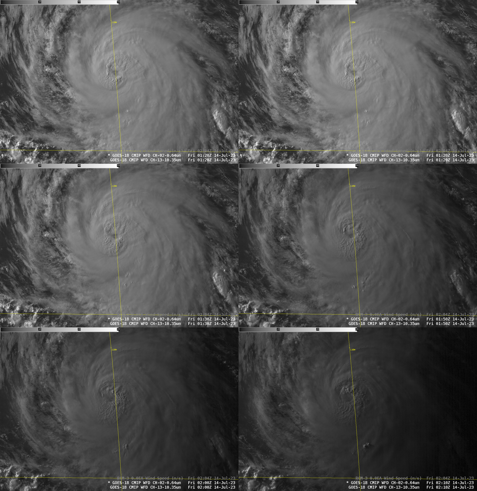
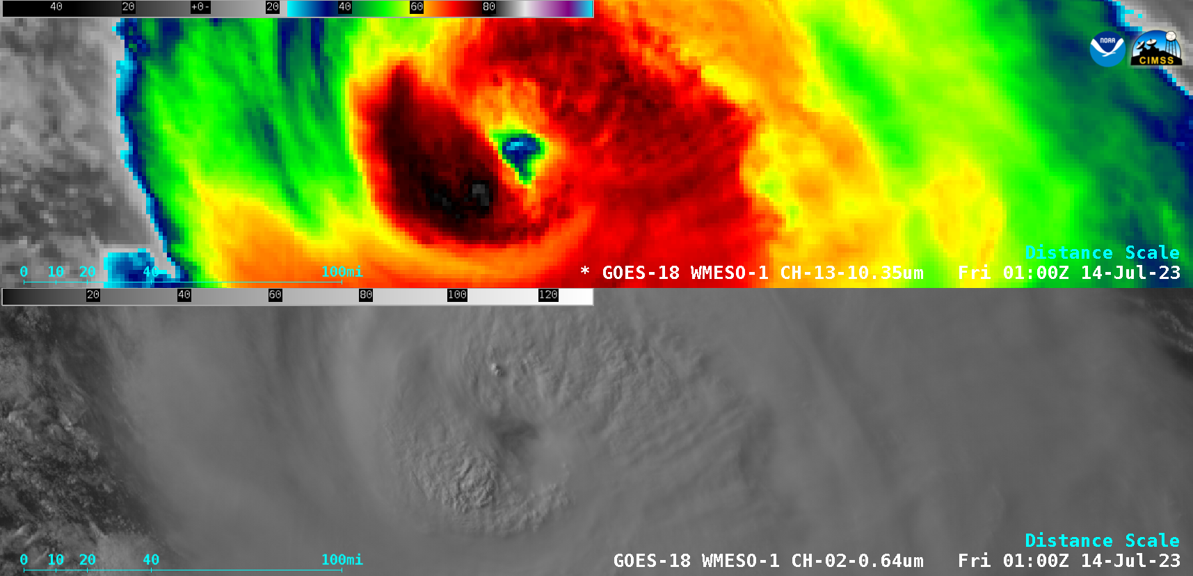
1-minute GOES-18 Infrared images (Band 13, 10.3 µm, top) and Visible images (Band 2, 0.64 µm, bottom) from 2200 UTC on 13 July to 0200 UTC on 14 July (courtesy Scott Bachmeier, CIMSS) [click to play animated GIF | MP4]
1-minute Mesoscale Domain Sector GOES-18 Infrared and Visible images during the 4-hour period from 2200 UTC on 13 July to 0200 UTC on 14 July (above) showed the evolution of deep convection within the eyewall of Calvin.
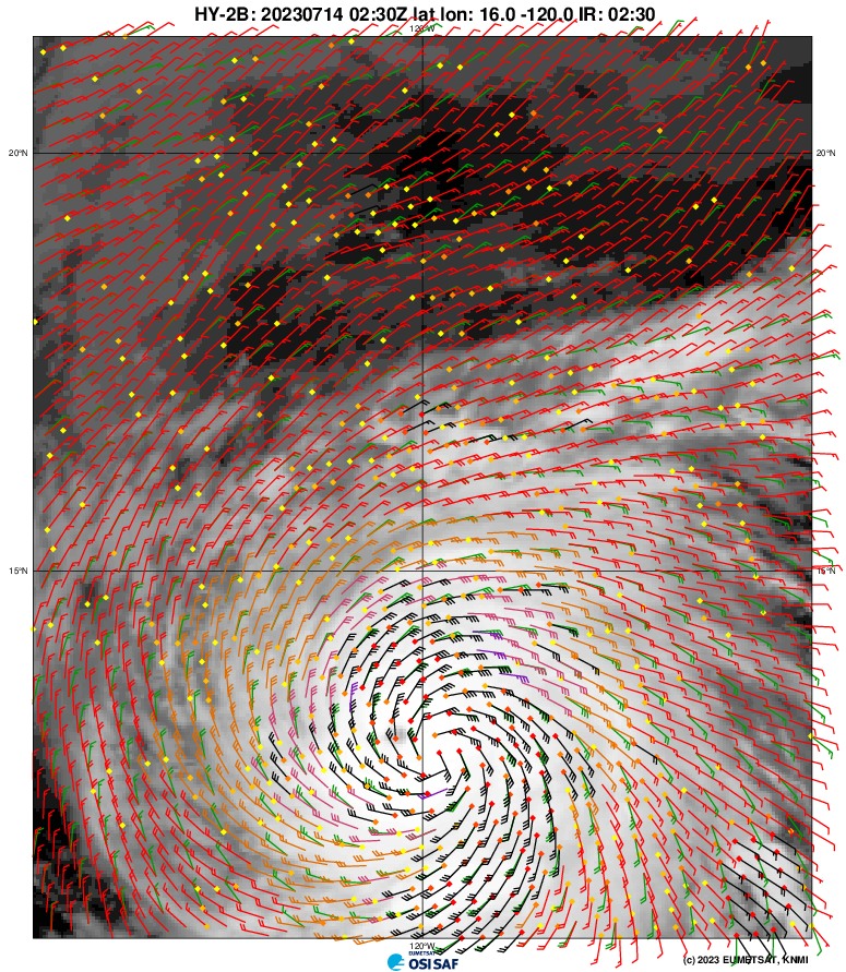
Other microwave products (beyond SAR) also showed the structure of this storm. For example, 0230 UTC HY2B scatterometry data, below (ASCAT observations from MetopB and MetopC did not sample Calvin’s eye on 13-14 July 2023), taken from this website, show a closed circulation — and also that same extension of strong winds in a curved band east and south of the storm center.
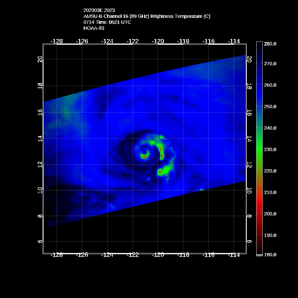
AMSU-B Imagery (89 GHz) at 0521 UTC on 14 July 2023, shown below (from this website), also shows the band of strong convection curving east and south of the eye. The AMSU-A cross-section through the eye (here) shows warm temperature anomalies above the eye.
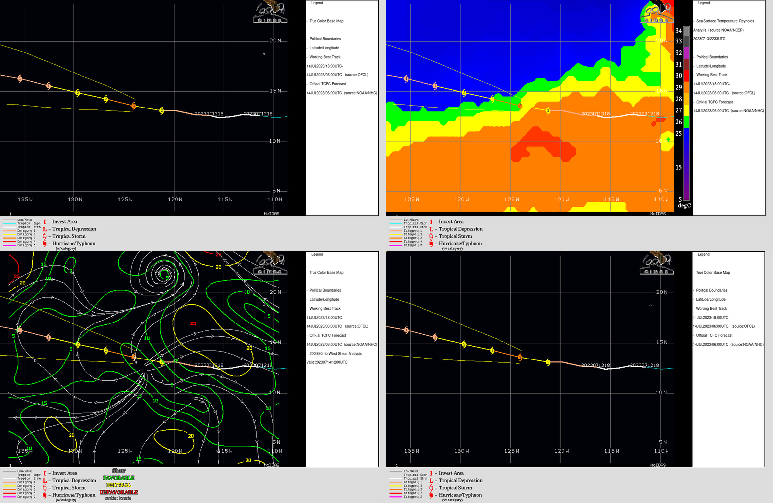
Imagery from the SSEC Tropical website, shown below, shows the storm moving over progressively cooler water in the next several days. Shear values at present are low. Long-range models continue to show a weakened system (and its moisture) moving over the Hawai’ian islands in the middle of next week. Therefore, interests in Hawai’i should closely monitor the progress of this storm.
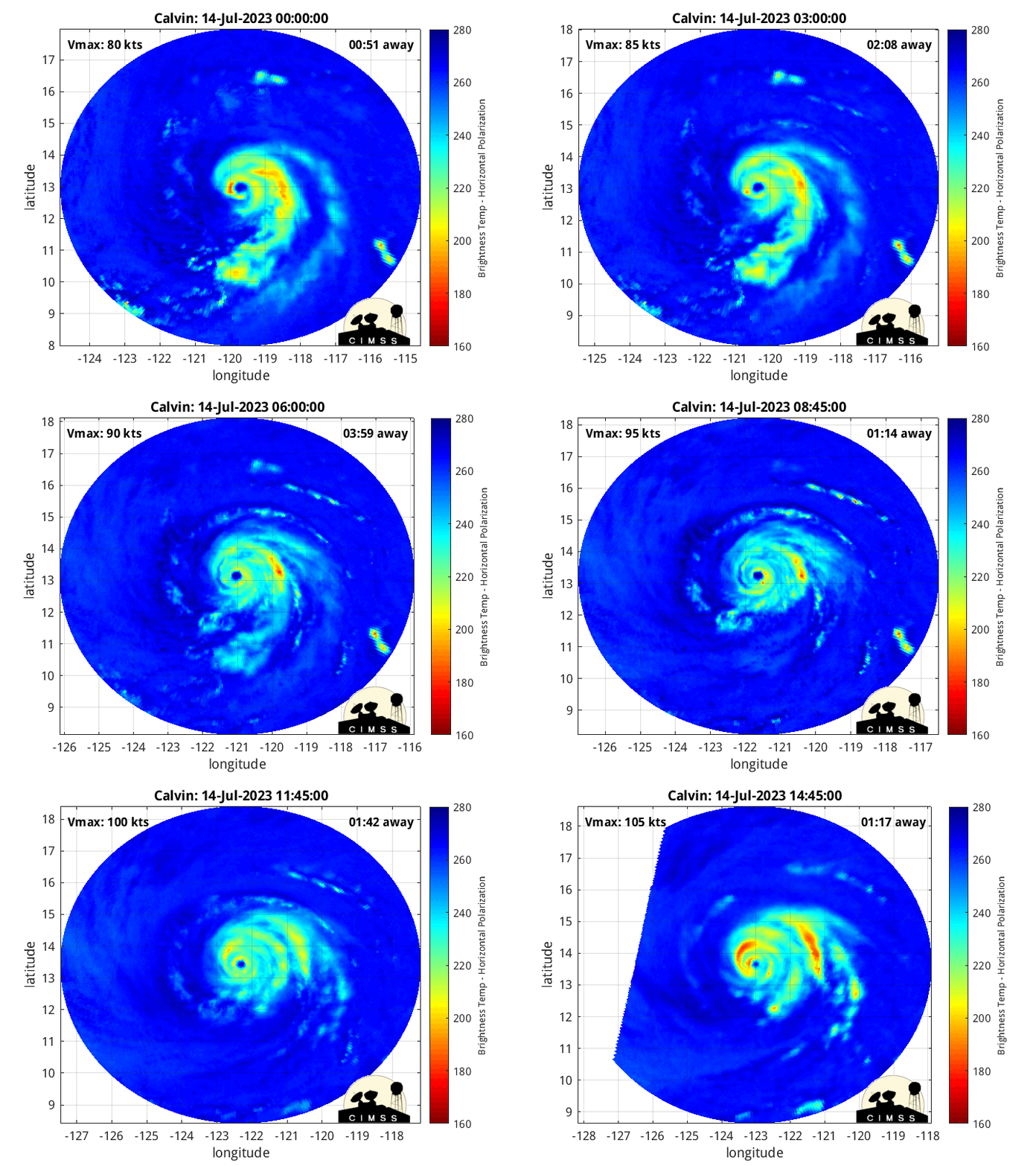
RCM-3 overflew Calvin just after 1400 UTC on 14 July as well, as shown in the slider below (click here to see the same domain/enhancement as shown above at 0200 UTC) that overlays SAR winds on top of the GOES-18 Band 13 Clean Window infrared (10.3 µm) brightness temperatures. Peak winds per the SAR analysis increased from just under 50 m/s at 0200 to nearly 60 m/s at 1400 UTC. The SAR wind structure at 1402 UTC shows two wind maxima over the western half of the storm. That double structure is also suggested at the end of the MIMIC-TC animation (from this website) shown below.
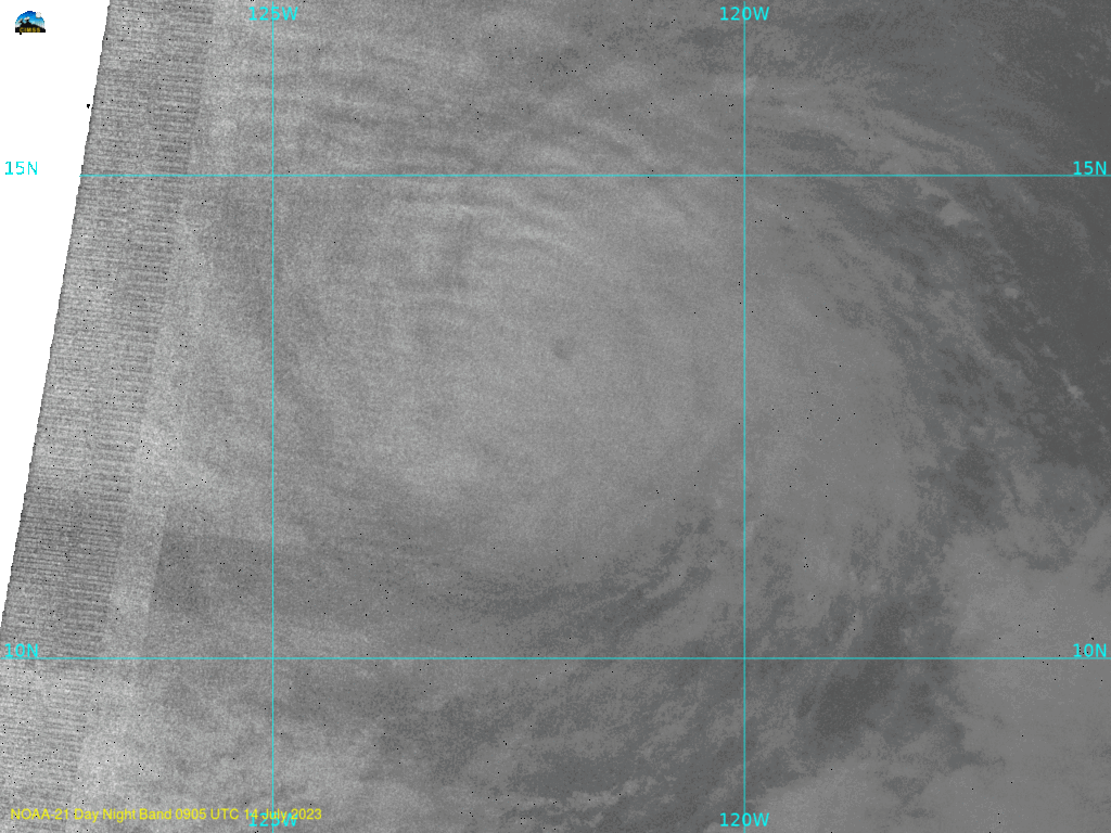
Using the methods discussed in this blog post, and after I created a domain centered on Calvin, NOAA-21 and Suomi-NPP imagery (in a very low-light condition) Day Night Band visible (0.7 µm) imagery were created with Polar2Grid (in this case, Polar2Grid’s hncc enhancement looked best), and a toggle of the two images, 30 minutes apart, is below. No lightning is detected in these images. The toggle of JPSS Day Night band imagery again testifies to the value of multiple JPSS satellites in orbit!
For the latest information on Calvin, refer to the National Hurricane Center, and also the NWS Forecast Office in Honolulu. There is also information at the CIMSS Tropical Website.

