Tropical Storm Humberto
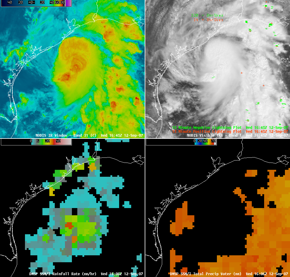
Tropical Depression #9 formed early in the day on 12 September 2007, and quickly intensified in the warm waters of the western Gulf of Mexico to become Tropical Storm Humberto (just off the coast of Texas). AWIPS images of the MODIS IR and visible channels (above; upper 2 panels) shows the early stages of a spiral band that began wrapping around the core of the cyclone during the afternoon hours. DMSP SSM/I imagery (above; lower 2 panels) depicted rainfall rates during the morning that as high as 30 mm per hour, and total precipitable water values of 55-65 mm in the near-storm environment.
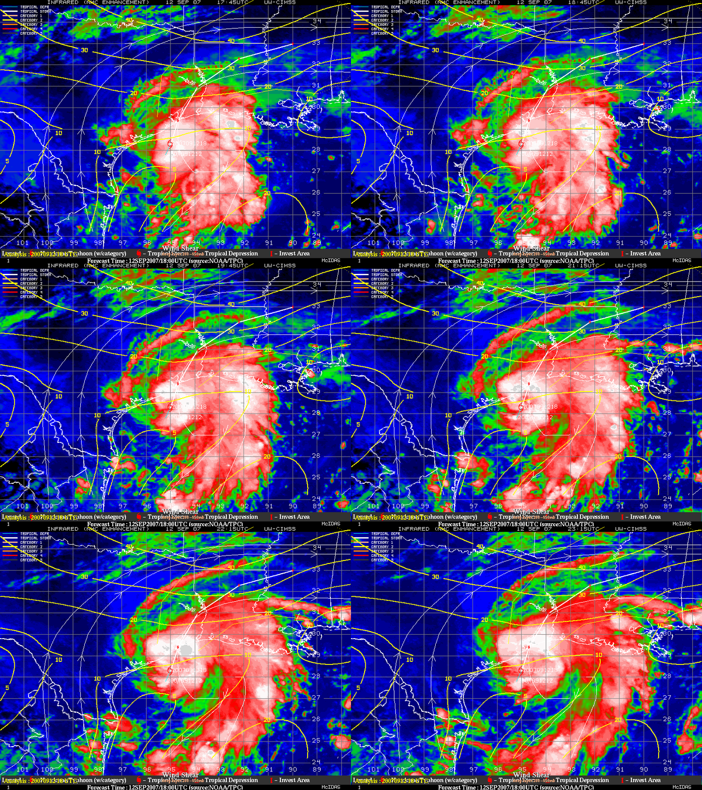
GOES-12 IR imagery and derived winds products from the CIMSS Tropical Cyclones site (below) indicated that Humberto developed in an environment that was characterized by very low deep layer wind shear (5-10 knots within the 850-200 hPa layer), which was a factor that aided in the intensification from tropical depression to tropical storm.


