SAR winds over Cyclone Judy on 2 March 2023

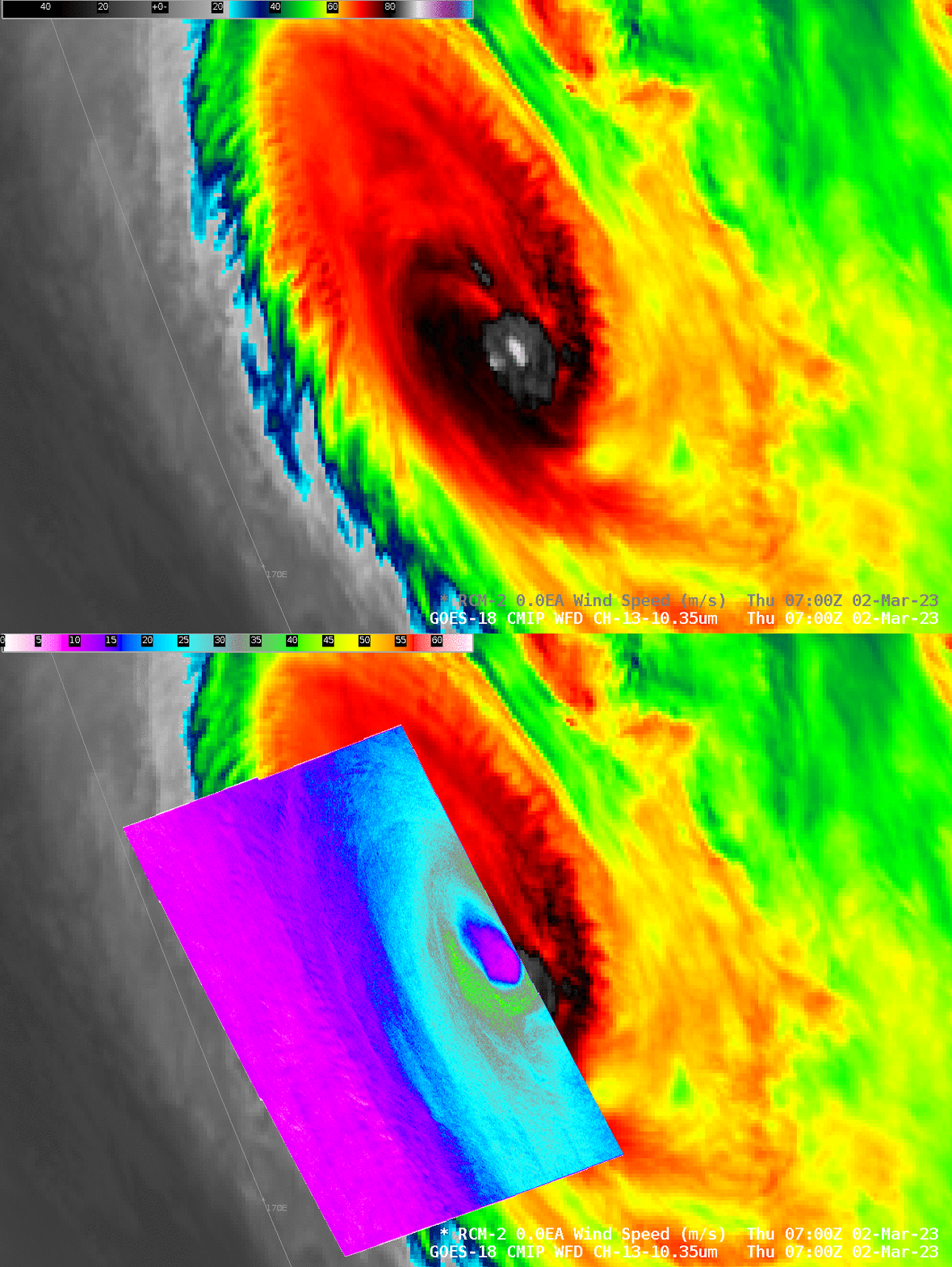
The Synthetic Aperture Radar instrument on RADARSAT Constellation Mission-2 (RCM-2) satellite sampled the winds over the western half of Cyclone Judy at 0700 UTC on 2 March 2023, as shown in the toggle above that also includes the GOES-18 Band 13 Clean Window infrared (10.3 µm) imagery. Peak winds are 41 m/s in the southern eyewall, and strongest winds are in general in the southern part of the eyewall (as shown in this analysis). The coldest cloud tops also are over the southern part of the storm’s eyewall. (Previous blog post on Judy is here)
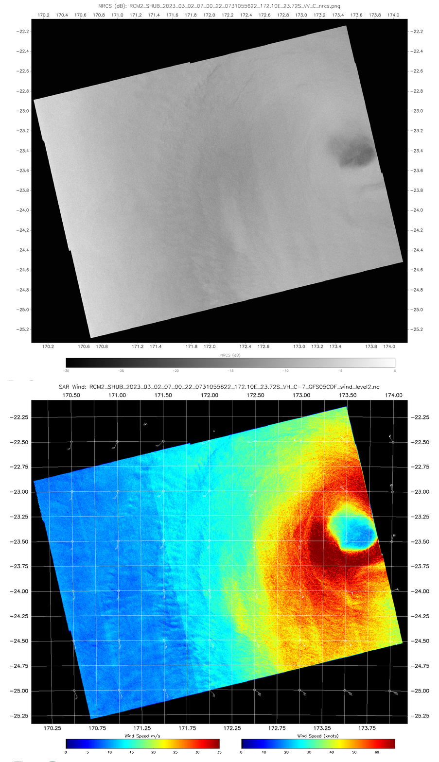
The toggle below compares the derived winds with the Normalized Radar Cross Section (NRCS) imagery, taken from this website. Additional information on the SAR wind distributions around the eye of Judy are available at the SAROPS Tropical Cyclone Judy website.

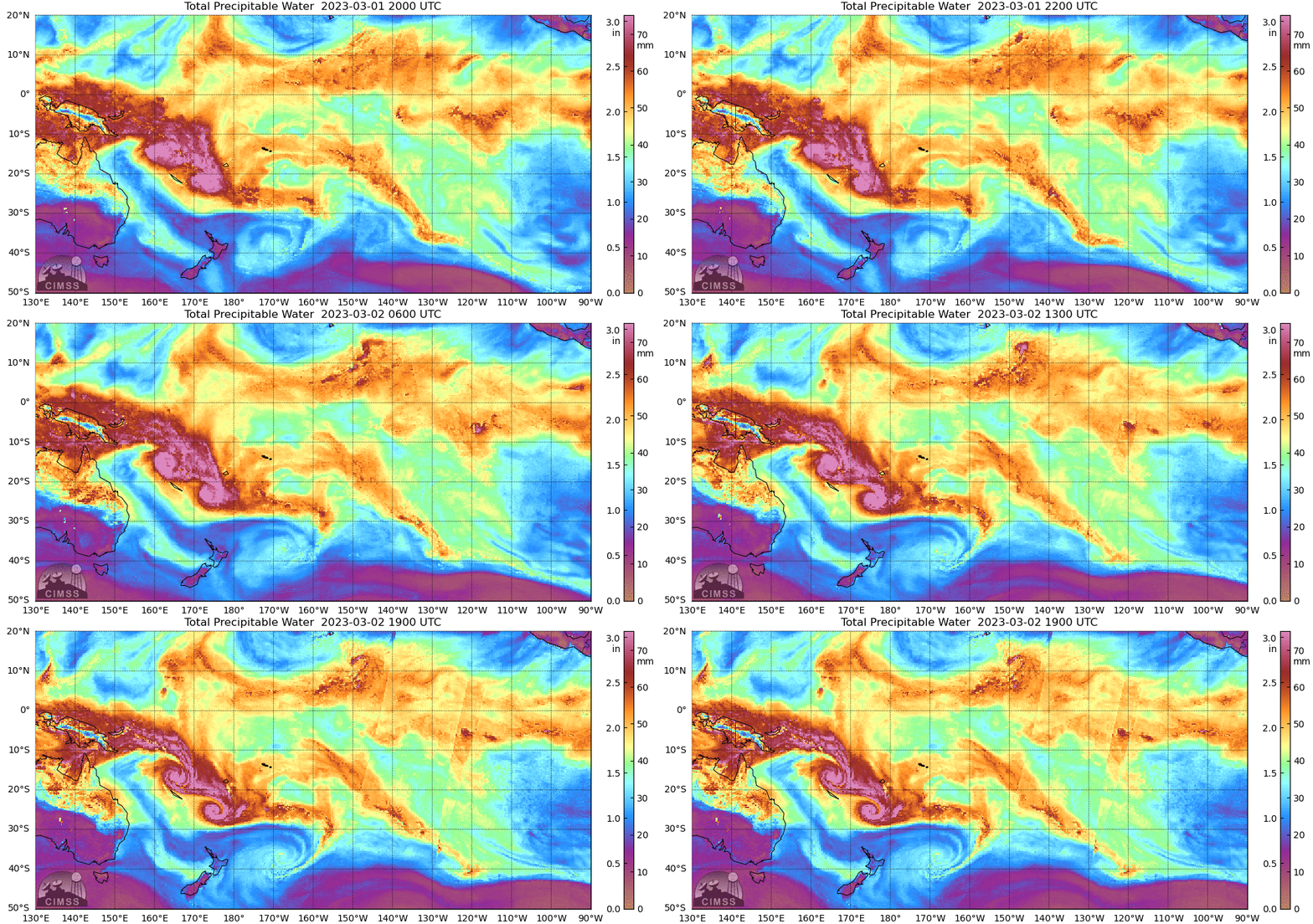
The mp4 animation below shows Cyclone Judy in the hours bracketing the SAR overpass above. One overshooting top in the eyewall is apparent just as the sun set on the storm at 0630 UTC. Total Precipitable Water fields from MIMIC-2 (link), below, show Judy moving southeastward — followed by Cyclone Kevin. For more information on these two storms, refer to the Joint Typhoon Warning Center or the Fiji Tropical Cyclone Warning Center or the CIMSS Tropical Website.


