By Scott Bachmeier •
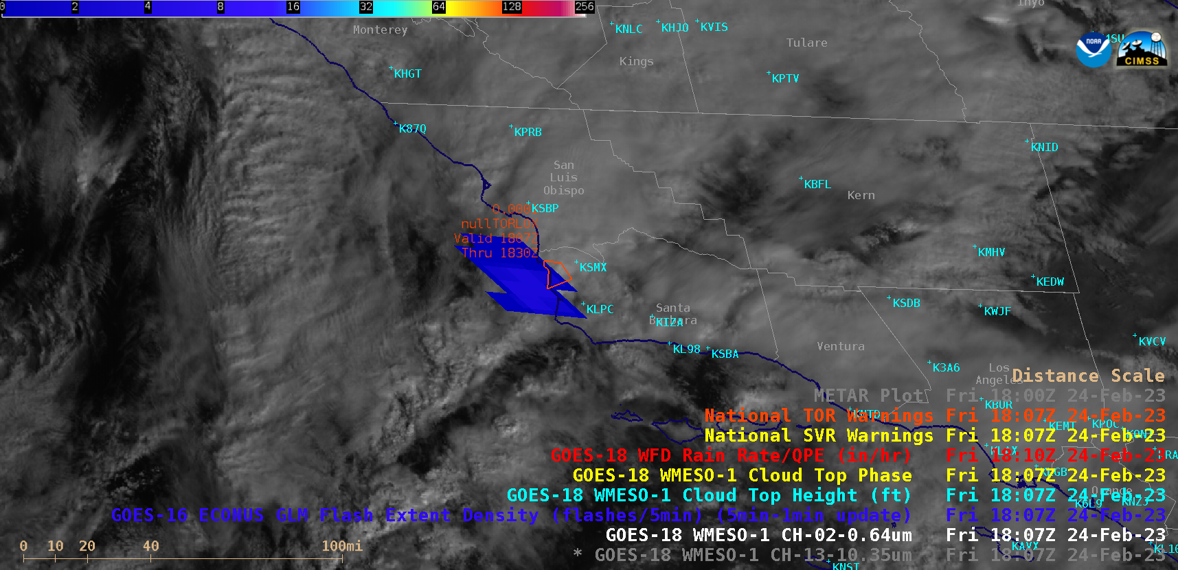
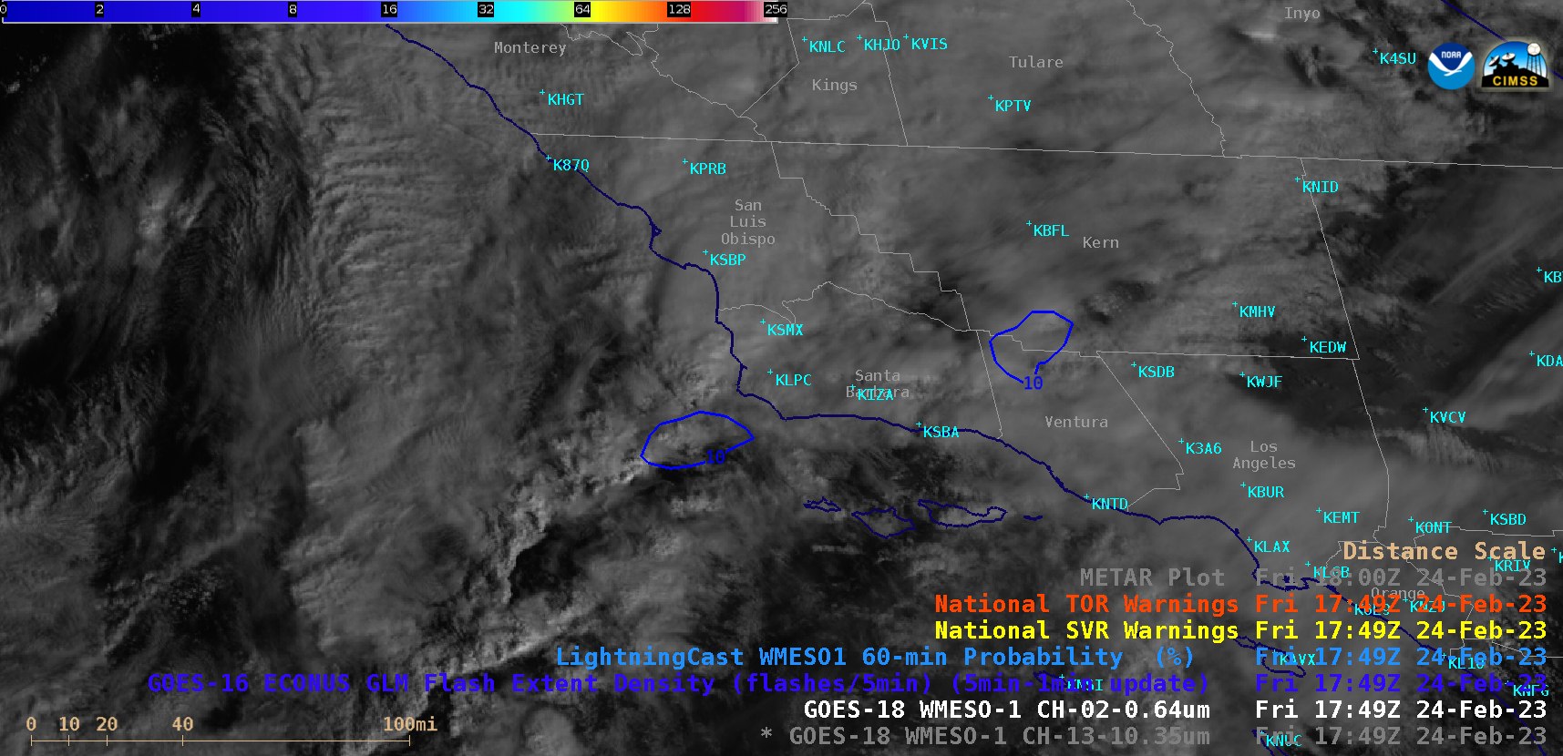
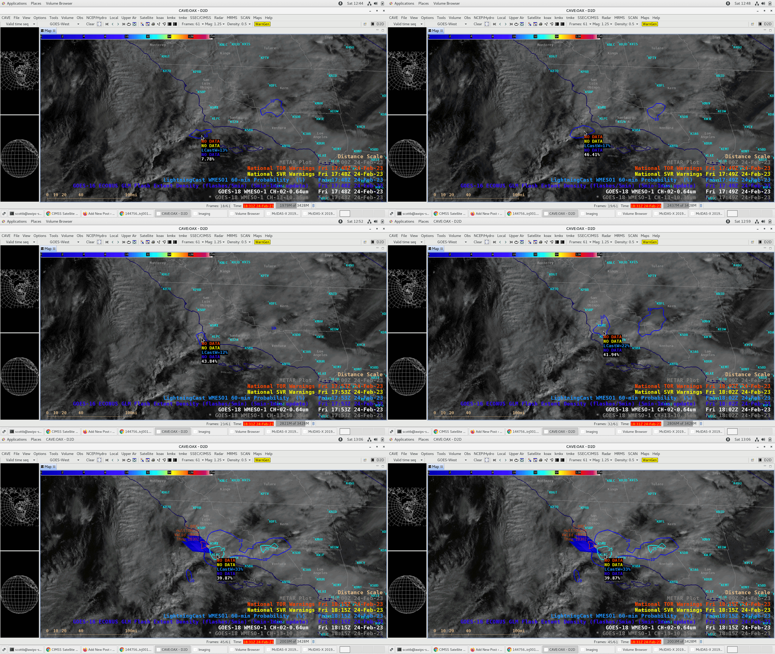
1-minute Mesoscale Domain Sector GOES-18 (GOES-West) “Red” Visible (0.64 µm) and “Clean” Infrared Window (10.3 µm) images (above), with and without an overlay of GLM Flash Extent Density, showed convection moving onshore in Southern California during the late morning hours on 24 February 2023 — which prompted NWS Los Angeles to issue a Tornado Warning at 1807 UTC. There was a notable lightning jump that began at 1803 UTC, 4 minutes prior to the issuance of the Tornado Warning. 1-minute GOES-18 Visible images (above) include contours of LightningCast Probability. Cursor-sampled maximum values of LightningCast Probability within each contour (below) indicated that while the offshore probability values were fairly low (ranging from 12% to 22%), they did begin to appear as early as 1748 UTC (19 minutes prior to the Tornado Warning) — and probability values increased to a more modest 33% at 1815 UTC as the tornado-warned storm moved farther inland (and the aforementioned lightning jump was still underway).Categories: GLM, GOES-18, Lightning, LightningCast, ProbSevere, Severe convection