Fatal tornadoes in the Bahamas
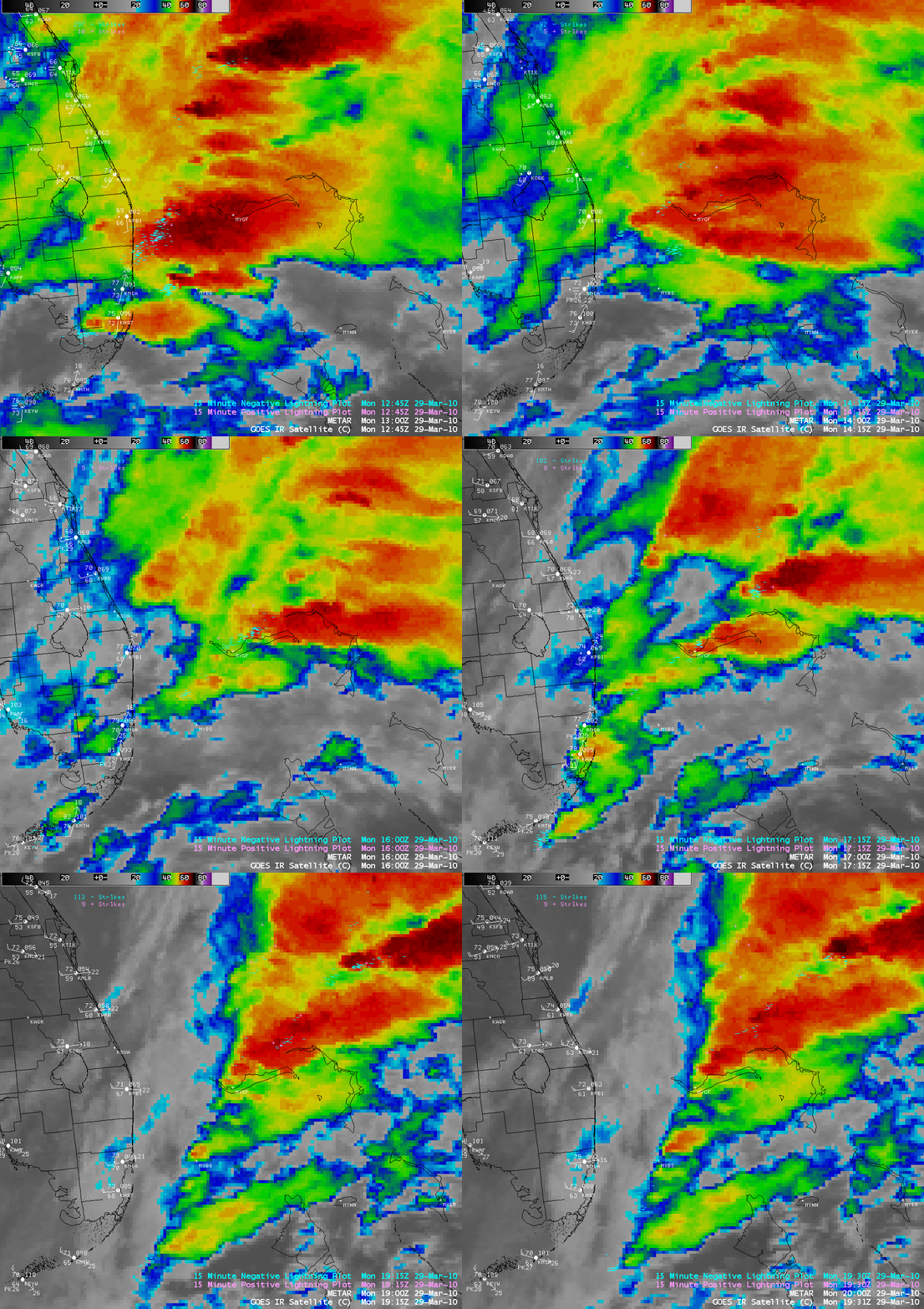
Strong convection moving eastward from Florida and across the Bahamas produced at least two tornadoes on the island of Grand Bahama on 29 March 2010 — according to media reports, there were fatalities at the Grand Bahama Container Port located at the western end of the island, where several large cranes were toppled. There were also tornadoes reported in Florida a few hours earlier. AWIPS images of GOES-12 10.7 µm IR channel data with an overlay of negative (cyan) and positive (violet) cloud-to-ground lightning strikes (above; also available as a QuickTime animation) showed several clusters of convection moving across Grand Bahama Island (located in the center of the images; station identifier MYGF is Freeport). In particular, note the storms with the highest density of negative cloud-to-ground lightning strikes moving across the island during the 15:15 – 15:45 UTC time period — this is likely the convective cell that produced the tornadoes. The coldest IR brightness temperatures over the Bahamas on the 4-km resolution GOES-12 images was -66º C (darker red color enhancement).
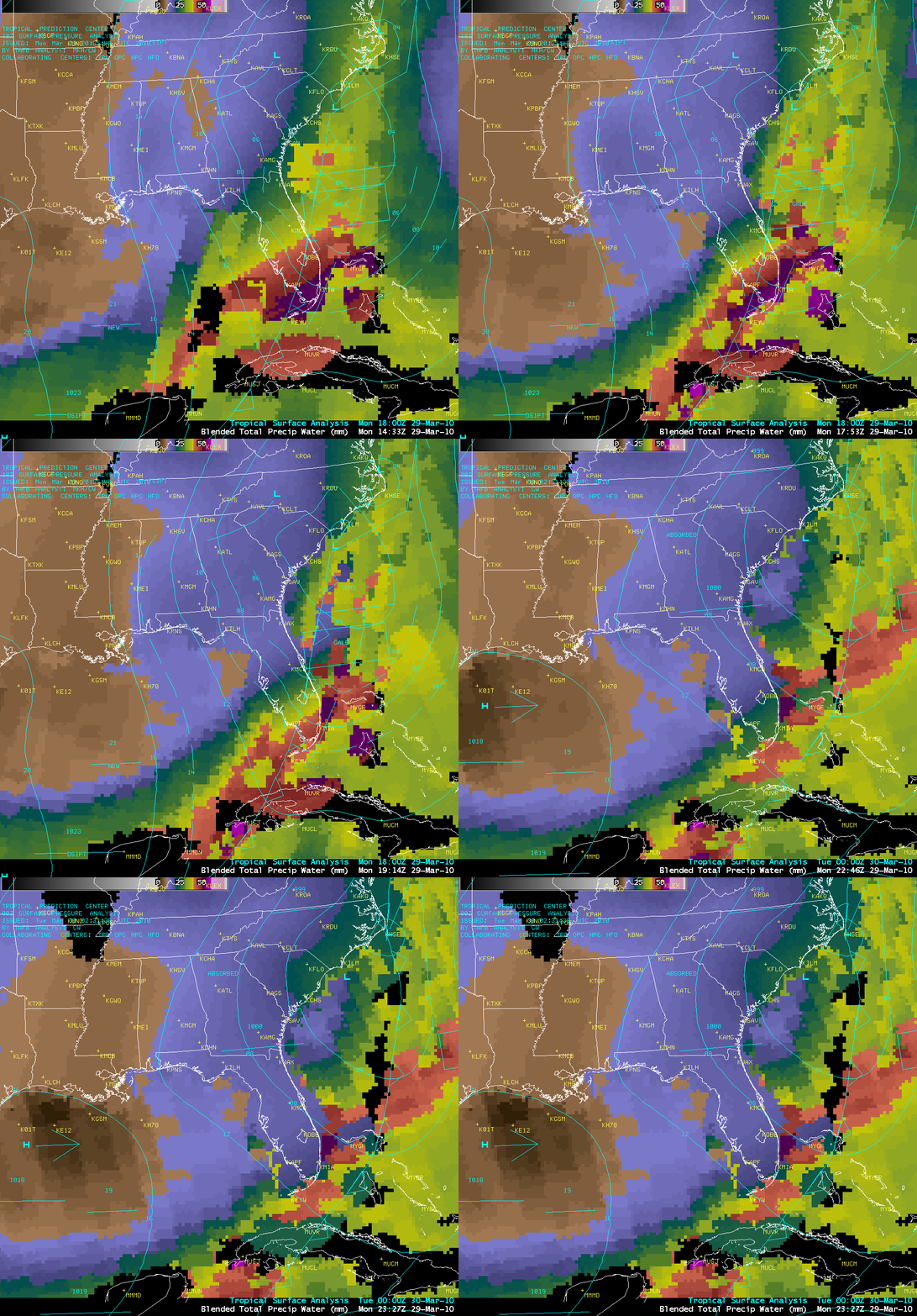
The Blended Total Precipitable Water (TPW) product (below) indicated that TPW values were in excess of 50 mm or 2.0 inches (darker purple color enhancement) along and ahead of a cold frontal boundary that was approaching from the west. These TPW values were 150%-200% above normal. In addition, the presence of a pre-frontal trough may have played a role in helping to enhance surface convergence in the vicinity of the Bahamas.
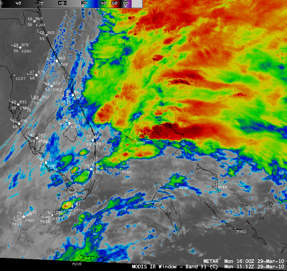
A closer view using 1-km resolution MODIS 11.0 µm IR channel data at 15:52 UTC (below) revealed greater detail in the overshooting top structure of the convection as it was moving over the eastern portion of the Grand Bahama Island. The coldest MODIS IR brightness temperatures near the island were -70º C (black color enhancement).
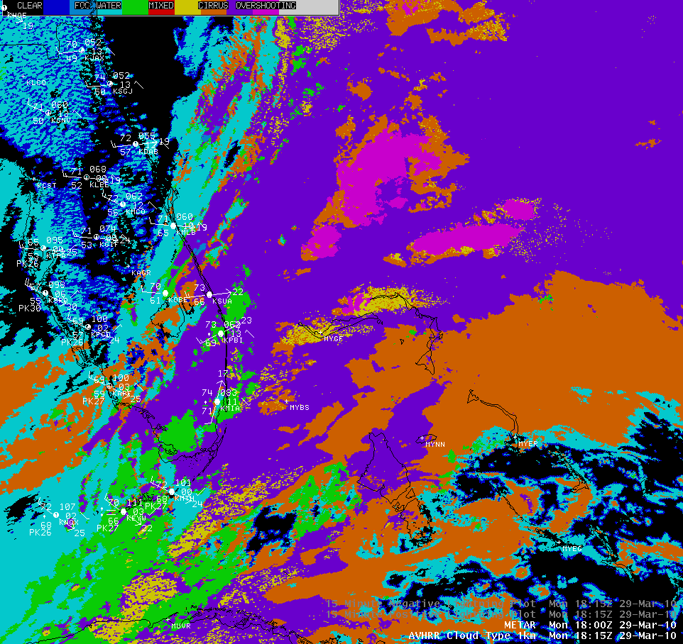
The CLAVR-x POES AVHRR Cloud Type product (below) indicated a number of “Overshooting Top” category clouds (violet color enhancement) associated with the stronger convective clusters.
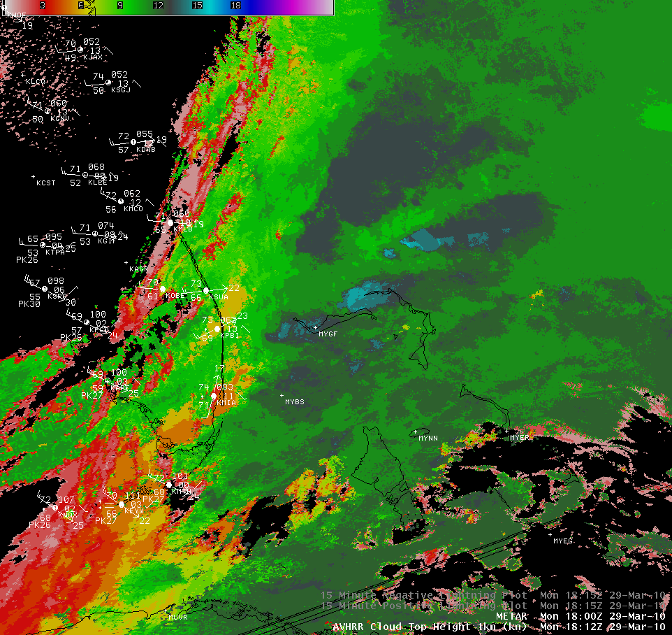
The POES AVHRR Cloud Top Height product (below) showed that the highest cloud tops over the Bahamas were around 15 km or 49,000 feet (cyan color enhancement).
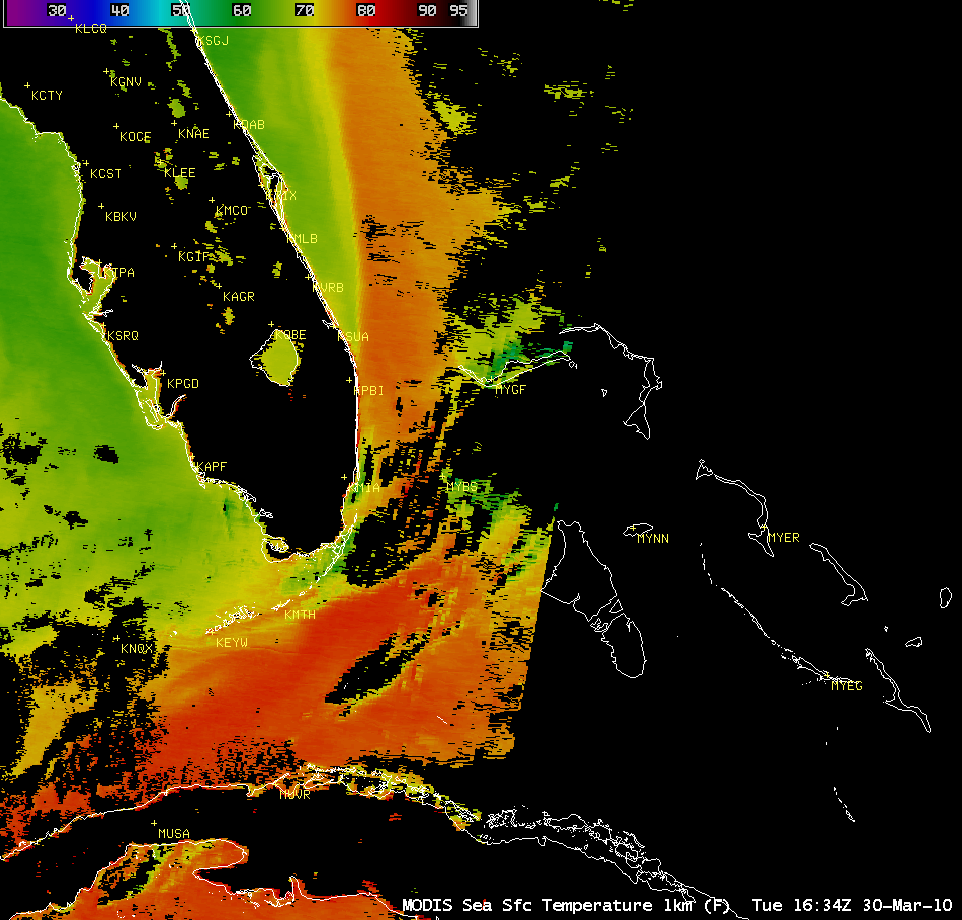
A MODIS Sea Surface Temperature (SST) product from the following day (below) revealed that there was a very strong SST gradient between Florida (where SST values were primarily in the mid 60s F, green colors) and the Bahamas (where SST values were in the mid 70s F, orange colors). Perhaps the significantly warmer SST values of the Gulf Stream may have also played a role in the intensification of the convection as it approached the Bahamas?


