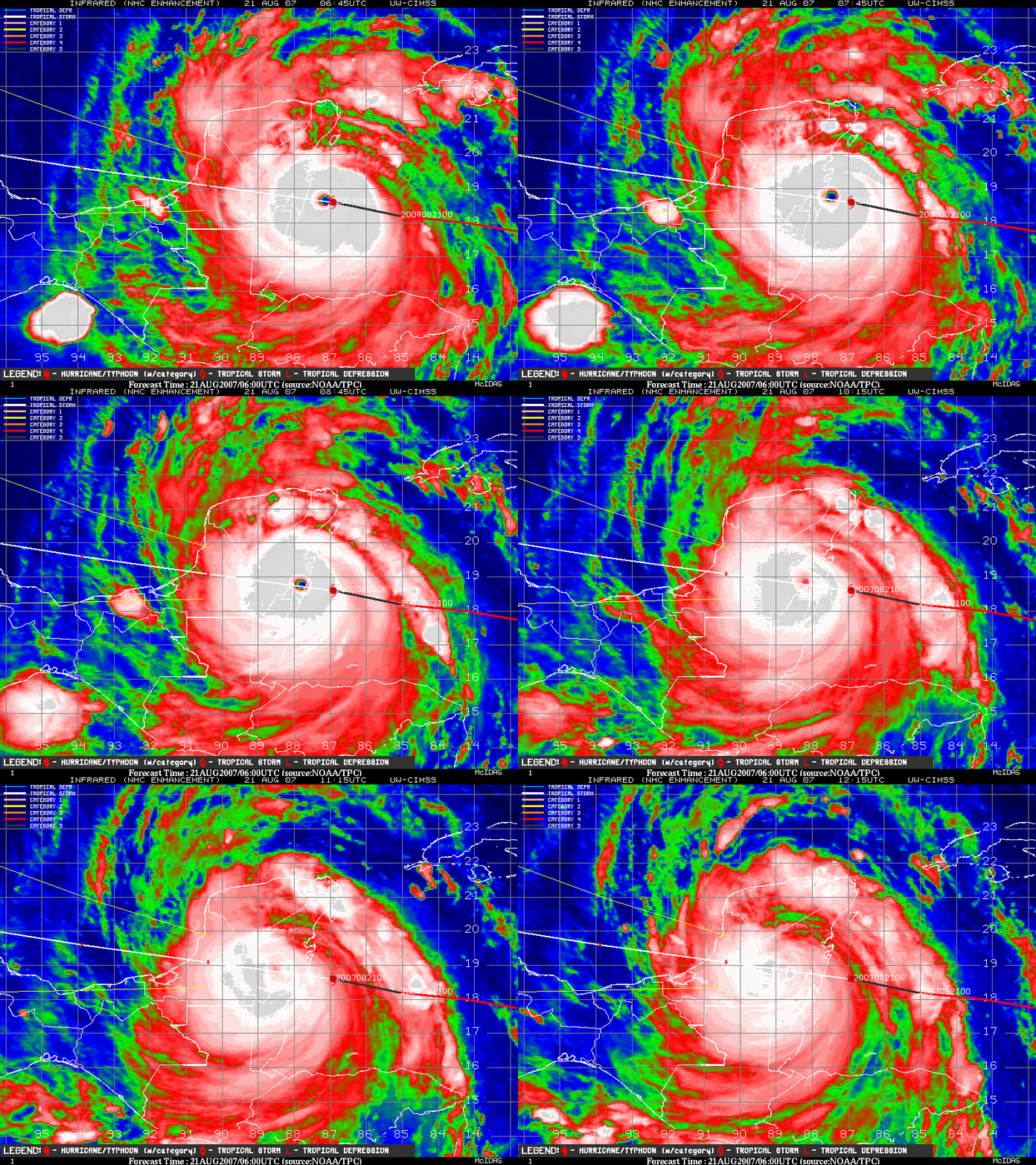
Hurricane Dean makes landfall as a Category 5 storm
GOES-12 IR images (above) from the CIMSS Tropical Cyclones site show Hurricane Dean making landfall along the Yucatan Peninsula region of Mexico during the early hours of 21 August 2007, with sustained surface winds near 165 mph. Dean was the first Category 5 storm to make landfall in the Atlantic Basin since Hurricane Andrew struck Florida back in 1992, and Dean’s central pressure at landfall (906 hPa) was the 3rd lowest pressure at landfall (behind 892 hPa with the 1935 Labor Day Hurricane in the Florida Keys, and 888 hPa with Hurricane Gilbert near Cancun, Mexico in 1988). While the appearance on satellite imagery (and the loss of a well-defined eye) indicated a rapid weakening after landfall, Dean is expected to maintain hurricane intensity as it traverses the Yucatan Peninsula.
An IR image from polar-orbiting NOAA-18 satellite (below) shows the eye of Hurricane Dean about 1 hour prior to landfall. Station identifier MMCM is Chetumal, Mexico. The coldest IR brightness temperatures in the northern eyewall region were -83º C / -117 º F (dark red enhancement), while IR brightness temperatures within the eye region were as warm as +20º C/ 68 º F.


