Erin…TUTT…Dean
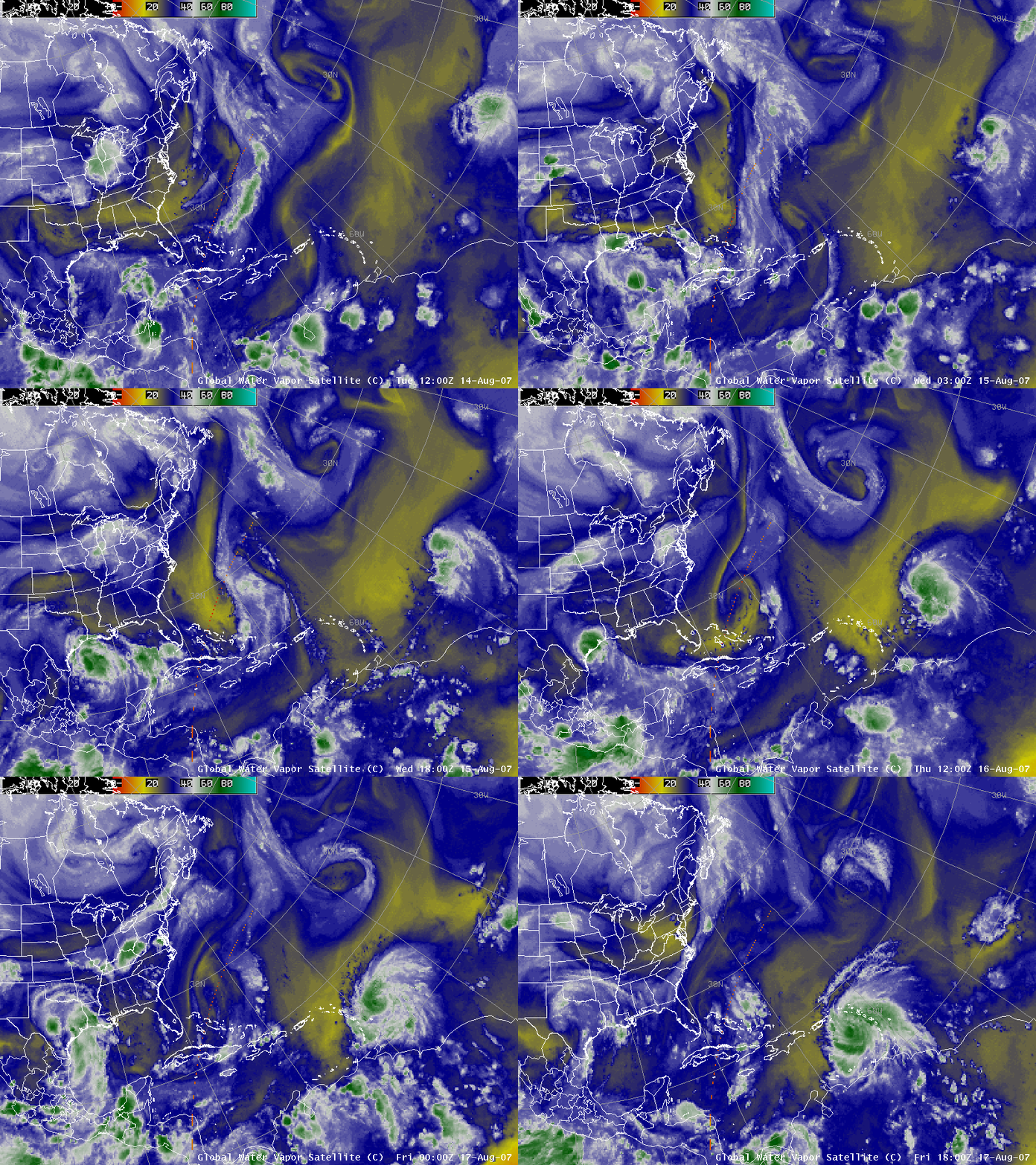
AWIPS images of the GOES-12 water vapor channel (above) showed 3 distinct cyclonic circulation features on 17 August 2007: (1) the remnants of Tropical Storm Erin over Texas, (2) a Tropical Upper Tropospheric Trough (TUTT) over the Bahamas, and (3) rapidly intensifying Hurricane Dean over the western Atlantic Ocean (see the CIMSS Tropical Cyclones site for the latest information on Hurricane Dean).
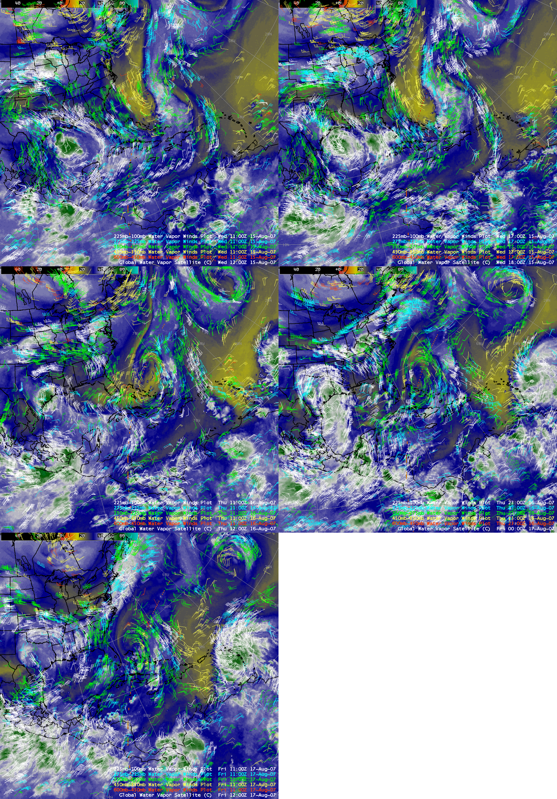
Satellite-derived water vapor winds (or Atmospheric Motion Vectors) using GOES-12 imagery (above) were helpful in diagnosing the intensification of the TUTT circulation over the Bahamas during the 15-17 August period. Note that the TUTT circulation was evident in the upper-tropospheric 200 hPa wind fields, but not on the lower-tropospheric 850 hPa wind fields.
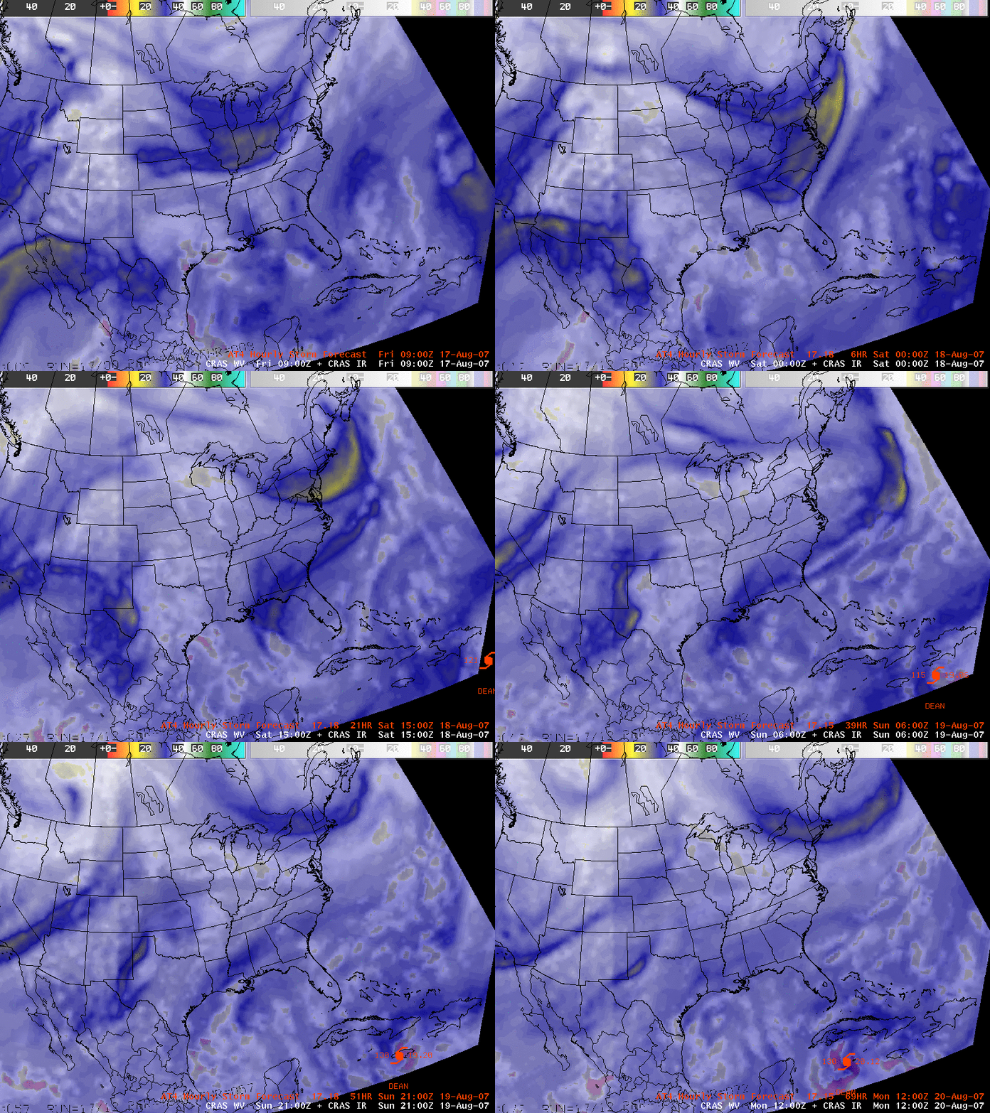
Since TUTT features can sometimes inhibit tropical cyclone development by introducing greater environmental shear, we examined a series of forecast synthetic water vapor channel + IR channel satellite imagery from the CRAS model (above). The CRAS water vapor image forecast suggested that the TUTT circuation would remain over the Gulf of Mexico, far to the northwest of Hurricane Dean as it intensified and moved westward across the Caribbean Sea.


