Unusually long and thin cloud band over the Arctic Ocean
Andy Heidinger (NOAA/NESDIS/Advanced Satellite Products Branch) pointed out a very long and thin cloud feature, which can be seen near the center of the false color Red/Green/Blue (RGB) image created using AVHRR imagery (above). In this particular RGB image, low clouds appear dark blue, while cirrus clouds are white. The cloud feature of interest (which stretched from the North Slope region of Alaska westward across the Arctic Ocean to the north of Siberia on 23 February 2010) appeared to be over 1000 km long and less than 10 km wide — a perfect candidate for the “What the heck is this?” blog category!
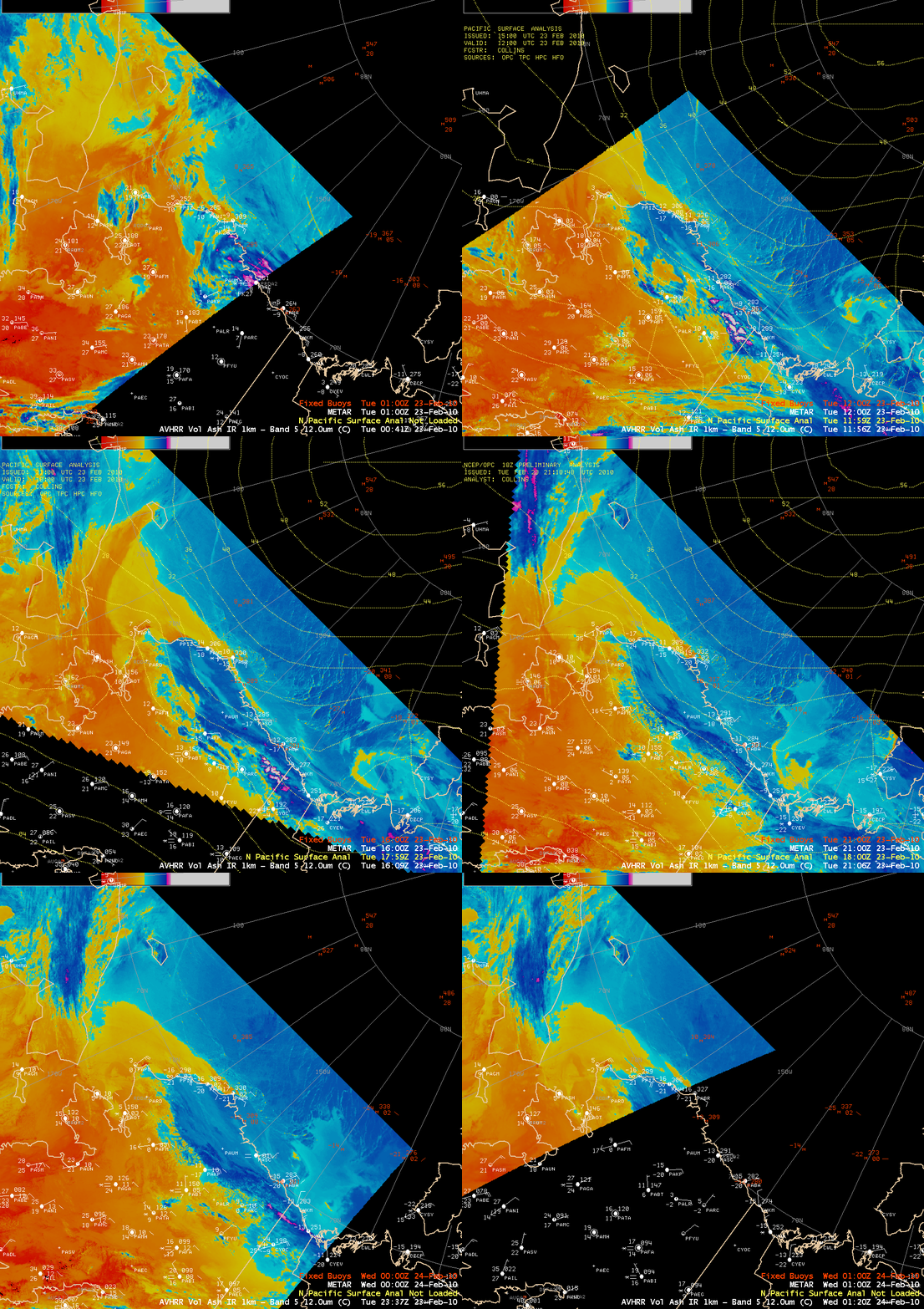
With a strong high pressure cell in place over the North Pole, it is possible that this thin cloud arc marked the leading edge of a relatively weak cold frontal boundary. The southward progress of this cloud feature could be followed on a sequence of AWIPS images of AVHRR 12.0 µm IR channel data (below) — the cloud arc was highlighted with a yellow to cyan color enhancement, representing IR brightness temperatures of -10º to -20º C. In addition, well offshore of the northeastern coast of Alaska you could also see the warmer thermal signature (denoted by the yellow color enhancement) of large thin spots and cracks forming in the the sea ice covering the Arctic Ocean.
It may be pure coincidence, but when this thin cloud arc passed southward across northern Alaska coastal station PAWI (Wainwright), they briefly reported freezing fog and a drop in visibility to 0.5 mile.
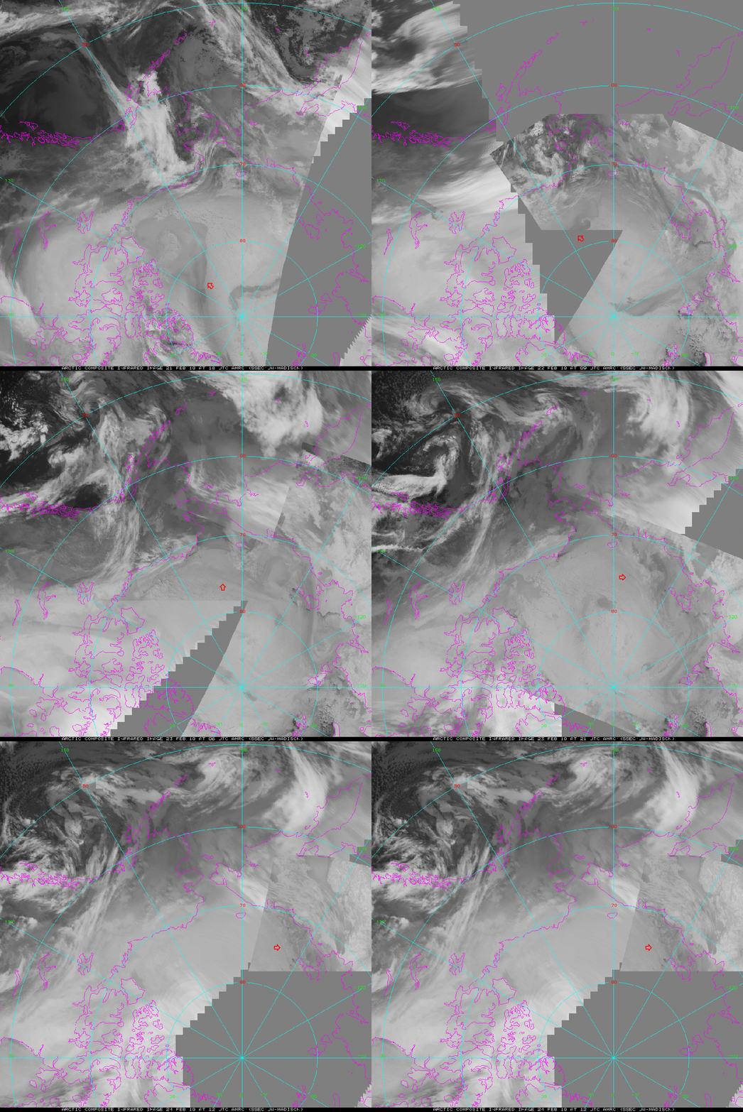
The progression of this cloud band could also be seen on a sequence of grayscale AVHRR composite IR images (below, courtesy of Matthew Lazzara, AMRC). The darker appearance of the cloud arc on the grayscale images supported the idea that this was indeed a relatively warm low cloud feature.
.
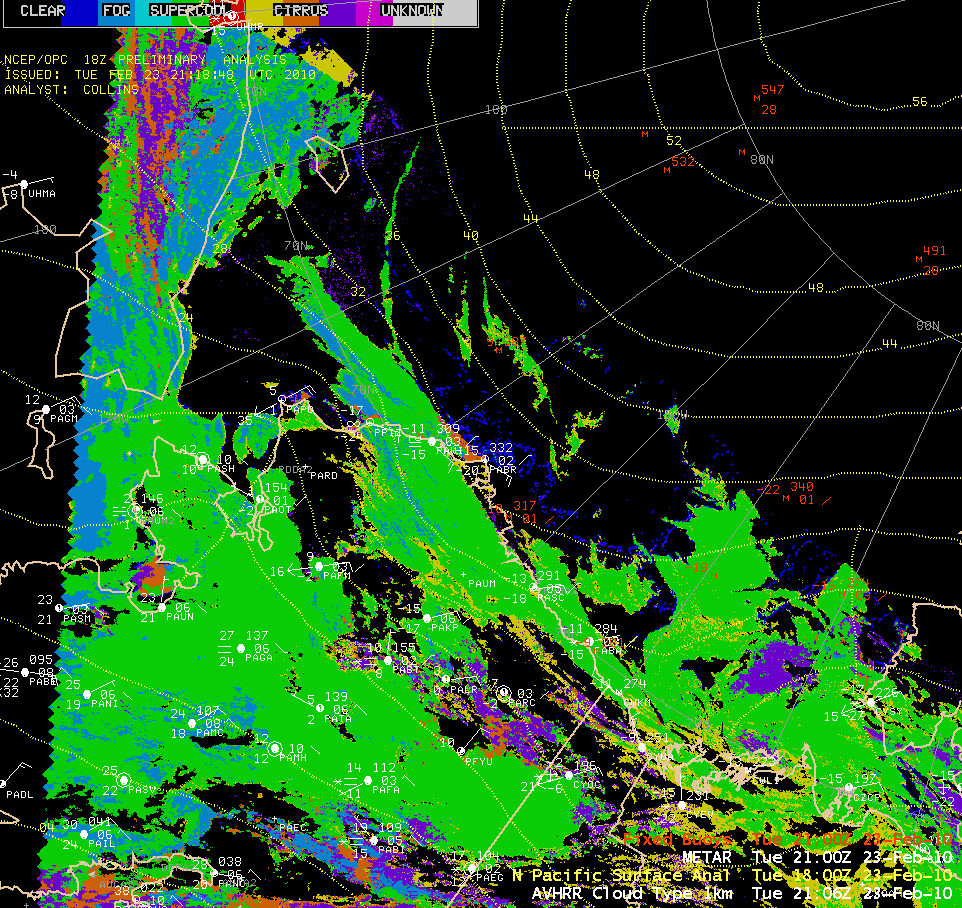
An AWIPS image of the AVHRR Cloud Type product (above) indicated that the cloud arc feature was composed primarily of supercooled water droplets (green color enhancement). The time of the AVHRR Cloud Type image corresponds to the time when Wainwright (station identifier PAWI) reported a brief period of freezing fog as the cloud arc passed southward through the area.
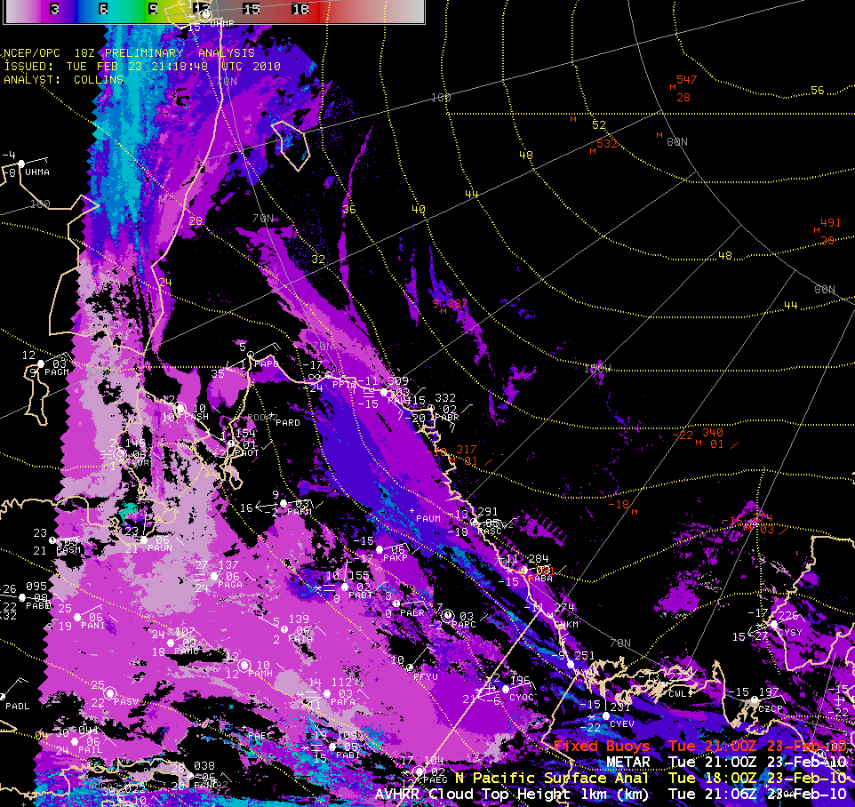
The corresponding AVHRR Cloud Top Height product (below) indicated that the top of the thin cloud band was in the 2-3 km range (darker purple color enhancement).


