Nice satellite views of the Vancouver, British Columbia region
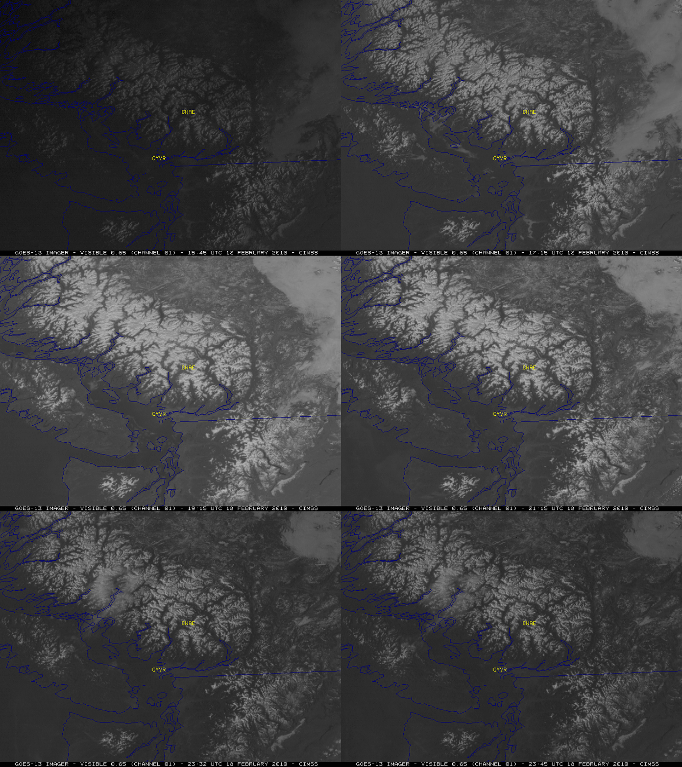
With an elongated ridge of high pressure in place along the British Columbia coast on 18 February 2010, nearly cloud-free conditions allowed for some nice satellite views of the Vancouver, British Columbia area (the site of the 2010 Winter Olympics). McIDAS images of GOES-13 visible channel data (above) showed the widespread snow-covered mountains that occupied much of the region, as well as the evolution of some of the cloud features during the day. Early in the animation, some small patches of fog and stratus clouds could be seen burning off as they slowly drifted southward over the waters of the Strait of Georgia. The locations of Vancouver (station identifier CYVR) and Whistler (station identifier CWAE) are indicated on the visible imagery
This animation also serves to highlight the improved Image Navigation and Registration (INR) of the GOES-13 satellite — there is much less image-to-image “wobble” compared to the previous generation of GOES satellites. NOTE: GOES-13 is scheduled to replace GOES-12 as the operational GOES-East satellite on 14 April 2010.
On the NOAA-19 false color Red/Green/Blue (RGB) image (below) using channels 01 (0.62 µm), 02 (0.86 µm), and 03 (3.7 µm), bare ground appears as shades of green to brown, snow cover is brighter white, and stratus clouds over the mountains farther to the east appear as shades of yellow.
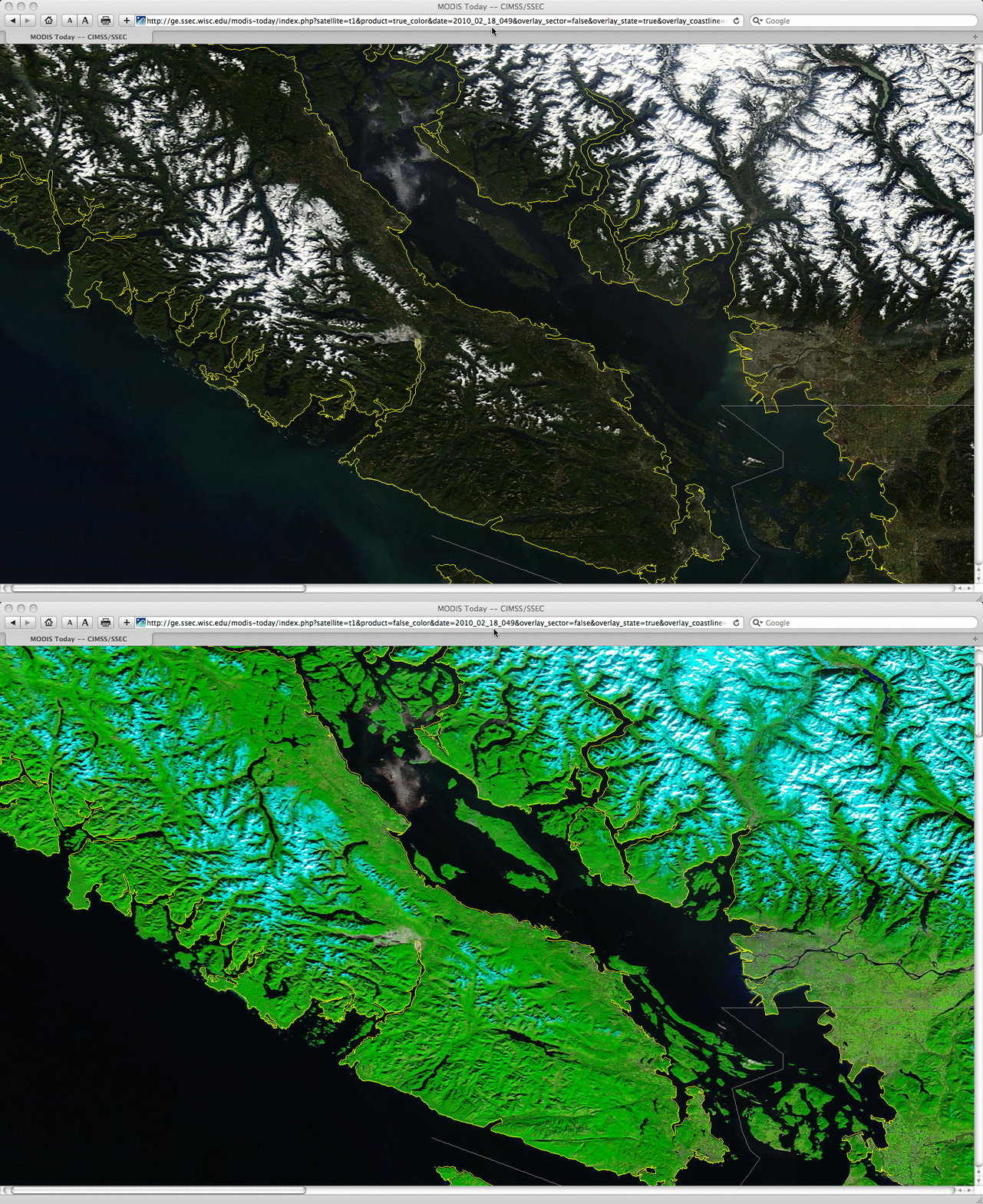
A comparison of 250-meter resolution MODIS true color and false color images from the SSEC MODIS Today site (below) shows even greater detail of the snow-covered terrain features of the region, as well as the few patches of fog/stratus cloud that remained over the northern portion of the Strait of Georgia at 19:07 UTC (where the AVHRR Sea Surface Temperature product showed that SST values were generally in the 40s F).


