GOES-14 is brought out of storage

Shortwave Infrared (3.9 µm) images from GOES-17, GOES-15, GOES-14 and GOES-16 [click to play animation | MP4]
The GOES-14 satellite was brought out of storage on 11 August 2021, for its annual checkout activities (NOAA bulletin). Shortwave Infrared (3.9 µm) images (above) provided a 4-GOES view of the thermal anomalies (or hot pixels, darker black enhancement) exhibited by the Richard Spring Fire in southeastern Montana. On that day the fire had burned over 149,000 acres, and was only 15% contained. The 4 panels of images are displayed in the native projection of each satellite.
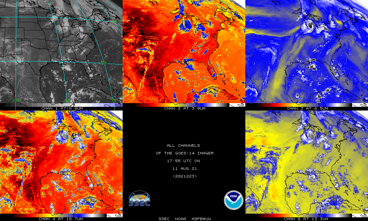
GOES-14 Imager spectral band images at 1755 UTC on 11 July 2021 (credit: Tim Schmit, NOAA/NESDIS/ASPB) [click to enlarge]
The GOES-14 Imager has the same 5 spectral bands (above) as GOES-15 (below).
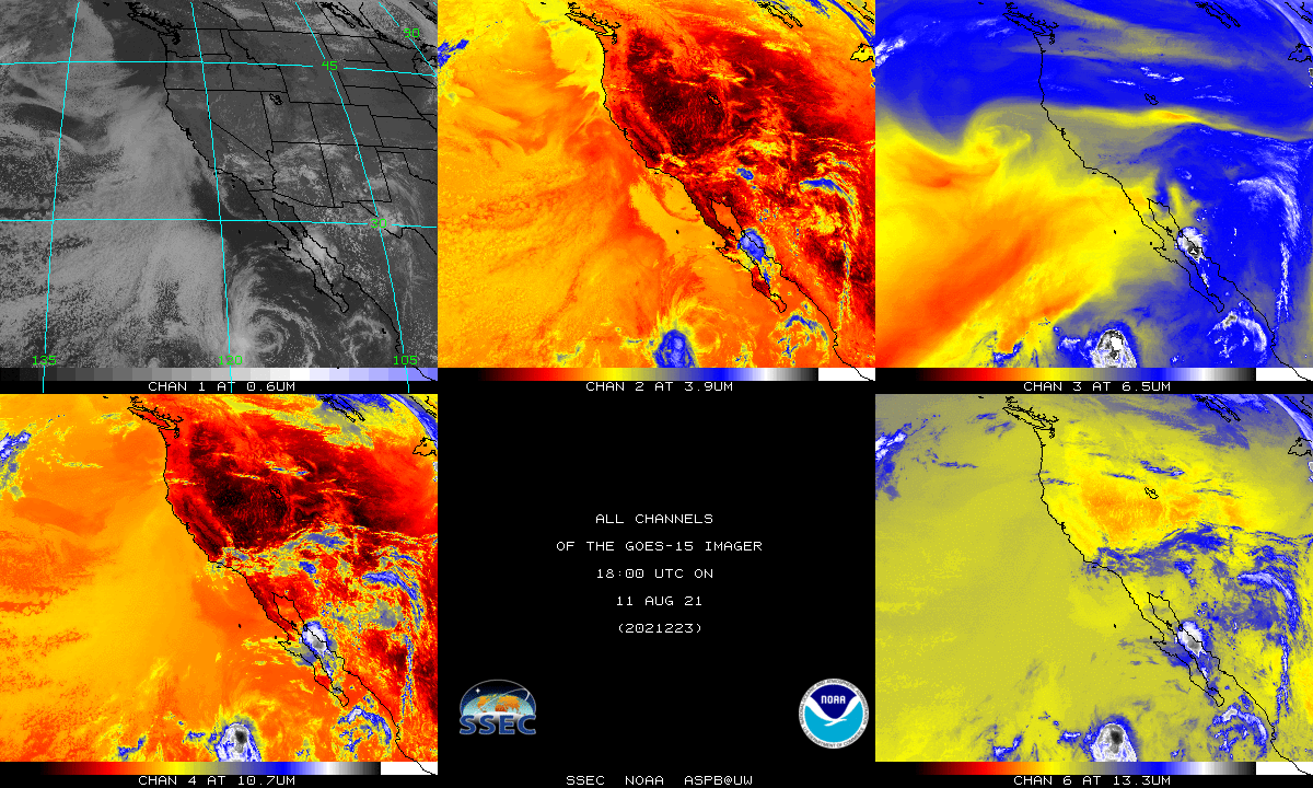
GOES-15 Imager spectral band images at 1800 UTC on 11 July 2021 (credit: Tim Schmit, NOAA/NESDIS/ASPB) [click to enlarge]
A sequence of Infrared images from EWS-G1 (formerly GOES-13), GOES-17, GOES-15, GOES-14 and GOES-16 — between 1345 UTC and 1500 UTC on 13 August — is shown below. Full-resolution data from all 5 of the GOES were received by satellite antennas operated by SSEC Satellite Data Services.
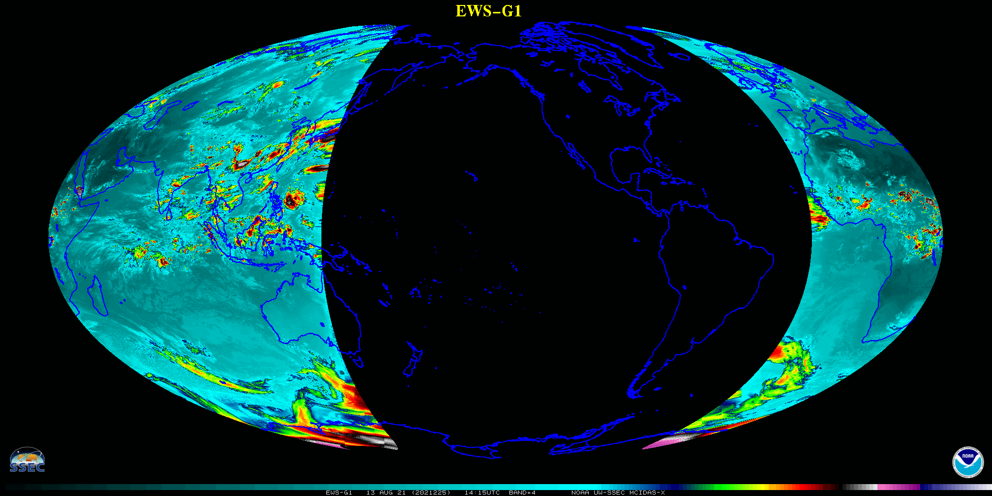
Sequence of Infrared images from EWS-G1 (formerly GOES-13), GOES-17, GOES-15, GOES-14 and GOES-16 (credit: Tim Schmit, NOAA/NESDIS/ASPB) [click to enlarge | MP4]