Subtropical storm in the South Pacific
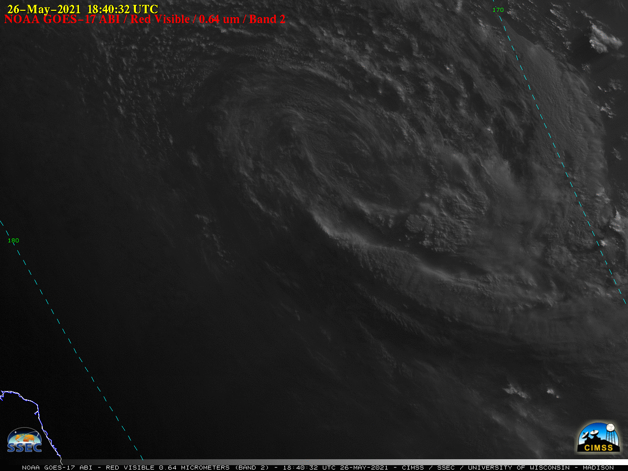
GOES-17 “Red” Visible (0.64 um) images [click to play animation | MP4]
GOES-17 “Clean” Infrared Window (10.3 um) images (below) highlighted the curved band of cold-topped convection wrapping into the deepening storm.
![GOES-17 "Clean" Infrared Window (10.3 um) images [click to play animation | MP4]](https://cimss.ssec.wisc.edu/satellite-blog/images/2021/05/210527_goes17_infrared_South_Pacific_subtropical_storm_anim.gif)
GOES-17 “Clean” Infrared Window (10.3 um) images [click to play animation | MP4]
![NOAA-20 Infrared Window (11.45 um) image [click to enlarge]](https://cimss.ssec.wisc.edu/satellite-blog/images/2021/05/210527_1205utc_noaa20_viirs_infrared_NZ_subtropical_storm.png)
NOAA-20 Infrared Window (11.45 um) image [click to enlarge]
![Suomi NPP VIIRS Day/Night Band (0.7 um) image [click to enlarge]](https://cimss.ssec.wisc.edu/satellite-blog/images/2021/05/nz_sts_snpp_dnb-20210527_122909.png)
Suomi NPP VIIRS Day/Night Band (0.7 um) image [click to enlarge]
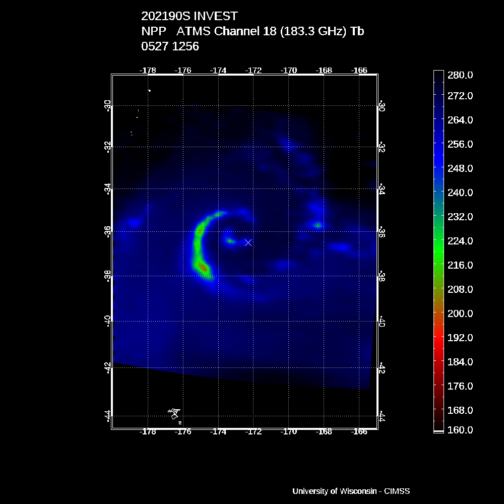
Suomi NPP ATMS Microwave (183.3 GHz) image (credit: Derrick Herndon, CIMSS) [click to enlarge]
![Cross section of Suomi NPP ATMS Brightness Temperature anomaly [click to enlarge]](https://cimss.ssec.wisc.edu/satellite-blog/images/2021/05/210527_1256utc_suomiNPP_atms_btAnomaly_xsect_NZ_subtropical_storm.gif)
Cross section of Suomi NPP ATMS Brightness Temperature anomaly (credit: Derrick Herndon, CIMSS) [click to enlarge]