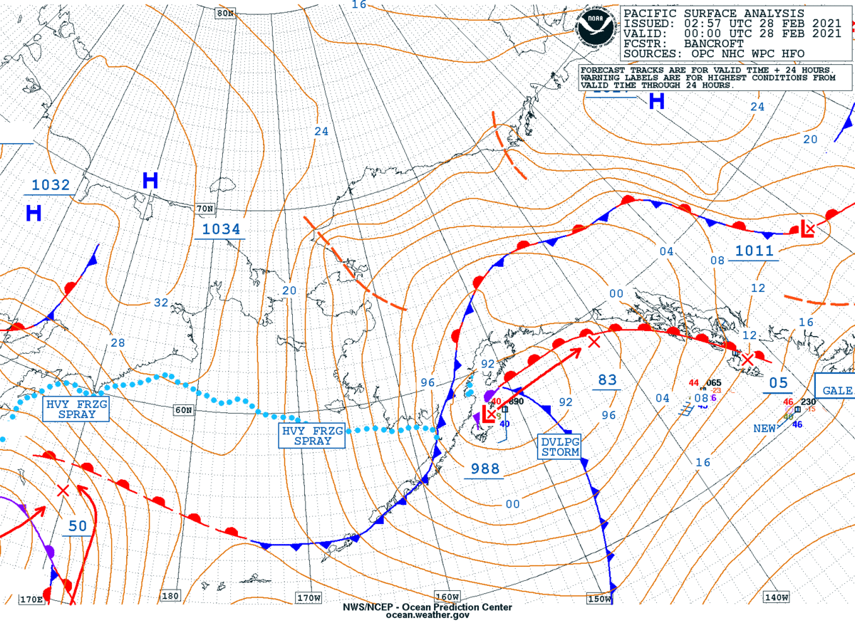
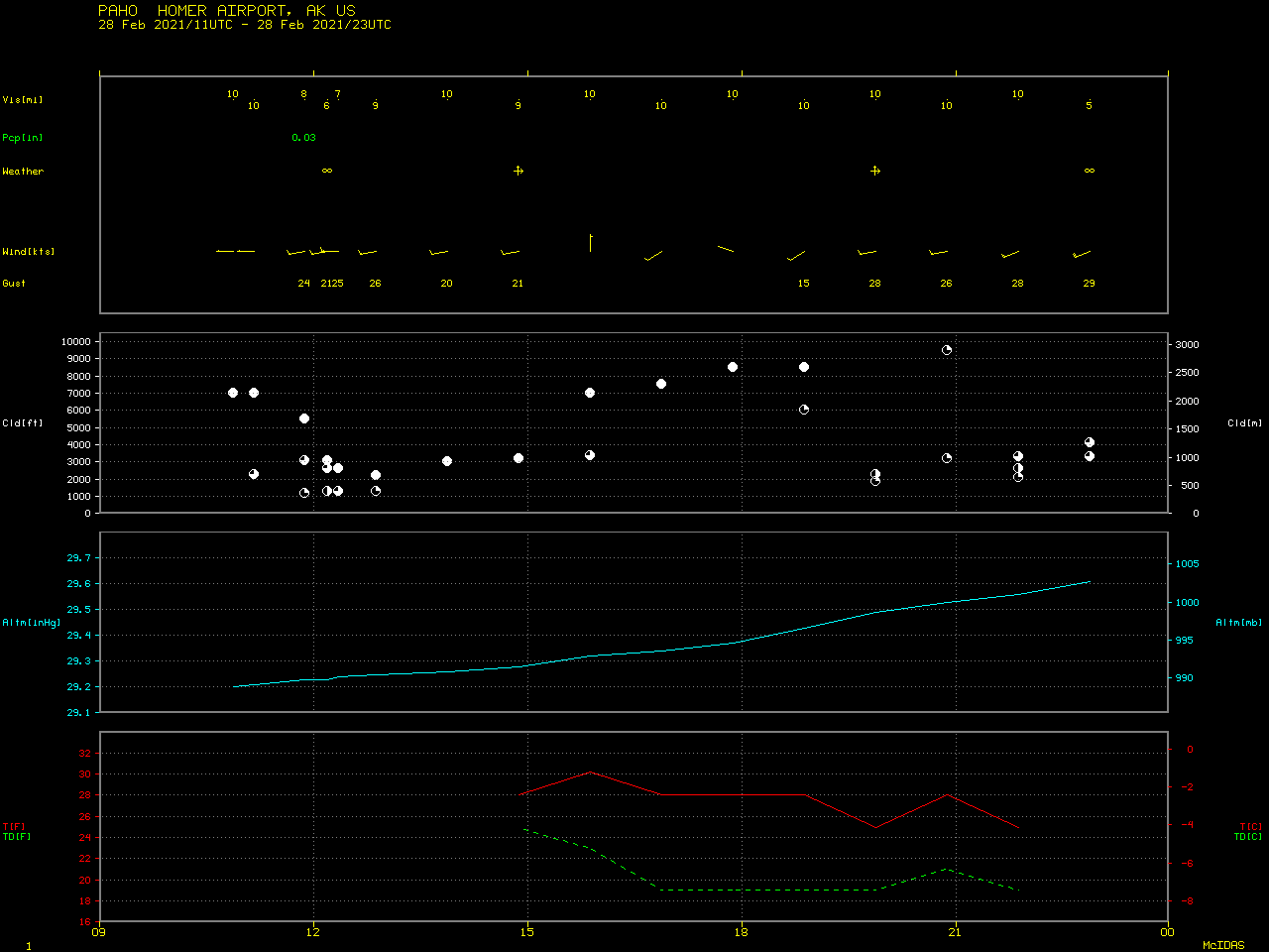
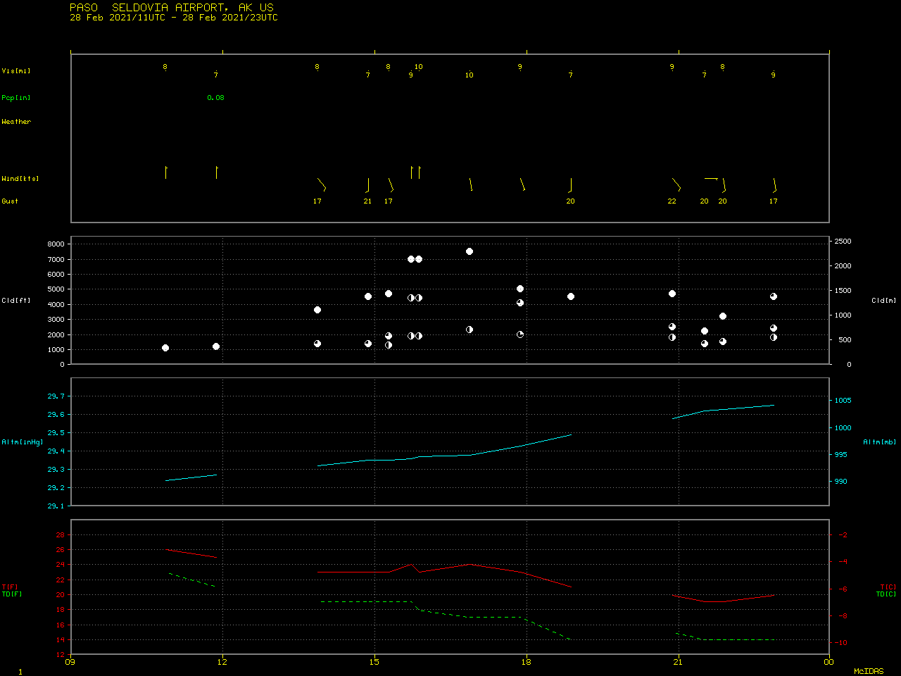
Re-suspended ash from the Katmai volcano in Alaska
![GOES-17 “Red” Visible (0.64 µm) images [click to play animation | MP4]](https://cimss.ssec.wisc.edu/satellite-blog/images/2021/02/210228_goes17_visible_AK_Katmai_ash_anim.gif)
GOES-17 “Red” Visible (0.64 µm) images [click to play animation | MP4]
A sequence of Suomi NPP VIIRS Day/Night Band (0.7 µm) images (below) showed that the plume had formed before sunrise — ample illumination from a Full Moon provided vivid “visible mages at night” (at 1131 UTC and 1311 UTC).
![Suomi NPP VIIRS Day/Night Band (0.7 µm) images [click to enlarge]](https://cimss.ssec.wisc.edu/satellite-blog/images/2021/02/210228_suomiNPP_viirs_dayNightBand_nearConstantContrast_AK_anim.gif)
Suomi NPP VIIRS Day/Night Band (0.7 µm) images [click to enlarge]
![ASCAT winds from Metop-C, at 0743 UTC and 2124 UTC [click to enlarge]](https://cimss.ssec.wisc.edu/satellite-blog/images/2021/02/210228_0734utc_2121utc_metopC_ascat_Katmai_anim.gif)
ASCAT winds from Metop-C, at 0743 UTC and 2124 UTC [click to enlarge]
![GOES-17 True Color RGB images [click to play animation | MP4]](https://cimss.ssec.wisc.edu/satellite-blog/images/2021/02/210228_goes17_trueColorRGB_AK_Katmai_ash_anim.gif)
GOES-17 True Color RGB images [click to play animation | MP4]