The first tropical cyclone of the season?
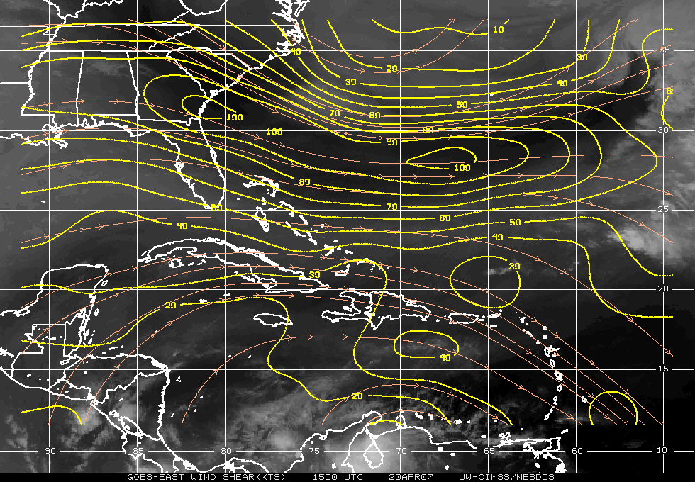
No…just a weak cyclonic vortex off the Atlantic coast of Florida that just happens to look like a tropical cyclone with an eye! GOES-12 visible imagery (above; Java animation) shows the cloud swirl as it developed what appeared to be an “eye” on 20 April 2007. While this vortex was responsible for some weak banded offshore rain features (radar reflectivity image), the GOES-12 10.7 µm IR brightness temperatures were still very warm (around 0º C), indicating a lack of deep convection. The vortex existed in a high-shear environment — around 90 knots on the CIMSS wind shear product (below) — which was not favorable for tropical cyclone development. In addition, the MODIS sea surface temperatures in that region were still below the 80º F (26.7º C) threshold generally considered necessary for tropical cyclone genesis, and GOES sounder total precipitable water values were only in the 20-30 mm (0.79-1.18 inch) range.
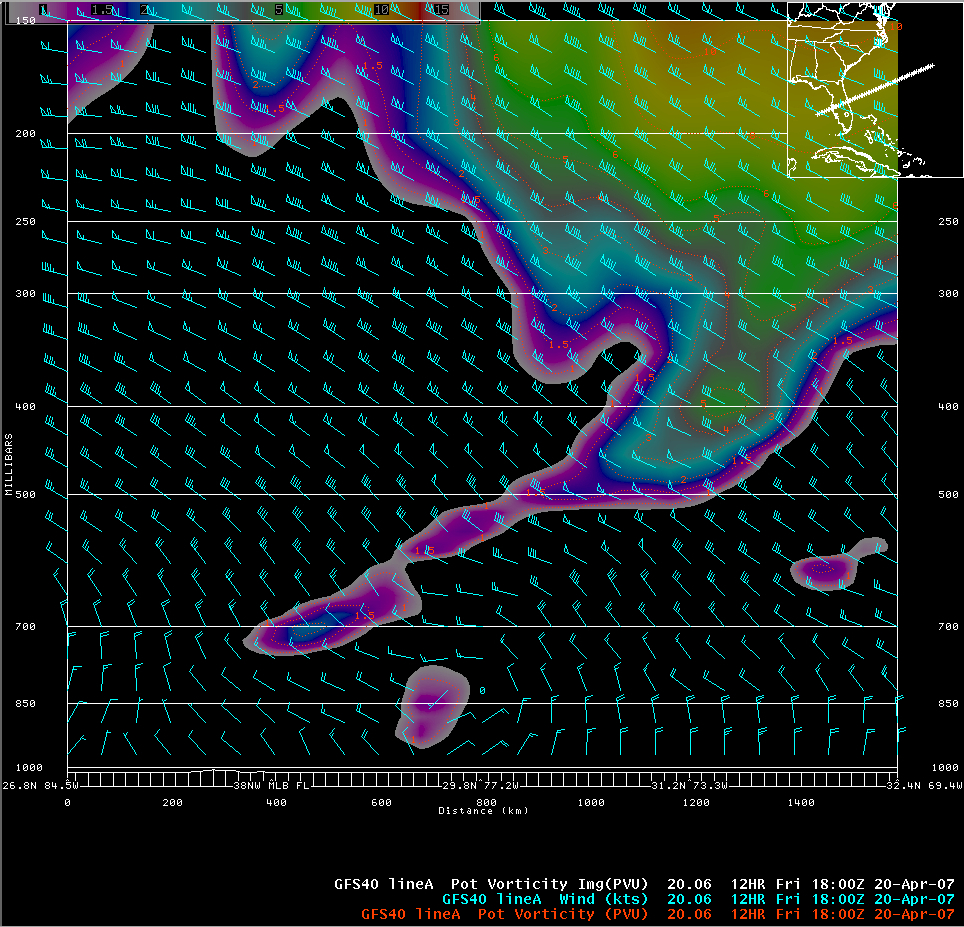
The history of this particular swirl is rather interesting. A Weather Channel Blog posting discussed a possible Mesoscale Convective Vortex (MCV) origin; if we follow satellite imagery back in time for a day or two, the development of this feature appears to have been tied to a fairly large mid/upper tropospheric cyclone that was just south of the Great Lakes on 18 April (QuickTime animations: GOES water vapor | GOES IR). A potential vorticity (PV) anomaly associated with the cyclone shows up as a local maximum of GOES Sounder total column ozone (light green to red enhancement on this QuickTime animation); a GFS model cross section through the region of the swirl at 18 UTC on 20 April (below) suggests that a PV “tail” lagging behind the main PV anomaly farther offshore may have played a role in helping to spin up the swirl.


