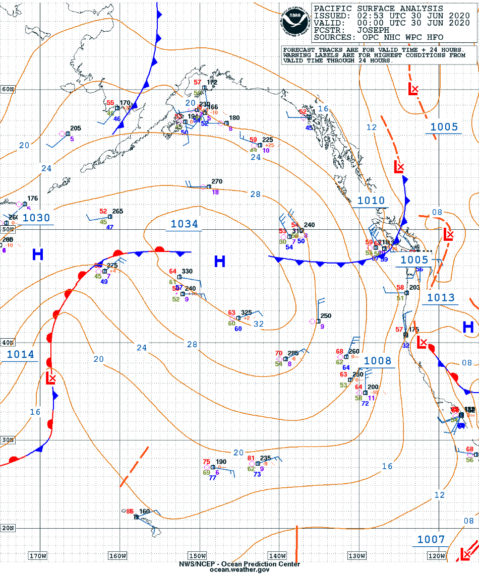
Actinoform clouds near Hawai’i
![GOES-17 “Red” Visible (0.64 µm) images [click to play animation | MP4]](https://cimss.ssec.wisc.edu/satellite-blog/images/2020/06/200630_goes17_visible_HI_actinoform_anim.gif)
GOES-17 “Red” Visible (0.64 µm) images [click to play animation | MP4]
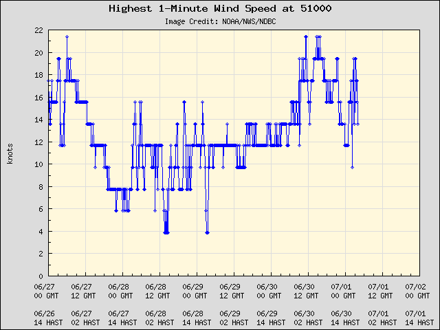
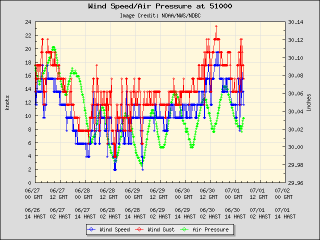
A closer look at the northernmost actinoform feature showed it moving over Buoy 51000 (located 245 miles northeast of Honolulu) around 04 UTC on 01 July — there was somewhat of an increase in 1-minute wind speeds and wind gusts as it approached, but no obvious perturbation was seen in the air pressure (it appeared to have arrived during the typical ~12-hourly drop in pressure).
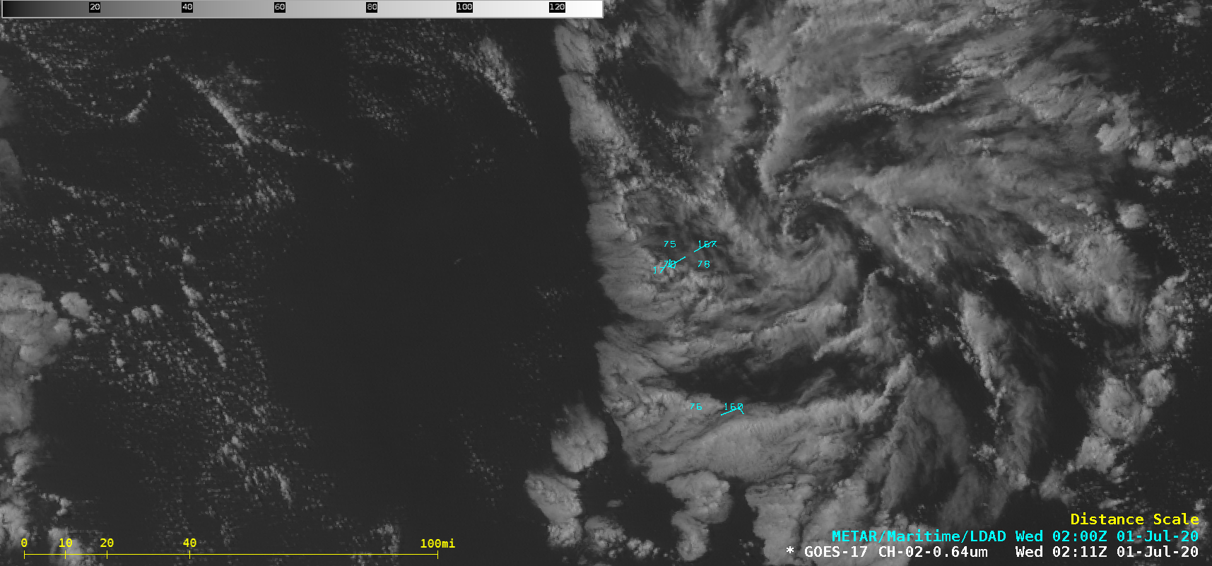
![GOES-17 “Red” Visible (0.64 µm) images [click to play animation | MP4]](https://cimss.ssec.wisc.edu/satellite-blog/images/2020/06/200630_goes17_visible_HI_buoy51000_actinoform_anim.gif)
GOES-17 “Red” Visible (0.64 µm) images [click to play animation | MP4]
![Sequence of 3 hourly (at 0010, 0110 and 0210 UTC) panoramic camera views from Buoy 51000 [click to enlarge]](https://cimss.ssec.wisc.edu/satellite-blog/images/2020/06/200630_buoy51000_panoramic_images_anim.gif)
Sequence of three hourly panoramic camera views from Buoy 51000 — at 0010, 0110 and 0210 UTC [click to enlarge]
![True Color RGB and Infrared Window (11.45 µm) images from NOAA-20 and Suomi NPP [click to enlarge]](https://cimss.ssec.wisc.edu/satellite-blog/images/2020/06/200630_2307utc_noaa20_2357utc_suomiNPP_viirs_trueColorRGB_infraredWindow_HI_actinoform_anim.gif)
True Color RGB and Infrared Window (11.45 µm) images from NOAA-20 and Suomi NPP [click to enlarge]
![Plots of rawinsonde data from Hilo, Hawai'i [click to enlarge]](https://cimss.ssec.wisc.edu/satellite-blog/images/2020/06/200630_PHTO_RAOBS.GIF)
Plots of rawinsonde data from Hilo, Hawai’i [click to enlarge]