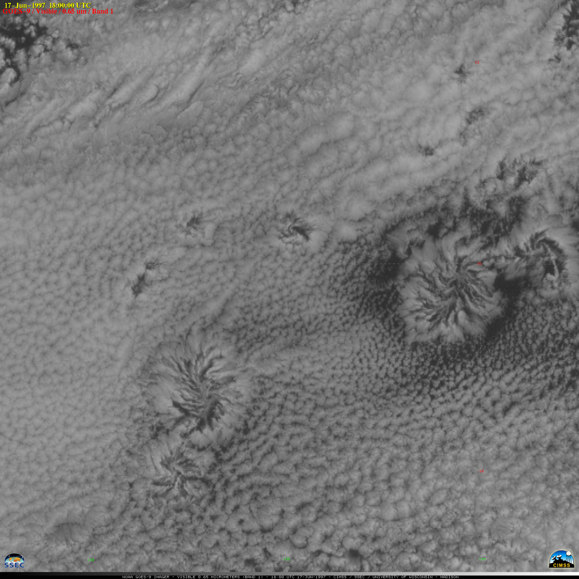
A train of low-level mesoscale cyclonic vortices (also known as actinae or actinoform clouds) was observed within the trade wind stratocumulus field over the eastern North Pacific Ocean (between Hawaii and Baja California) on 17 June 1997. Several stages of maturity are seen, with the largest circulation [about 100 km in diameter] having what appears to be a ring of compensating subsidence around it. From the appearance of the cloud bands which spiral radially inward, low-level convergence is sufficient to initiate upwelling convection in the vicinity of the larger vortex centers, but this convection has difficulty penetrating the cap of the well-defined trade wind inversion. Also of interest in the image animation are what appear to be gravity waves propagating southeastward through the stratocumulus field (perpendicular to the direction of vortex translation).
Additional images from the following day (18 June 1997):
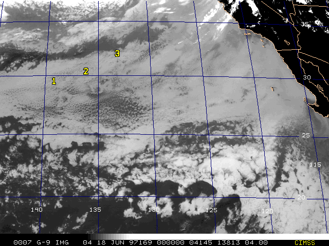
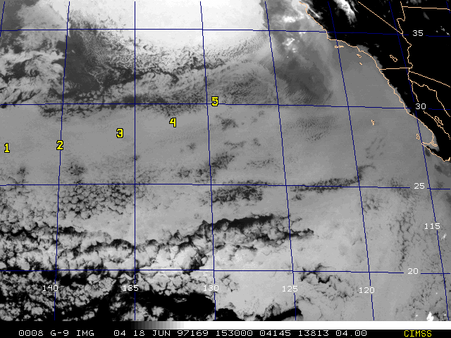
In the two GOES-9 infrared channel 4 (11-micron) images above, a chain of 3 to 5 distinct vortex centers are visible as warm (dark) relatively cloud-free regions within the stratocumulus cloud deck. These vortices drifted west-southwestward in the prevailing northeasterly trade wind flow, maintaining approximately 4 degrees of latitudinal separation.
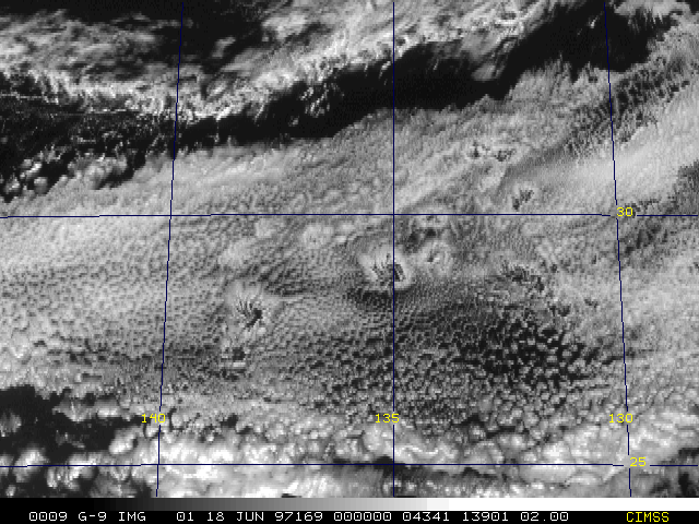
A GOES-9 visible image of this region is shown below.