Developing winter storm over Colorado
![GOES-16 Mid-level Water Vapor (6.9 um) images, with hourly plots of surface wind barbs and gusts (knots) [click to play animation | MP4]](https://cimss.ssec.wisc.edu/satellite-blog/images/2020/03/G16_WV_WINDS_PLAINS_19MAR2020_B9_2020079_180114_GOES-16_0001PANEL_FRAME00073.GIF)
GOES-16 Mid-level Water Vapor (6.9 um) images, with hourly plots of surface wind barbs and gusts (knots) [click to play animation | MP4]
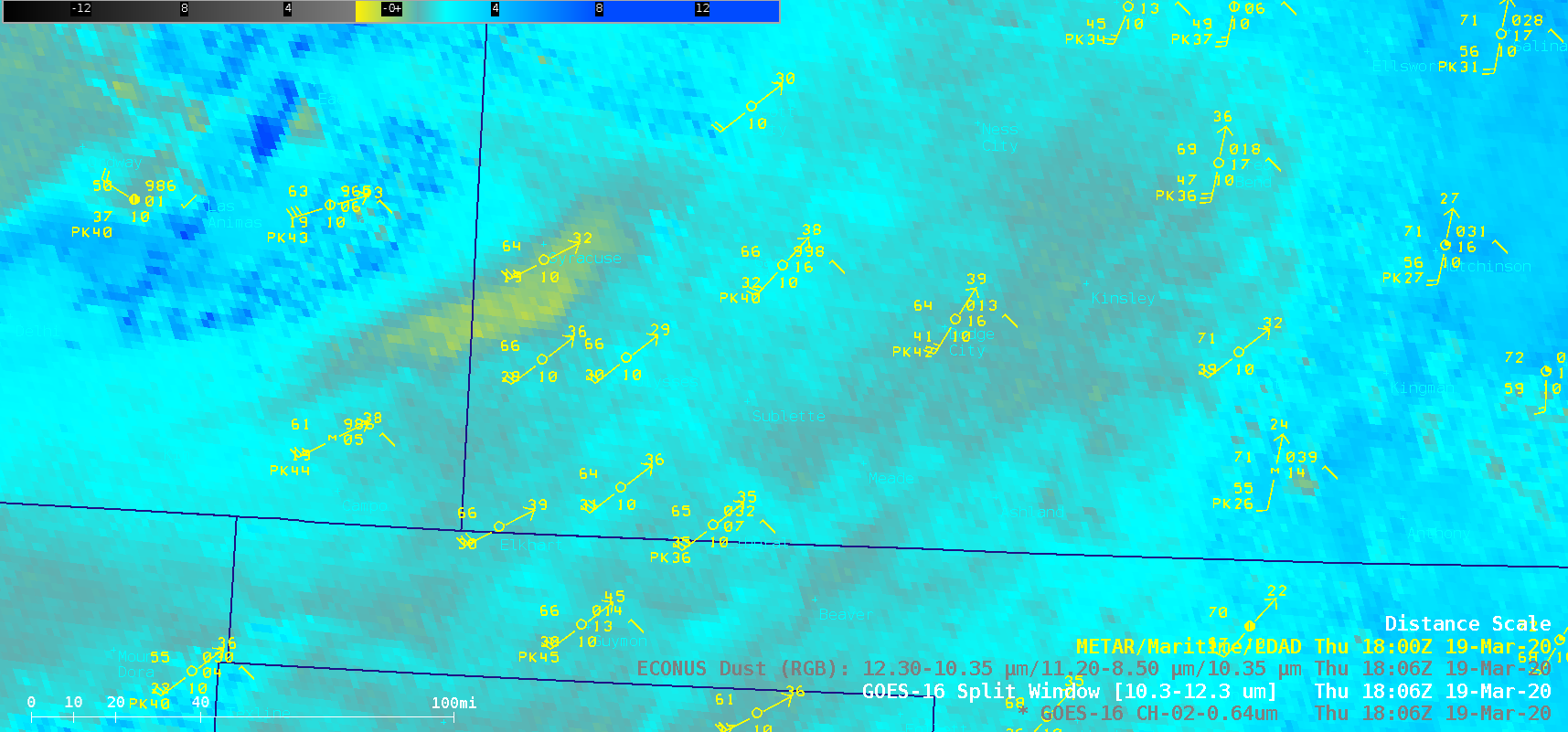
As a result of the strong winds, several areas of blowing dust were seen in GOES-16 “Red” Visible (0.64 um), Split Window Difference (10.3-12.3 um) and Dust Red-Green-Blue (RGB) images (below): (1) a well-defined plume that originated in southeastern Colorado and moved northeastward across western Kansas, (2) a smaller plume originating north/northwest of Lamar, Colorado which moved eastward toward the Colorado/Kansas border, (3) a small plume that originated over the burn scar from the 07 March “Beaver Fire” in the Oklahoma Panhandle, and (4) multiple narrow plumes of dust in the wake of a cold front that moved southeastward across the region late in the day (which reduced the surface visiblity to 2 miles in southwestern Kansas).

GOES-16 “Red” Visible (0.64 um), Split Window Difference (10.3-12.3 um) and Dust RGB images [click to play animation | MP4]
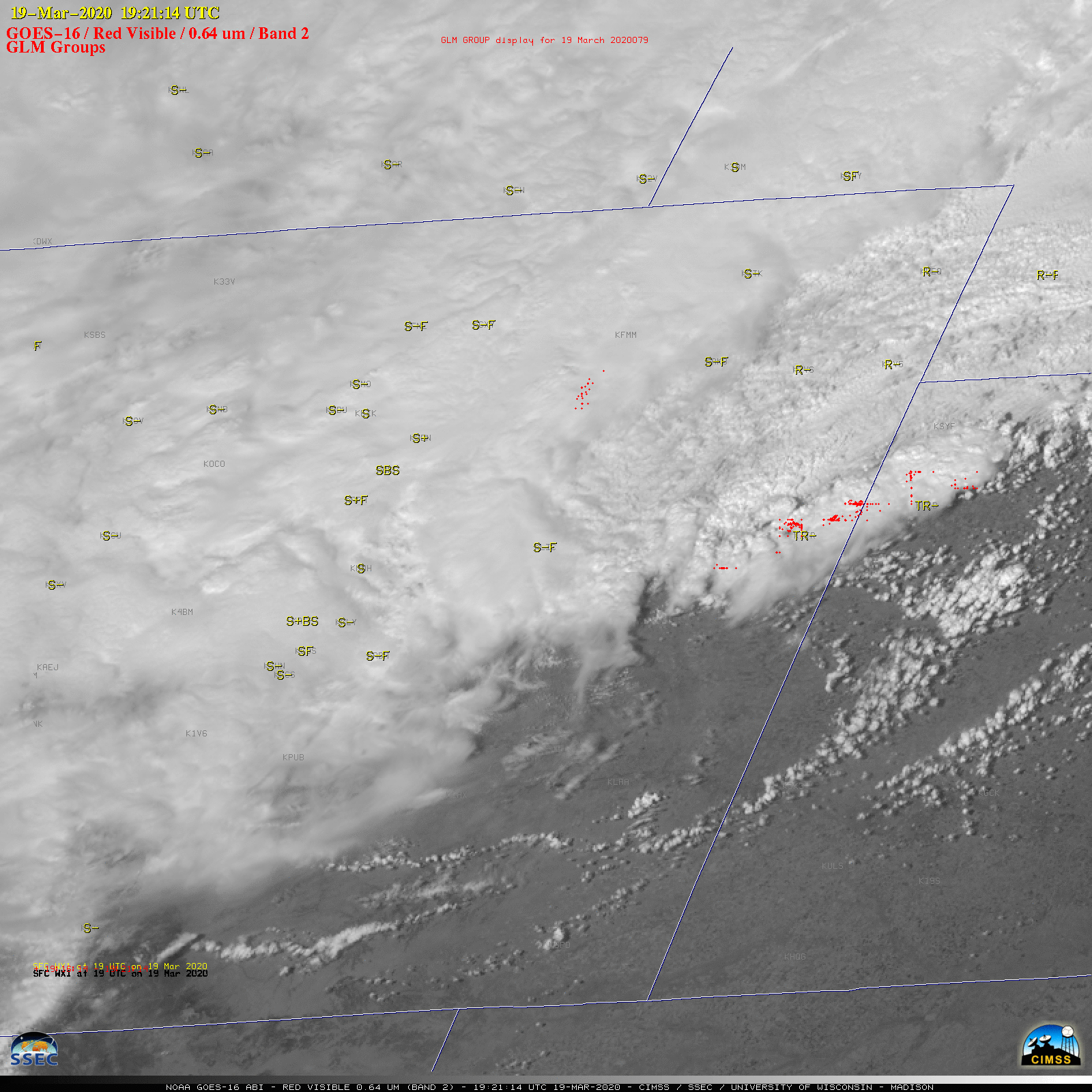
GOES-16 Visible images with plots of GLM Groups (below) revealed a few clusters of lightning associated with convective elements that were likely producing thundersnow across northeastern Colorado and near the Colorado/Nebraska border. Where warmer air was still present near the Colorado/Kansas border, a more longer-lived thunderstorm was producing rainfall at the surface.

GOES-16 “Red” Visible (0.64 um) images, with GLM Groups plotted in red and hourly surface weather type plotted in yellow [click to play animation | MP4]
This poor TV tower was blasted with #lightning about 60 times yesterday during the winter storm. @JimCantore we had a huge #thundersnow event in #COwx yesterday triggered by TV towers and wind turbines. Check out the blog I wrote here: https://t.co/9lqqL1cK78 pic.twitter.com/F7rkDOhCVM
— Ch?is Vagas|?y (@COweatherman) March 20, 2020
===== 20 March Update =====
![GOES-16 Day Cloud Phase Distinction RGB images [click to play animation | MP4]](https://cimss.ssec.wisc.edu/satellite-blog/images/2020/03/dcpd-20200320_161114.png)
GOES-16 Day Cloud Phase Distinction RGB images [click to play animation | MP4]
===== 21 March Update =====
On 21 March, a decrease in cloudiness over eastern Colorado allowed much of the snow cover (shades of cyan) to be seen in a swath of 30-meter resolution Landsat-8 False Color imagery as viewed using RealEarth (above). The effects of terrain were evident, with a lack of snow cover seen in areas where downslope flow was prevalent during the winter storm.

![NOAA-20 True Color RGB image at 18:40 UTC [click to enlarge]](https://cimss.ssec.wisc.edu/satellite-blog/images/2020/03/200319_1840utc_noaa20_trueColorRGB_CO_KS_blowing_dust.png)
![Landsat-8 False Color RGB image, with and without labels [click to enlarge]](https://cimss.ssec.wisc.edu/satellite-blog/images/2020/03/200321_1724utc_landsat8_falseColorRGB_CO_snow_cover_anim.gif)