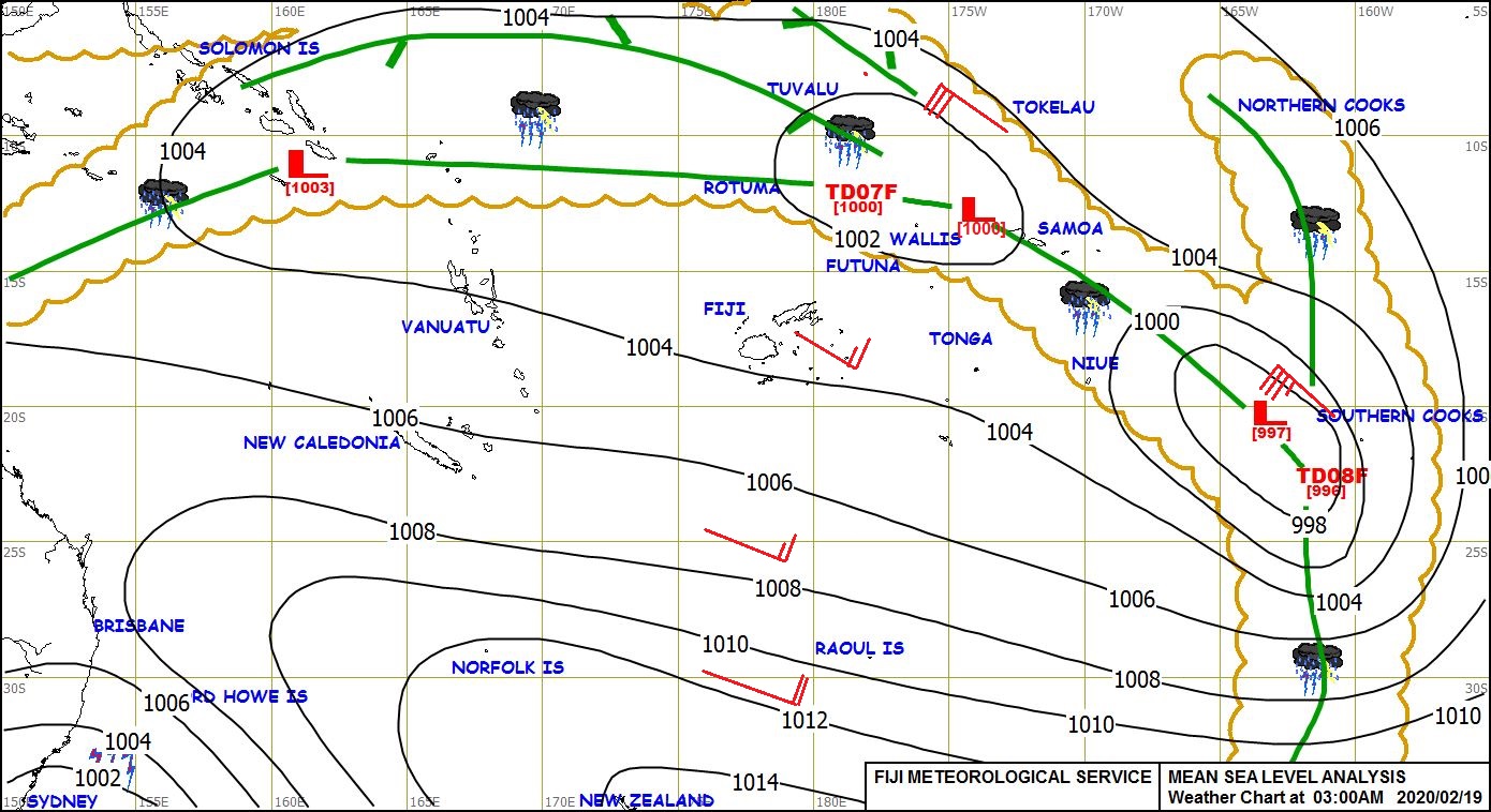
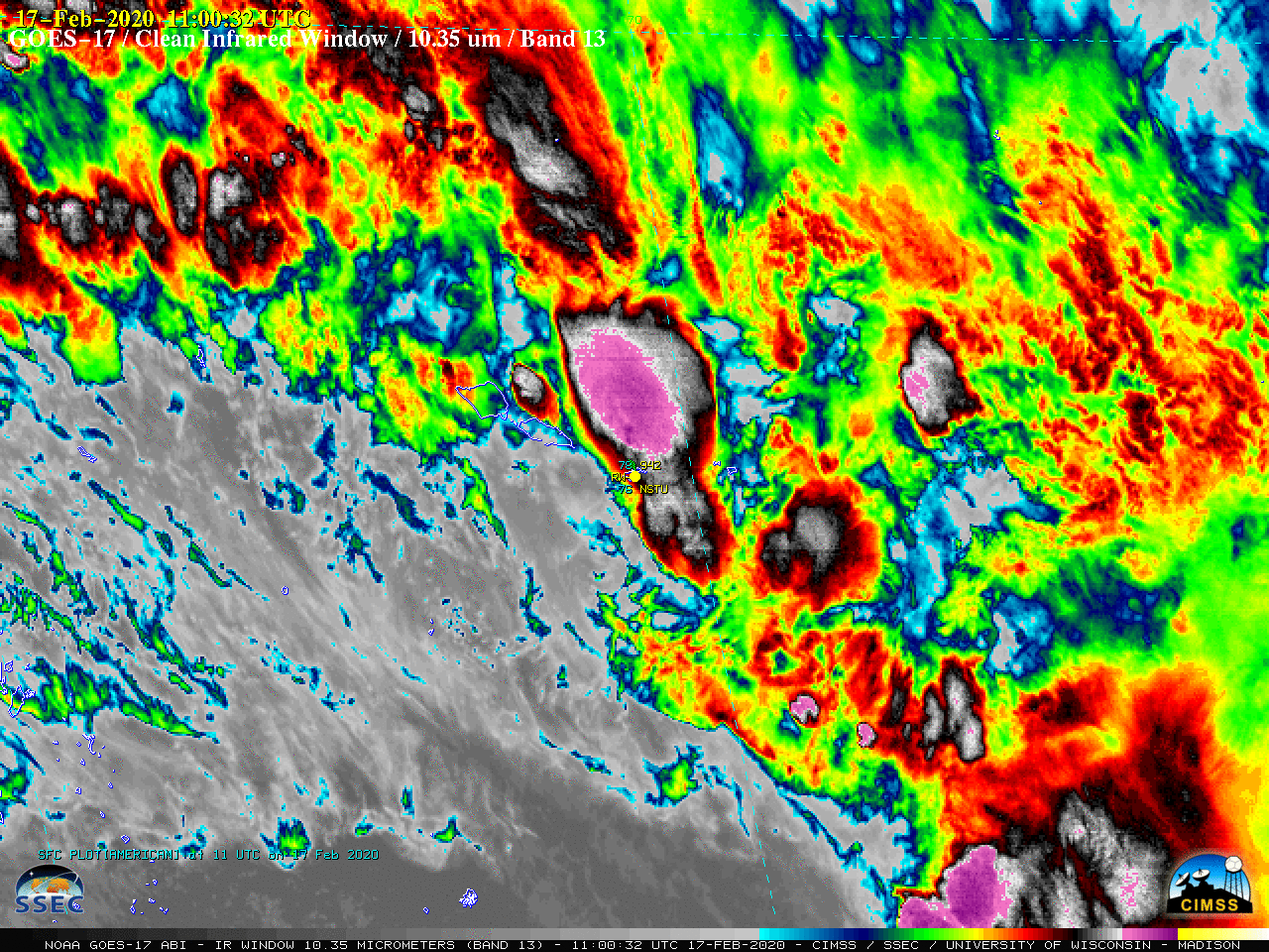
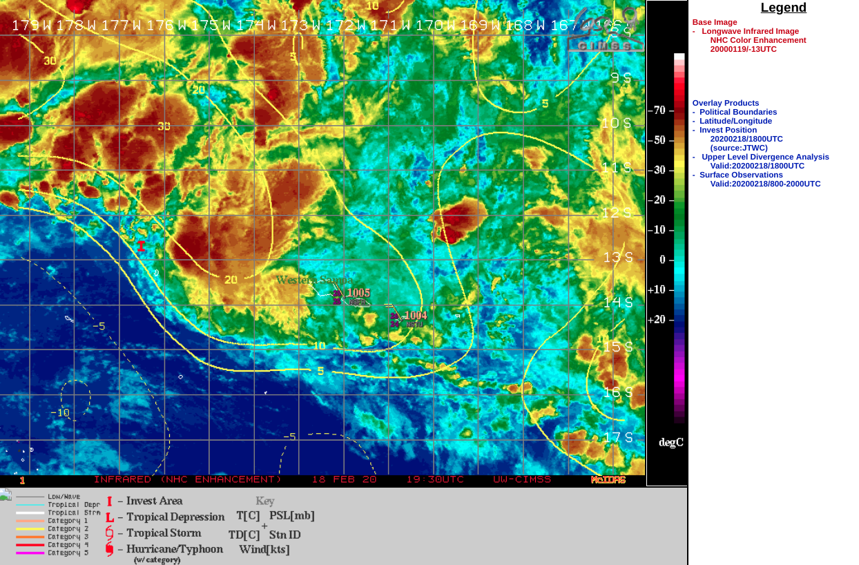
Tropical Invest 96P and Tropical Cyclone Vicky near American Samoa

GOES-17 “Clean” Infrared Window (10.35 µm) images, 16-18 February [click to play animation | MP4]
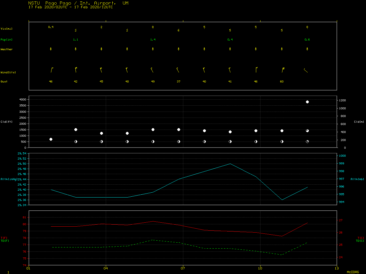
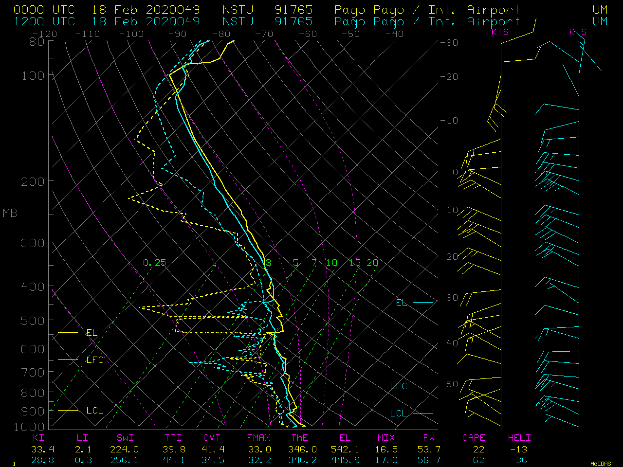
With an increasing probability of Invest 96P becoming better organized (aided by low values of deep-layer wind shear along with modest upper-level divergence), a GOES-17 Mesoscale Domain Sector was positioned over the Samoan Islands on 18 February — providing “Red” Visible (0.64 µm) and “Clean” Infrared Window images at 1-minute intervals (below). During this period, the coldest convective overshooting tops exhibited infrared brightness temperatures in the -80 to -85ºC range (which corresponded to the tropopause temperatures seen in Pago Pago rawinsonde data).
![GOES-17 "Red" Visible (0.64 µm) and "Clean" Infrared Window (10.35 µm) images, 18 February [click to play animation | MP4]](https://cimss.ssec.wisc.edu/satellite-blog/images/2020/02/200218_goes17_visible_infrared_American_Samoa_anm.gif)
GOES-17 “Red” Visible (0.64 µm) and “Clean” Infrared Window (10.35 µm) images with surface plots for Pago Pago, American Samoa on 18 February [click to play animation | MP4]
===== 20 February Update =====
![GOES-17 "Red" Visible (0.64 µm) and "Clean" Infrared Window (10.35 µm) images with surface plots for Pago Pago, American Samoa on 18 February [click to play animation | MP4]](https://cimss.ssec.wisc.edu/satellite-blog/images/2020/02/200220_goes17_visible_infrared_American_Samoa_anim.gif)
GOES-17 “Red” Visible (0.64 µm) and “Clean” Infrared Window (10.35 µm) images with surface plots for Pago Pago, American Samoa on 20 February [click to play animation | MP4]
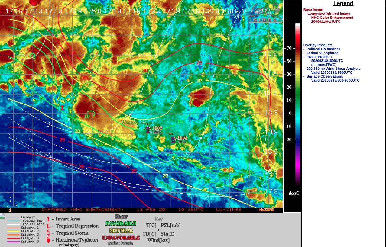
GOES-17 Infrared Window (11.2 µm) images from the CIMSS Tropical Cyclones site (below) showed that Vicky was moving through an environment characterized by of low values of Deep Layer Wind Shear, a favorable factor for further intensification.
![GOES-17 Infrared Window (11.2 µm) images with contours of Deep Layer Wind Shear (click to enlarge]](https://cimss.ssec.wisc.edu/satellite-blog/images/2020/02/200220_00utc_shear_Cyclone_Vicky_anim.gif)
GOES-17 Infrared Window (11.2 µm) images with contours of Deep Layer Wind Shear [click to enlarge]
![Hourly MIMIC Total Precipitable Water product during the 16-20 February period [click to play animation | MP4]](https://cimss.ssec.wisc.edu/satellite-blog/images/2020/02/200216_200220_mimicTPW_anim.gif)
Hourly MIMIC Total Precipitable Water product during the 16-20 February period [click to play animation | MP4]