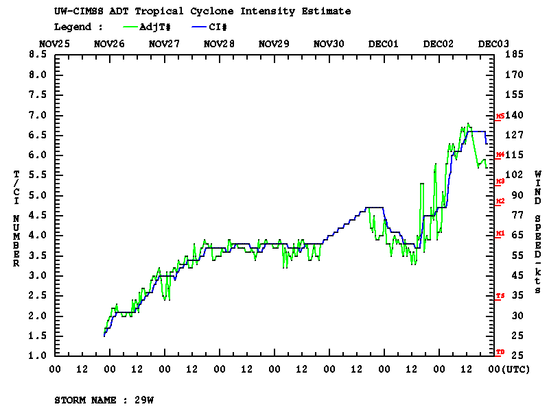
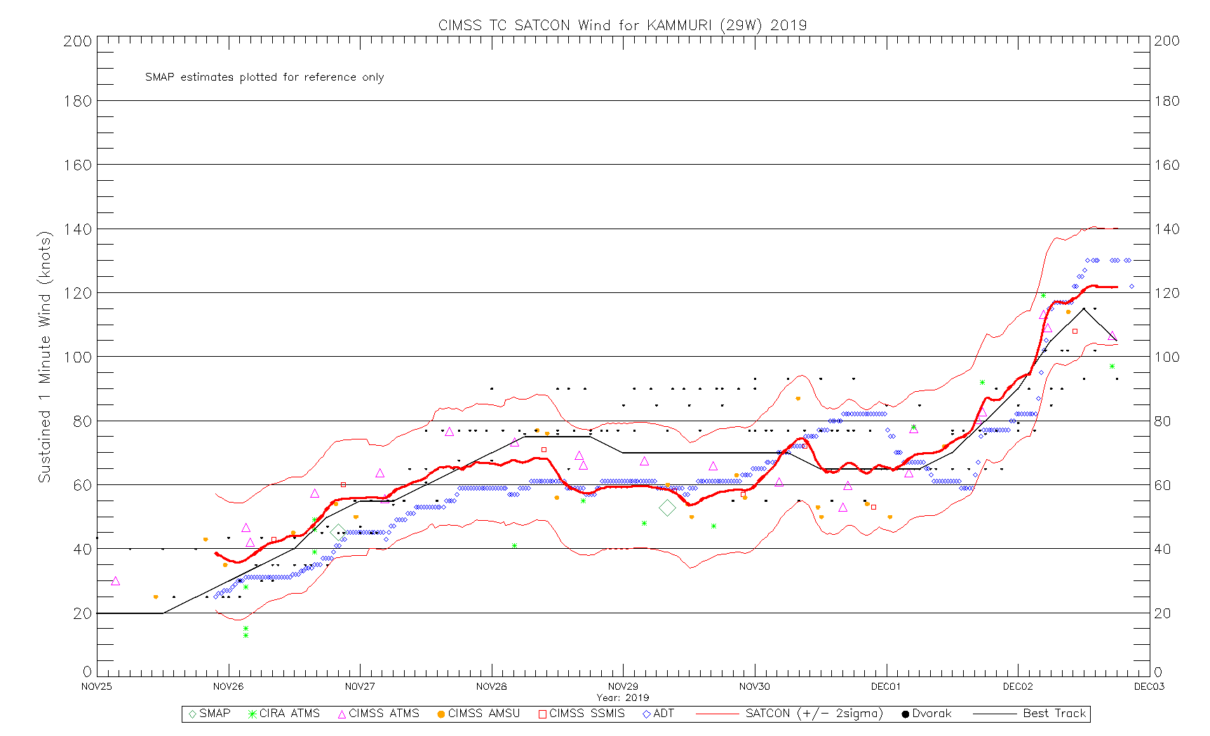
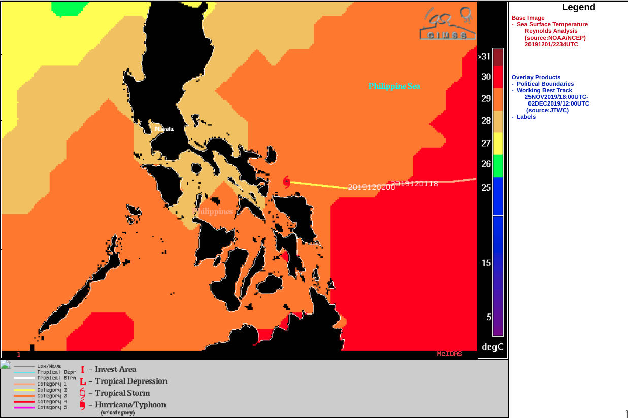
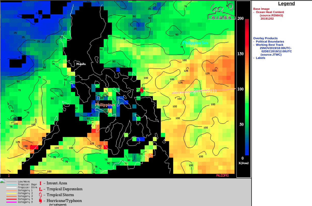
Typhoon Kammuri makes landfall in the Philippines

Himawari-8 “Clean” Infrared (10.4 µm) images [click to play animation | MP4]
VIIRS Infrared Window (11.45 µm) from Suomi NPP at 1707 UTC and NOAA-20 at 1757 UTC viewed using RealEarth (below) depicted Kammuri 2-3 hours after landfall.
![VIIRS Infrared Window (11.45 µm) from Suomi NPP at 1707 UTC and NOAA-20 at 1757 UTC [click to enlarge]](https://cimss.ssec.wisc.edu/satellite-blog/wp-content/uploads/sites/5/2019/12/191202_1707utc_suomiNPP_1757utc_noaa20_viirs_infrared_Typhoon_Kammuri_anim.gif)
VIIRS Infrared Window (11.45 µm) from Suomi NPP at 1707 UTC and NOAA-20 at 1757 UTC [click to enlarge]
![GCOM-W1 AMSR2 Microwave (85 GHz) image at 1725 UTC [click to enlarge]](https://cimss.ssec.wisc.edu/satellite-blog/wp-content/uploads/sites/5/2019/12/191202_1725utc_gcomW1_amsr2_microwave_Kammuri.png)
GCOM-W1 AMSR2 Microwave (85 GHz) image at 1725 UTC [click to enlarge]