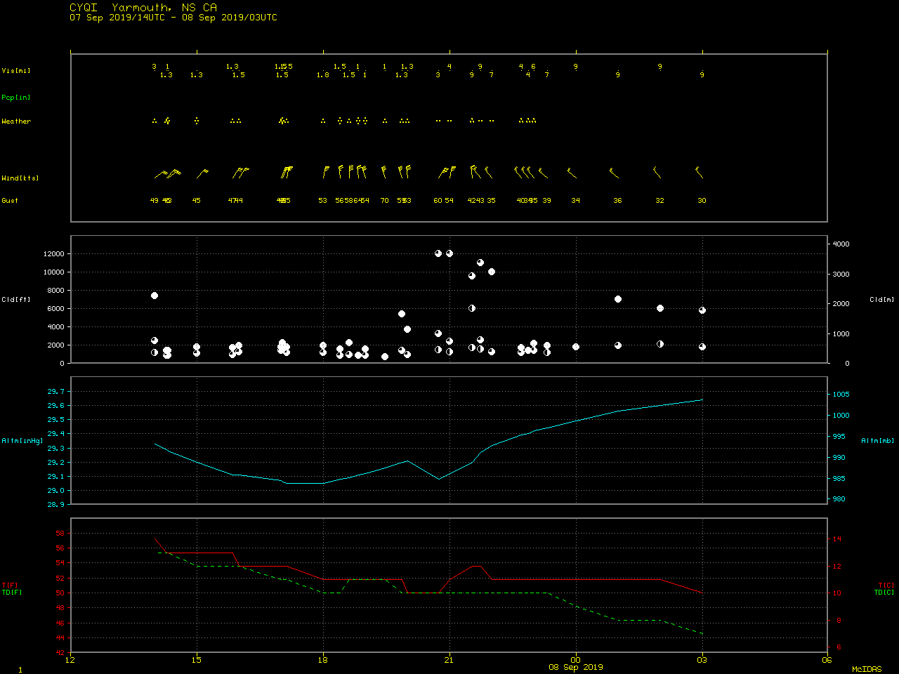
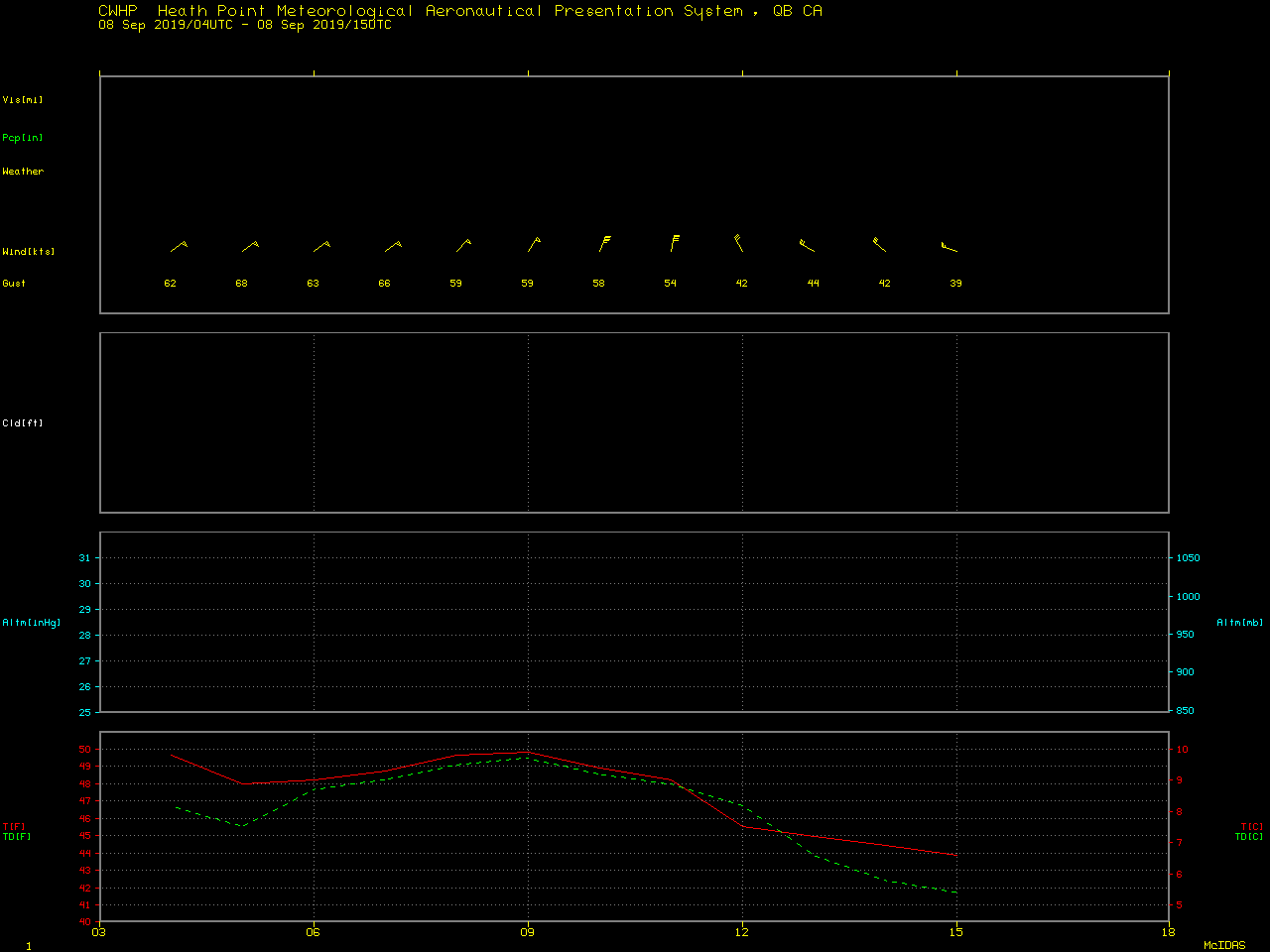
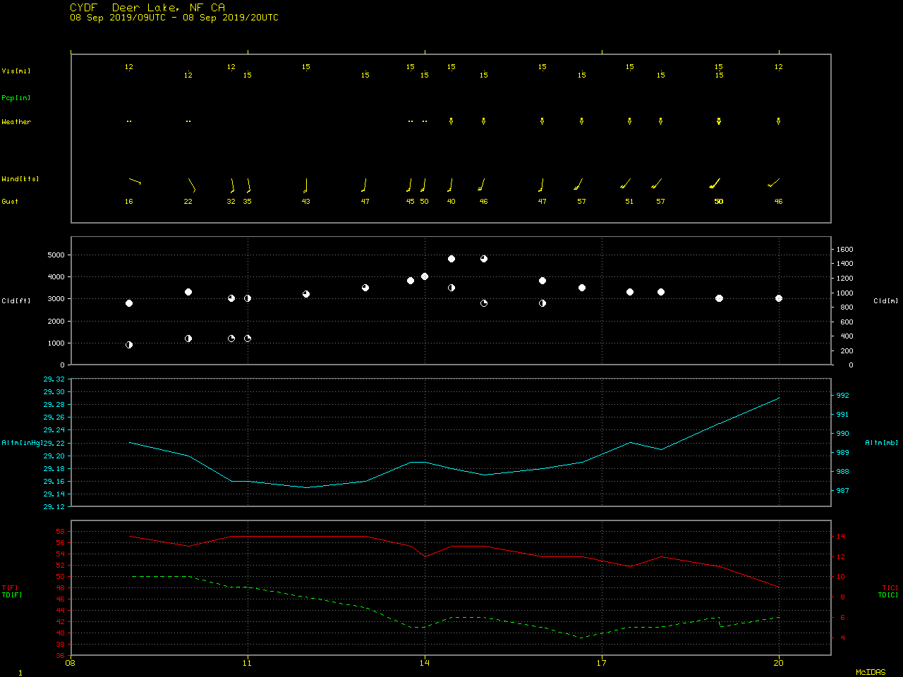
Dorian moves across the Maritime Provinces of Canada
![GOES-16 “Red” Visible (0.64 µm) and “Clean” Infrared Window (10.35 µm) images [click to play animation | MP4]](https://cimss.ssec.wisc.edu/satellite-blog/wp-content/uploads/sites/5/2019/09/190907_goes16_visible_infrared_Dorian_anim.gif)
GOES-16 “Red” Visible (0.64 µm) and “Clean” Infrared Window (10.35 µm) images [click to play animation | MP4]
![VIIRS True Color RGB and Infrared Window (11.45 µm) images from Suomi NPP and NOAA-20 [click to enlarge]](https://cimss.ssec.wisc.edu/satellite-blog/wp-content/uploads/sites/5/2019/09/190907_suomiNPP_noaa20_viirs_trueColor_infraredWindow_Dorian_anim.gif)
VIIRS True Color RGB and Infrared Window (11.45 µm) images from Suomi NPP and NOAA-20 [click to enlarge]
![Metop-B ASCAT winds [click to enlarge]](https://cimss.ssec.wisc.edu/satellite-blog/wp-content/uploads/sites/5/2019/09/190907_15utc_metopB_ascat_Dorian.png)
Metop-B ASCAT winds [click to enlarge]
![Suomi NPP VIIRS True Color RGB and Infrared Window (11.45 µm) images [click to enlarge]](https://cimss.ssec.wisc.edu/satellite-blog/wp-content/uploads/sites/5/2019/09/190908_1630utc_suomiNPP_viirs_trueColor_infraredWindow_PTC_Dorian_anim.gif)
Suomi NPP VIIRS True Color RGB and Infrared Window (11.45 µm) images [click to enlarge]
#Dorian is a storm the Maritimes won't soon forget.
Wind gusts to 145 km/h (even stronger Les Suetes) up to 161 mm of rainfall, damaging storm surge and yes, the first snow of the season.
Here's a summary on the Hurricane turned Post Tropical storm#nsstorm #nbstorm #pestorm pic.twitter.com/EDi16LRQd7— Ryan Snoddon (@ryansnoddon) September 9, 2019