Lake effect snow in Nevada
Lake Effect Snow off Pyramid Lake will affect the morning commute for much of Reno-Sparks. Accumulations up 3 inches with locally heavier amount through noon today. Slow down when in the band. #LakeEffect pic.twitter.com/ul2RJRb46F
— NWS Reno (@NWSReno) February 21, 2019

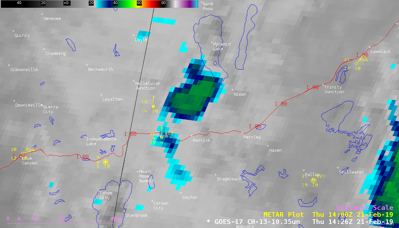
GOES-17 “Clean” Infrared Window (10.3 µm) images [click to play animation | MP4]
A morning overpass of the NOAA-19 satellite provided a 1-km resolution Infrared Window (10.8 µm) image of the lake effect cloud at 1254 UTC (below). The coldest cloud-top infrared brightness temperature on that image was -46ºC.
GOES-17 cloud-top infrared brightness temperatures associated with this feature were as cold as -47ºC just after 15 UTC, which were very close to the tropopause temperature of -47.9ºC on 12 UTC rawinsonde data from Reno (below). Although clouds often prevented a good view of Lake Pyramid, Terra MODIS Sea Surface Temperature values of 42º and 43ºF were sampled on 11 and 16 February (below). With a northerly flow of air having temperatures around 20ºF across such warm water, significant boundary layer instability was generated to aid the growth of the lake effect cloud feature. Although the view angle from GOES-16 (GOES-East) was rather large, a Land Surface Temperature pixel mapped to the northern portion of the lake had a value of 39.3ºF at 1701 UTC (below).

![Terra MODIS Sea Surface Temperature product on 11 and 16 February [click to enlarge]](https://cimss.ssec.wisc.edu/satellite-blog/wp-content/uploads/sites/5/2019/02/190211_190216_modis_sst_Pyramid_Lake_NV_anim.gif)
![GOES-16 Land Surface Temperature product at 1701 UTC [click to enlarge]](https://cimss.ssec.wisc.edu/satellite-blog/wp-content/uploads/sites/5/2019/02/190221_1701utc_goes16_landSurfaceTemperature_Pyramid_Lake_NV.png)