Strong midlatitude cyclone north of Hawai’i
GOES-17 “Red” Visible (0.64 µm) images [click to play MP4 animation]
* GOES-17 images shown here are preliminary and non-operational *
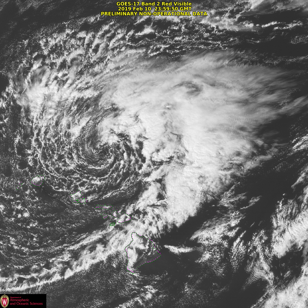
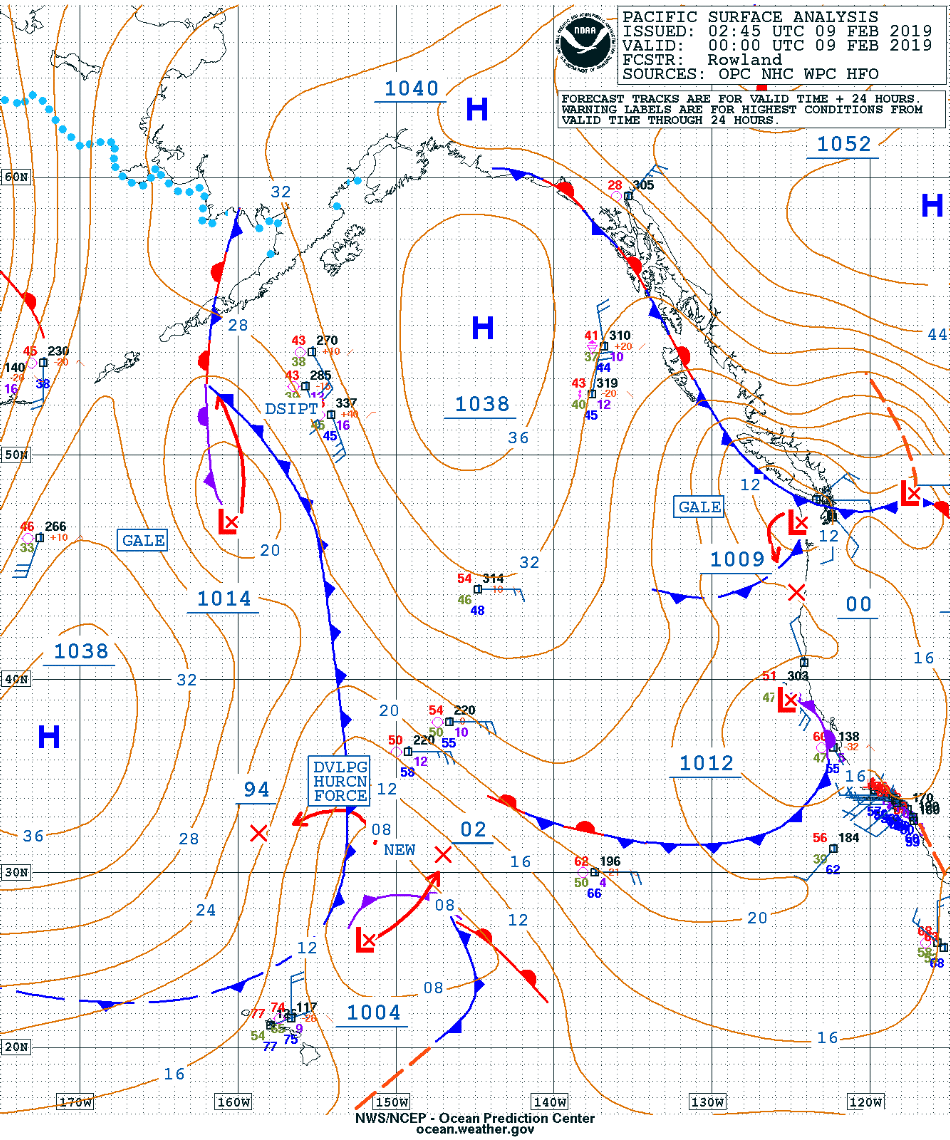
1-minute Mesoscale Domain Sector GOES-17 “Red” Visible (0.64 µm) images from the AOS site (above) showed the distinct circulation of a strong midlatitude cyclone (surface analyses) that was centered just north of Hawai’i on 10 February 2019. The pressure gradient associated with this storm produced strong winds across the island chain. Wave heights to 38.4 feet were recorded at Buoy 51208 near Kaua’i, with wind gusts to 57 knots at Buoy 51001 northwest of Kauwa’i.
Here's a brief overview of some of the highest wind speeds and other impacts we experience over the weekend. Unsettled weather looks to stick around though the rest of the week with breezy trades. See https://t.co/fUefWa9aTA for the full forecast #hiwx pic.twitter.com/24Qi1fnxAJ
— NWSHonolulu (@NWSHonolulu) February 13, 2019
GOES-17 Low-level (7.3 µm), Mid-level (6.9 µm) and Upper-level (6.2 µm) Water Vapor images (below) revealed the presence of numerous lee waves which extended hundreds of miles downwind of the islands — most notable were those emanating from Kauwa’i.
![GOES-17 Low-level (7.3 µm), Mid-level (6.9 µm) and Upper-level (6.2 µm) images [click to play animation | MP4]](https://cimss.ssec.wisc.edu/satellite-blog/wp-content/uploads/sites/5/2019/02/190210_goes17_waterVapor_Hawaii_anim.gif)
GOES-17 Low-level (7.3 µm), Mid-level (6.9 µm) and Upper-level (6.2 µm) Water Vapor images [click to play animation | MP4]
![Derived Motion Winds calculated using GOES-15 Water Vapor (6.5 µm) imagery [click to enlarge]](https://cimss.ssec.wisc.edu/satellite-blog/wp-content/uploads/sites/5/2019/02/190210_goes15_waterVapor_winds_anim.gif)
Derived Motion Winds calculated using GOES-15 Water Vapor (6.5 µm) imagery [click to enlarge]
![GOES-17 Air Mass RGB images [click to play MP4 animation]](https://cimss.ssec.wisc.edu/satellite-blog/wp-content/uploads/sites/5/2019/02/20190210060038_namer.jpg)
GOES-17 Air Mass RGB images [click to play MP4 animation]
![Suomi NPP VIIRS True Color and Infrared Window (11.45 µm) images at 23 UTC [click to enlarge]](https://cimss.ssec.wisc.edu/satellite-blog/wp-content/uploads/sites/5/2019/02/190210_23utc_suomiNPP_viirs_truecolor_infrared_HI_anim.gif)
Suomi NPP VIIRS True Color and Infrared Window (11.45 µm) images at 23 UTC [click to enlarge]