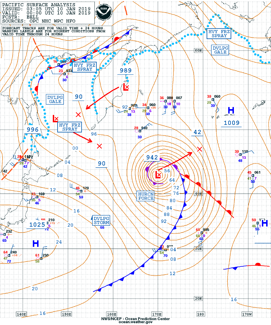
Hurricane Force low in the West Pacific
GOES-17 “Red” Visible (0.64 µm) images [click to play animation | MP4]
* GOES-17 images shown here are preliminary and non-operational *
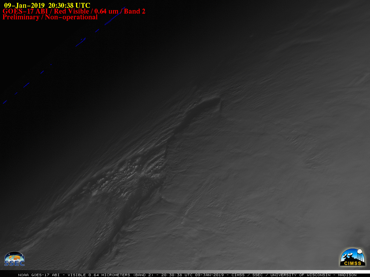
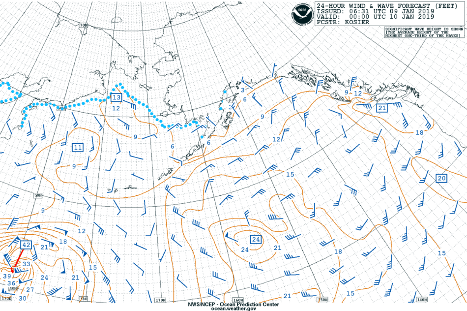
GOES-17 “Red” Visible (0.64 µm) images (above) revealed the low-level circulation of an occluded Hurricane Force low (surface analyses) over the West Pacific Ocean on 09 January – 10 January 2019. This storm was forecast to produce wave heights up to 40-60 feet.
GOES-17 Low-level (7.3 µm), Mid-level (6.9 µm) and Upper-level (6.2 µm) Water Vapor images (below) showed the circulation of the storm at higher altitudes.
![GOES-17 Low-level (7.3 µm, left), Mid-level (6.9 µm, center) and Upper-level (6.2 µm, right) Water Vapor images [click to play animation | MP4]](https://cimss.ssec.wisc.edu/satellite-blog/wp-content/uploads/sites/5/2019/01/190110_goes17_waterVapor_West_Pacific_storm_anim.gif)
GOES-17 Low-level (7.3 µm, left), Mid-level (6.9 µm, center) and Upper-level (6.2 µm, right) Water Vapor images [click to play animation | MP4]
![GOES-17 Mid-level Water Vapor (6.9 µm) image with Metop-A ASCAT surface scatterometer winds [click to enlarge]](https://cimss.ssec.wisc.edu/satellite-blog/wp-content/uploads/sites/5/2019/01/190110_0930utc_goes17_waterVapor_ascat_winds_West_Pacific_anim.gif)
GOES-17 Mid-level Water Vapor (6.9 µm) image with Metop-A ASCAT surface scatterometer winds [click to enlarge]
![NOAA-20 VIIRS True Color and Infrared Window (11.45 µm) images [click to enlarge]](https://cimss.ssec.wisc.edu/satellite-blog/wp-content/uploads/sites/5/2019/01/190110_suomiNPP_noaa20_viirs_truecolor_infrared_West_Pacific_anim.gif)
NOAA-20 VIIRS True Color and Infrared Window (11.45 µm) images [click to enlarge]