Fog/stratus dissipation in southern Louisiana
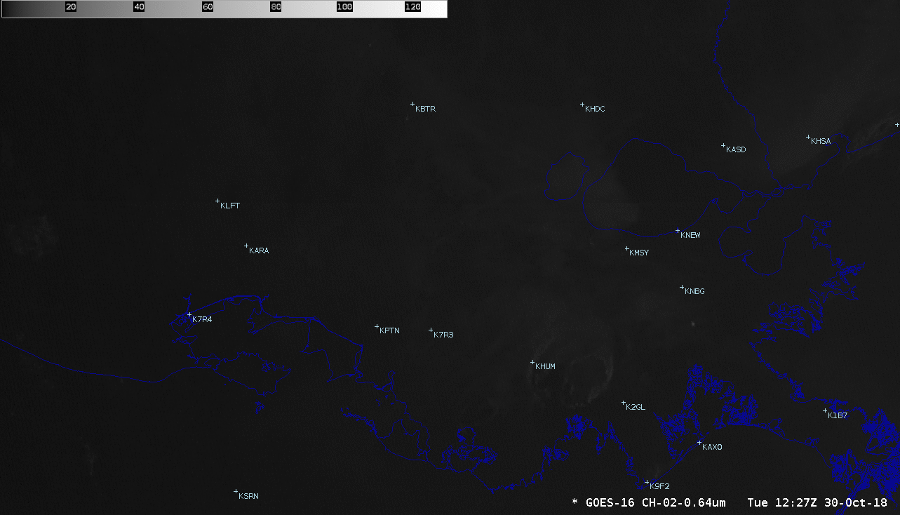
GOES-16 “Red” Visible (0.64 µm) images [click to play animation | MP4]
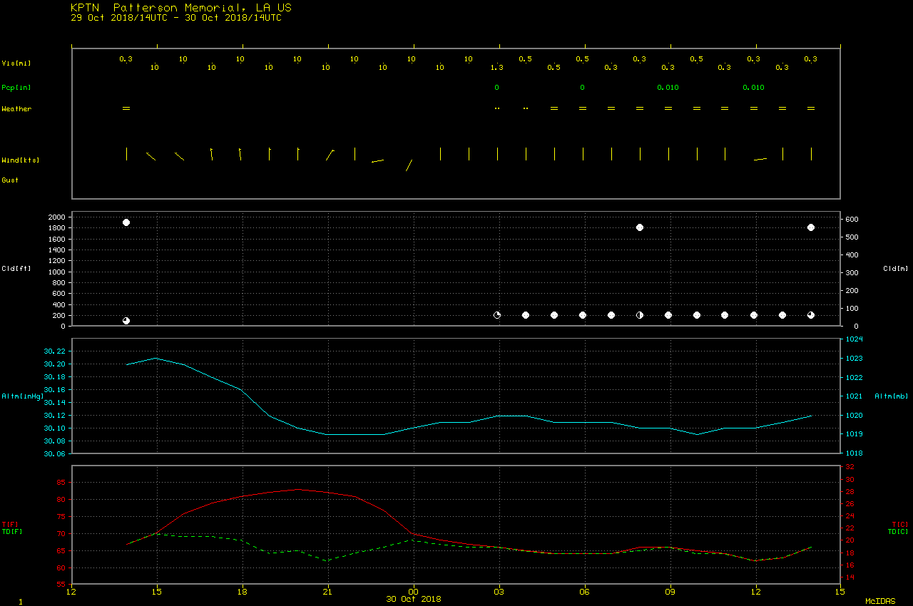
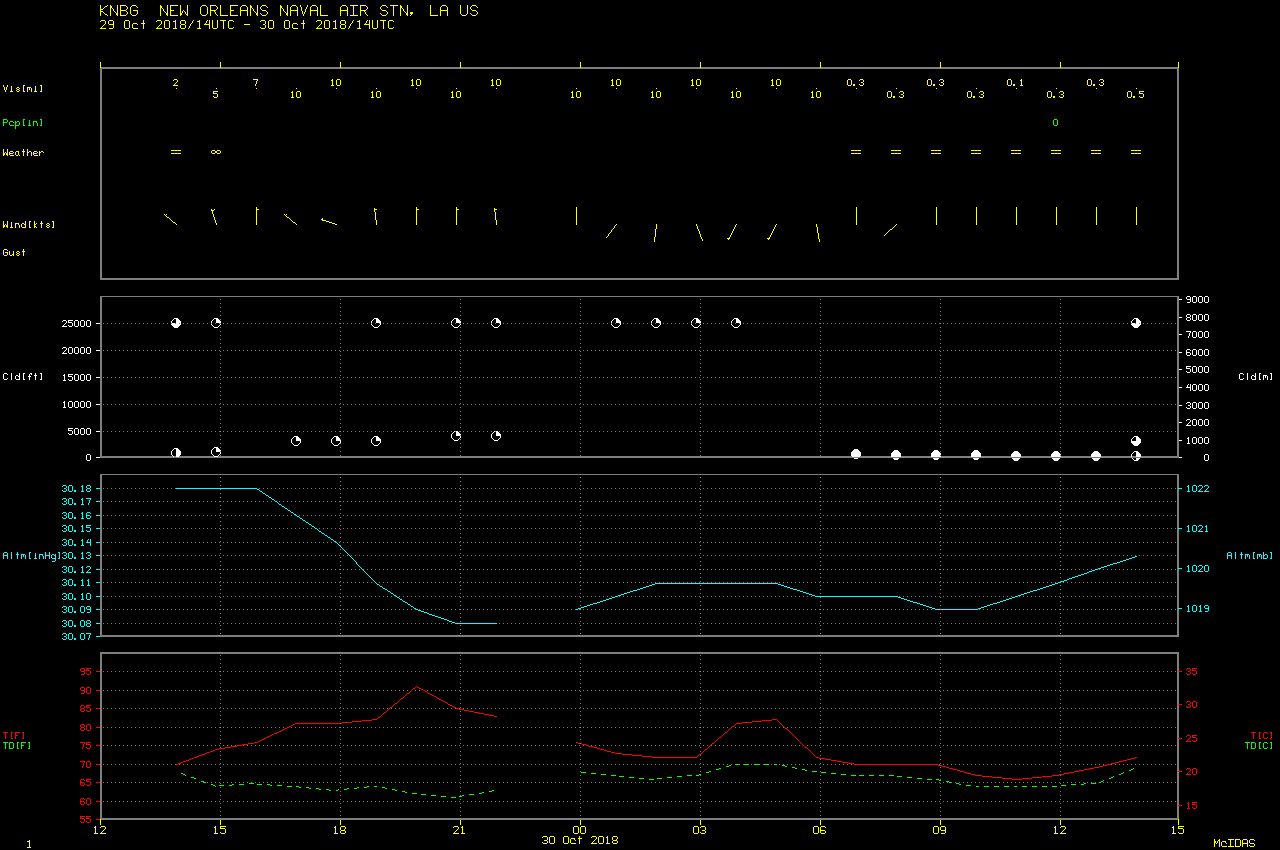
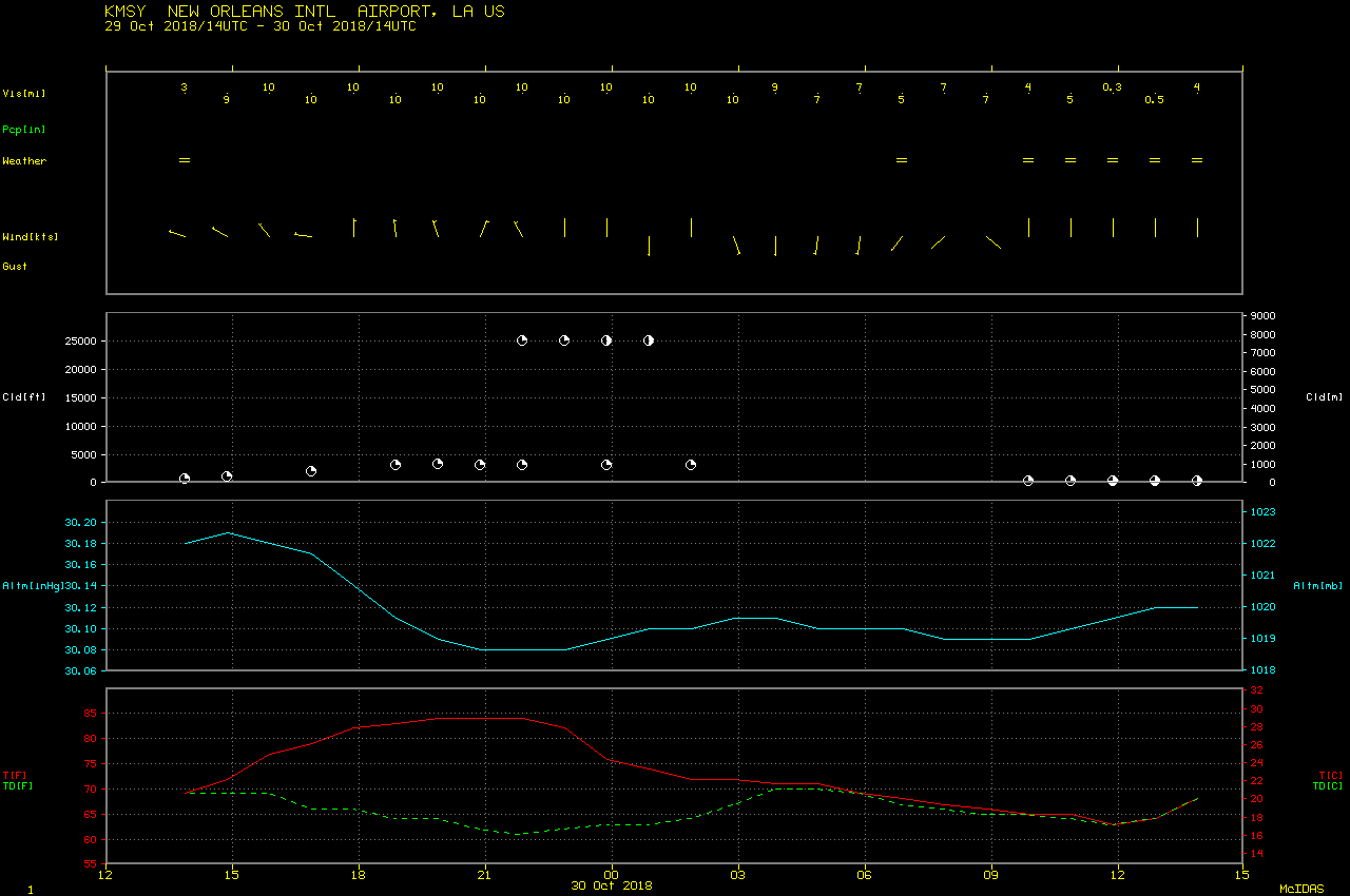
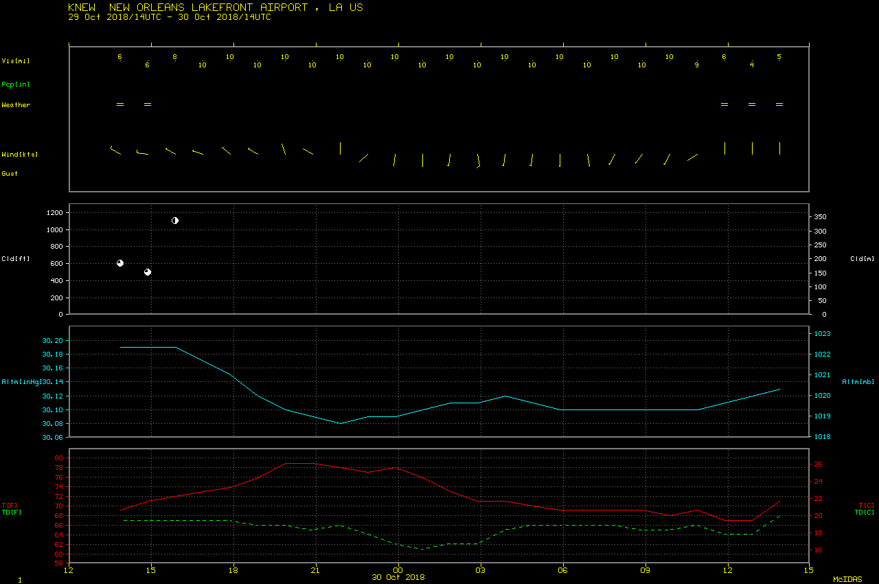
GOES-16 GEOCAT Low IFR Probability and Fog/Low Stratus Depth products (below) indicated that this fog and low stratus had been increasing in coverage and spreading northward across Louisiana during the preceding nighttime hours (VIIRS fog/stratus Brightness Temperature Difference images) — and the fog/stratus was relatively shallow, only having a depth of about 300 feet or less. In fact, if you look closely at the Visible animation above, a few small spots of slightly brighter cloud can be seen in the vicinity of Baton Rouge KBTR which are tall objects (such as refinery stacks, and even the State Capitol building) protruding above the fog/stratus and acting as an obstacle to their flow.
![GOES-16 Low Instrument Flight Rules (IFR) Probability [click to play animation | MP4]](https://cimss.ssec.wisc.edu/satellite-blog/wp-content/uploads/sites/5/2018/10/181030_goes16_lowIFR_probability_anim.gif)
GOES-16 Low Instrument Flight Rules (IFR) Probability [click to play animation | MP4]
![GOES-16 Fog/Low Stratus Depth product [click to play animation | MP4]](https://cimss.ssec.wisc.edu/satellite-blog/wp-content/uploads/sites/5/2018/10/181030_goes16_fogLowStratusDepth_anim.gif)
GOES-16 Fog/Low Stratus Depth product [click to play animation | MP4]
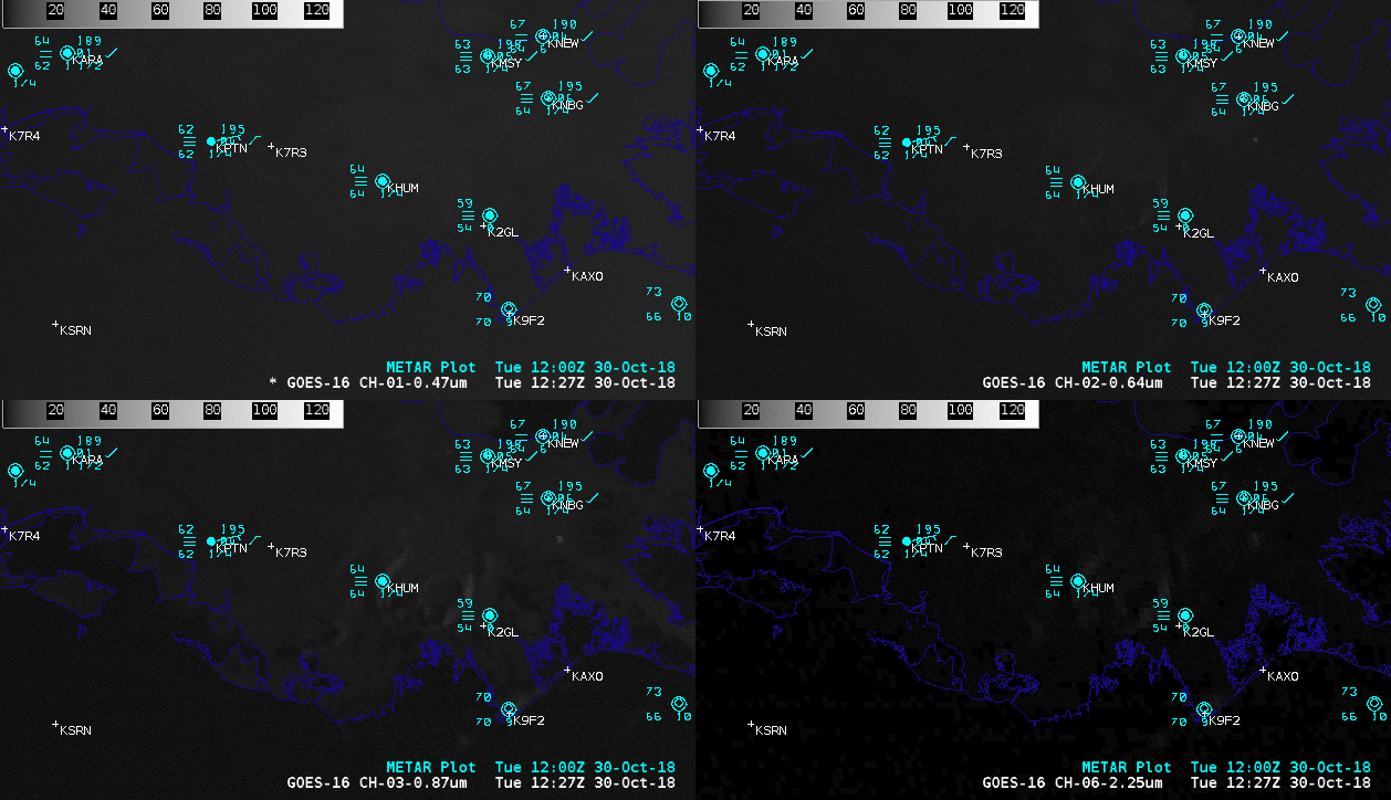
Sequence of 4-panel comparisons of GOES-16 “Blue” Visible (0.47 µm), “Red” Visible (0.64 µm), Near-Infrared “Vegetation” (0.86 µm), “Snow/Ice” (1.61 µm), and “Cloud Particle Size” (2.24 µm), and Shortwave Infrared (3.9 µm) images [click to play animation | MP4]
![Aqua MODIS Shortwave Infrared (3.7 µm) image [click to enlarge]](https://cimss.ssec.wisc.edu/satellite-blog/wp-content/uploads/sites/5/2018/10/MODIS_4_MICRON_20181029_1906.png)
Aqua MODIS Shortwave Infrared (3.7 µm) image [click to enlarge]
![GOES-16 Shortwave Infrared (3.9 µm) images [click to play animation | MP4]](https://cimss.ssec.wisc.edu/satellite-blog/wp-content/uploads/sites/5/2018/10/181029_goes16_shortwaveInfrared_LA_v2_anim.gif)
GOES-16 Shortwave Infrared (3.9 µm) images [click to play animation | MP4]