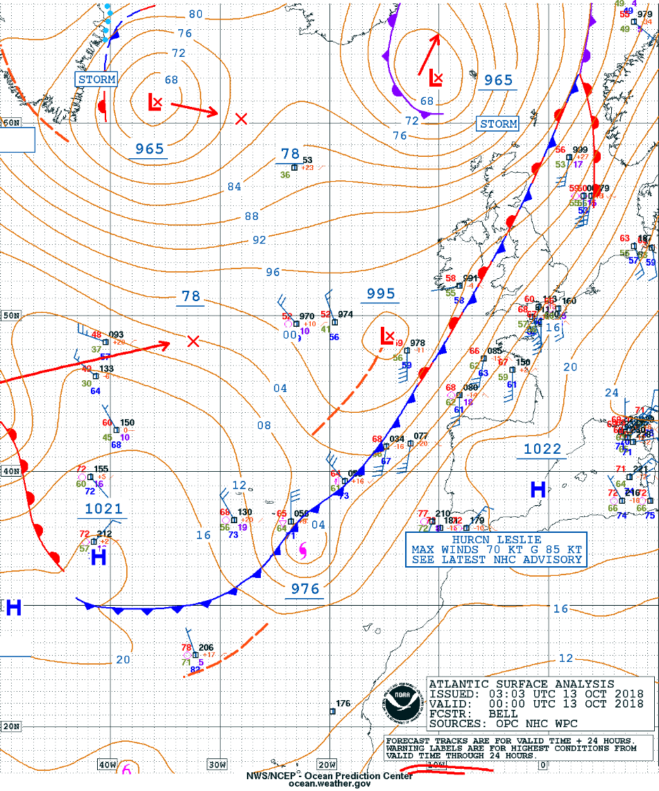
Post-Tropical Cyclone Leslie makes landfall in Portugal
![Aqua MODIS True Color RGB image [click to enlarge]](https://cimss.ssec.wisc.edu/satellite-blog/wp-content/uploads/sites/5/2018/10/181013_1419utc_aqua_modis_truecolor_Leslie_anim.gif)
Aqua MODIS True Color RGB image, with and without surface reports [click to enlarge]
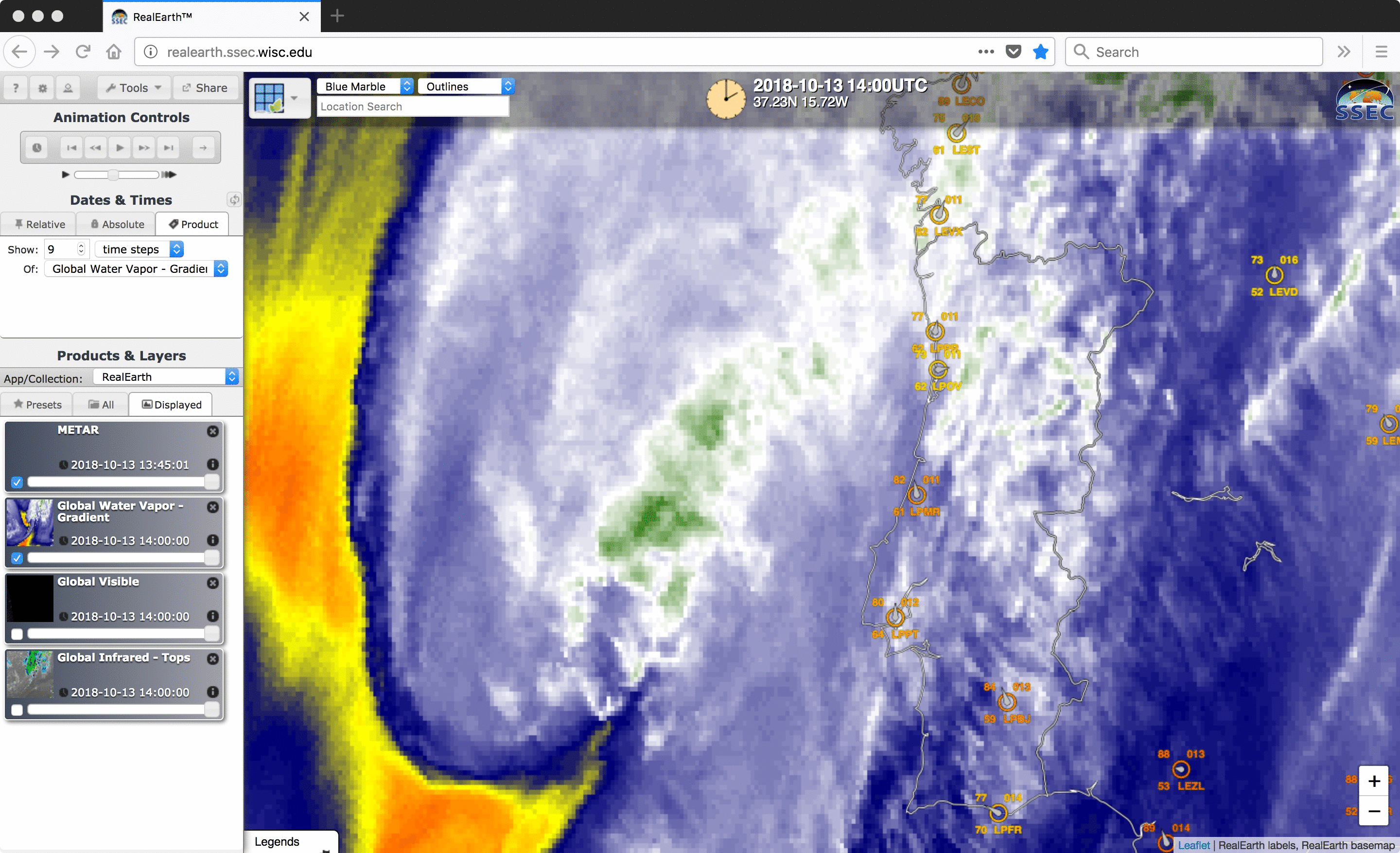
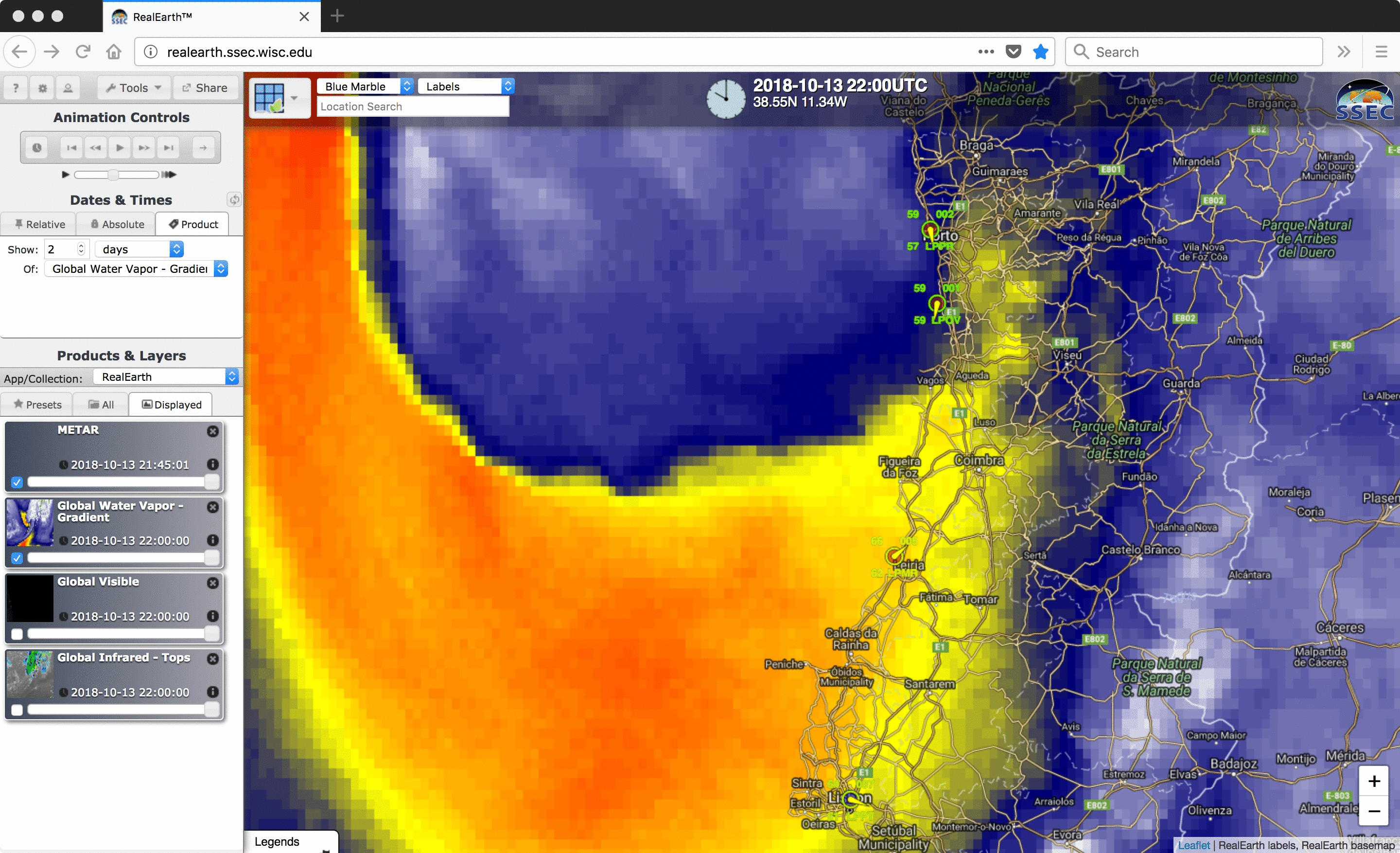
EUMETSAT Meteosat-11 middle/upper-tropospheric Water Vapor (6.25 µm) images (below) exhibited a warm/drying trend (brighter shades of yellow) along the western and southern edges of Leslie as it moved inland across Portugal. Hourly Meteosat-11 Water Vapor images visualized using RealEarth are available here.
![EUMETSAT Meteosat-11 Water Vapor (6.25 µm) images, with hourly plots of surface winds and gusts in knots [click to play animation | MP4]](https://cimss.ssec.wisc.edu/satellite-blog/wp-content/uploads/sites/5/2018/10/181013_meteosat11_waterVapor_b5_Leslie_landfall_anim.gif)
EUMETSAT Meteosat-11 Water Vapor (6.25 µm) images, with hourly plots of surface winds and gusts in knots [click to play animation | MP4]
According to data from @ipma_pt a maximum wind gust of 176,4 km/h has been measured in Figueira da Foz near the coast during the passage of storm #Leslie! Two more hurricane-force gusts were observed in Coimbra and Aveiro (Image source: https://t.co/gOO95O2WUz). #wetter pic.twitter.com/T55ykhL8Vm
— Luca Mathias (@meteomathias) October 14, 2018
![Meteosat-11 Water Vapor (7.35 µm) images, with hourly splots of surface winds and gusts in knots [click to play animation | MP4]](https://cimss.ssec.wisc.edu/satellite-blog/wp-content/uploads/sites/5/2018/10/181013_meteosat11_waterVapor_band6_sting_jet_anim.gif)
EUMETSAT Meteosat-11 Water Vapor (7.35 µm) images, with hourly plots of surface winds and gusts in knots [click to play animation | MP4]
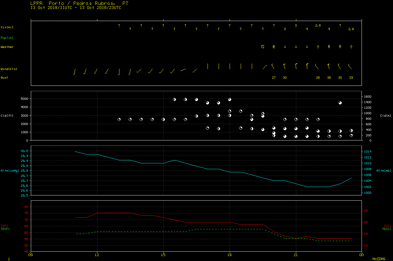
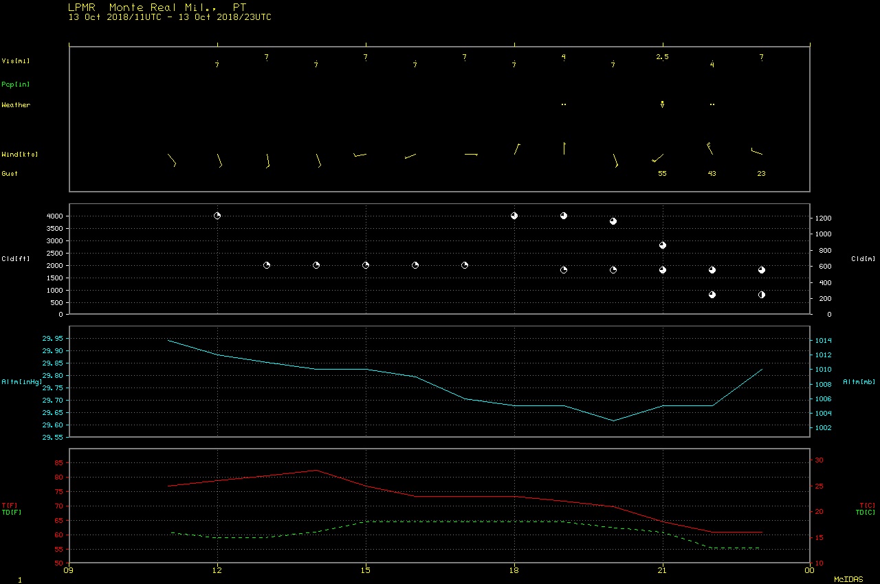
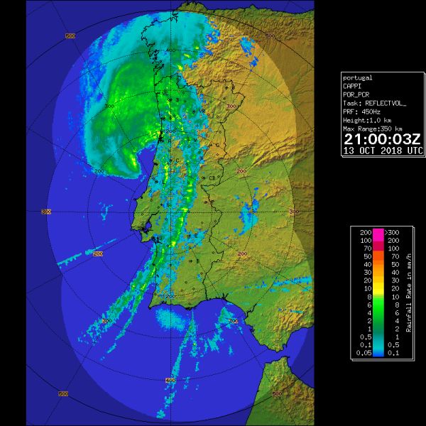
Radar composites from the Portuguese Institute for Sea and Atmosphere (IPMA) confirmed that post-tropical cyclone Leslie made landfall around 2100 UTC (below).
![Radar reflectivity composites [click to play animation]](https://cimss.ssec.wisc.edu/satellite-blog/wp-content/uploads/sites/5/2018/10/181013_Portugal_radar_Leslie_landfall_anim.gif)
Radar reflectivity composites [click to play animation]
Although the view from GOES-16 (GOES-East) was very oblique, the warm/dry signature around the western and southern edges of the storm was still evident on Mid-level Water Vapor (6.9 µm) imagery (below).
![GOES-16 Mid-level Water Vapor (6.9 µm) images, with hourly plots of surface winds and gusts in knots [click to play animation | MP4]](https://cimss.ssec.wisc.edu/satellite-blog/wp-content/uploads/sites/5/2018/10/181013_goes16_waterVapor_Leslie_landfall_anim.gif)
GOES-16 Mid-level Water Vapor (6.9 µm) images, with hourly plots of surface winds and gusts in knots [click to play animation | MP4]
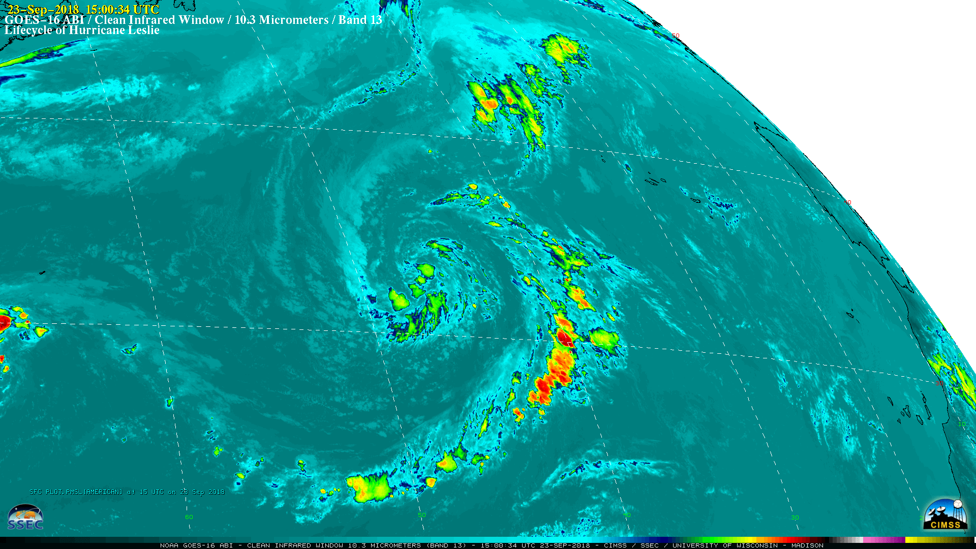
The entire life cycle of Leslie — from becoming a named Subtropical Storm at 15 UTC on 23 September to making landfall as a post-tropical cyclone in Portugal at 21 UTC on 13 October — is shown with 15-minute GOES-16 “Clean” Infrared Window (10.3 µm) and Mid-level Water Vapor (6.9 µm) images (below). Note that 5-minute imagery was available on 01 October, when GOES-16 was performing a test of the Mode 4 scan strategy.
GOES-16 “Clean” Infrared Window (10.3 µm) images [click to play MP4 animation]
![GOES-16 Mid-level Water Vapor (6.9 µm) images [click to play MP4 animation]](https://cimss.ssec.wisc.edu/satellite-blog/wp-content/uploads/sites/5/2018/10/G16_WV_LESLIE_LIFECYCLE_22SEP_13OCT2018_2018266_150034_GOES-16_0001PANEL.GIF)
GOES-16 Mid-level Water Vapor (6.9 µm) images [click to play MP4 animation]
The long and winding adventure of Hurricane #Leslie has finally come to a close. Over its 22.25 day existence as a coherent cyclone, it largely spun harmlessly over open ocean. It ultimately impacted #Portugal as an extratropical cyclone, producing wind gusts upwards of 110mph. pic.twitter.com/9vrOiBxQAy
— Brenden Moses (@Cyclonebiskit) October 14, 2018