Leeside frontal gravity wave moves southward across the Plains
![GOES-17 Upper-level Water Vapor (6.2 µm) images, with surface frontal analyses [click to play MP4 animation]](https://cimss.ssec.wisc.edu/satellite-blog/wp-content/uploads/sites/5/2018/10/g17_wv_frontal_gravity_wave-20181004_050119.png)
GOES-17 Upper-level Water Vapor (6.2 µm) images, with surface frontal analyses [click to play MP4 animation]
* GOES-17 images shown here are preliminary and non-operational *
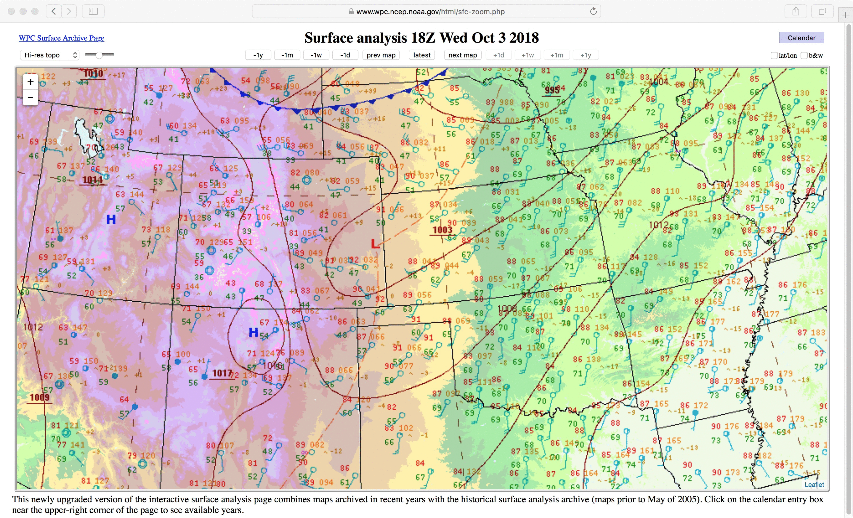
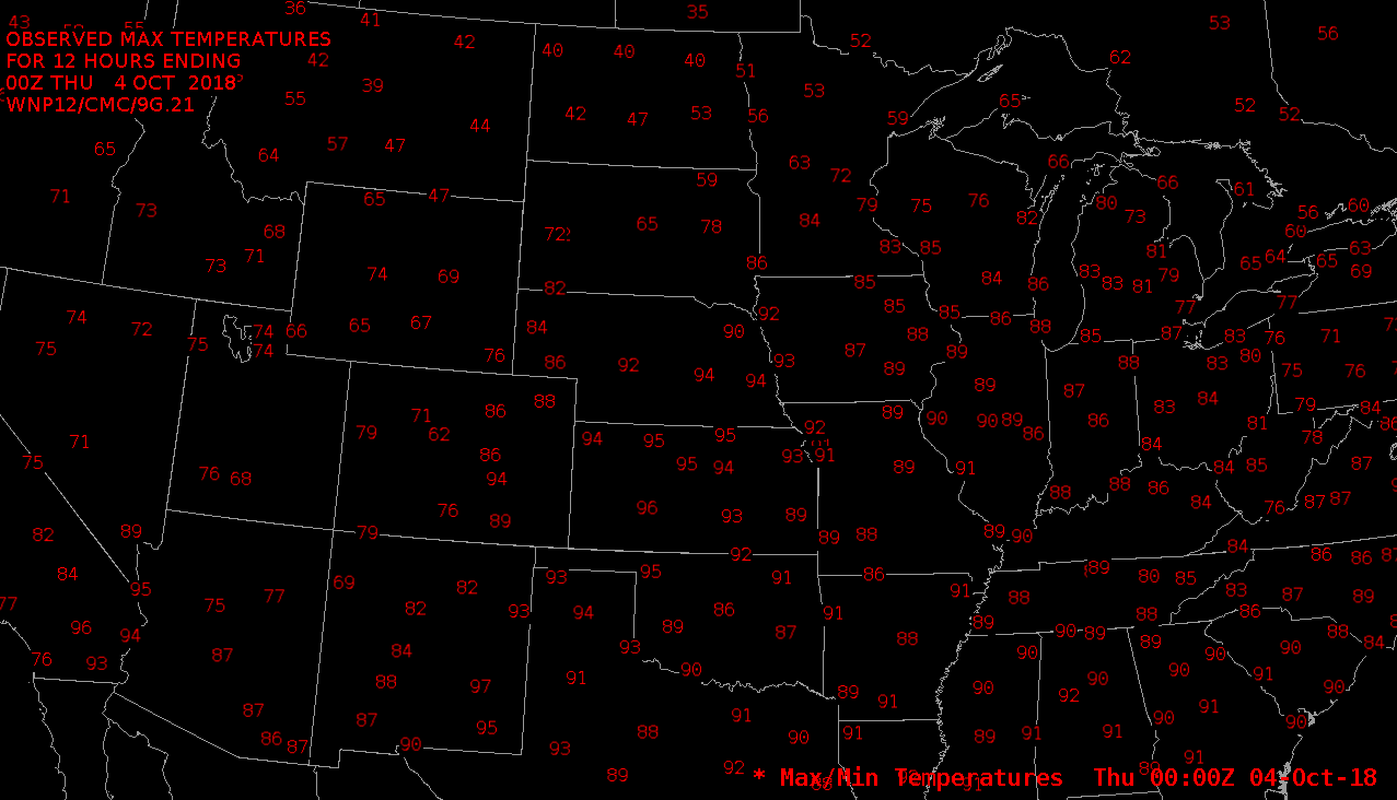
A strong cold front (surface analyses | max/min temperatures) moved southward across the Plains states during the 03 October – 04 October 2018 period — and GOES-17 Upper-level Water Vapor (6.2 µm) images (above) revealed a distinct leeside frontal gravity wave as it propagated from southern Colorado and southern Kansas at 05 UTC to southeastern New Mexico and the southern Texas Panhandle by 20 UTC. Thunderstorms formed along the stalled residual wave along the New Mexico/Texas border after 1930 UTC.
Pilot reports of high-altitude “mountain wave” turbulence (below) were seen at 1559 and 1721 UTC, along the north-to-south oriented portion of the gravity wave that had become stationary over eastern New Mexico.
![GOES-17 Upper-level Water Vapor (6.2 µm) images, with pilot reports of turbulence [click to enlarge]](https://cimss.ssec.wisc.edu/satellite-blog/wp-content/uploads/sites/5/2018/10/181004_goes17_water_vapor_pilot_reports_anim.gif)
GOES-17 Upper-level Water Vapor (6.2 µm) images, with pilot reports of turbulence [click to enlarge]
![Aqua MODIS Water Vapor (6.7 µm) image [click to enlarge]](https://cimss.ssec.wisc.edu/satellite-blog/wp-content/uploads/sites/5/2018/10/modis_wv_frontal_wave-20181004_080619.png)
Aqua MODIS Water Vapor (6.7 µm) image [click to enlarge]
![GOES-17 Low-level (7.3 µm, left), Mid-level (6.9 µm, center) and Upper-level (6.2 µm, right) Water Vapor images, with plots of surface wind barbs [click to play MP4 animation]](https://cimss.ssec.wisc.edu/satellite-blog/wp-content/uploads/sites/5/2018/10/G17_WATER_VAPOR_PLAINS_CDFNT_04OCT2018_960x490_B1098_2018276_210119_0003PANELS_00001.GIF)
GOES-17 Low-level (7.3 µm, left), Mid-level (6.9 µm, center) and Upper-level (6.2 µm, right) Water Vapor images, with hourly plots of surface wind barbs [click to play MP4 animation]