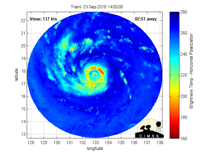
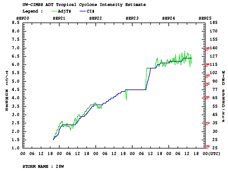
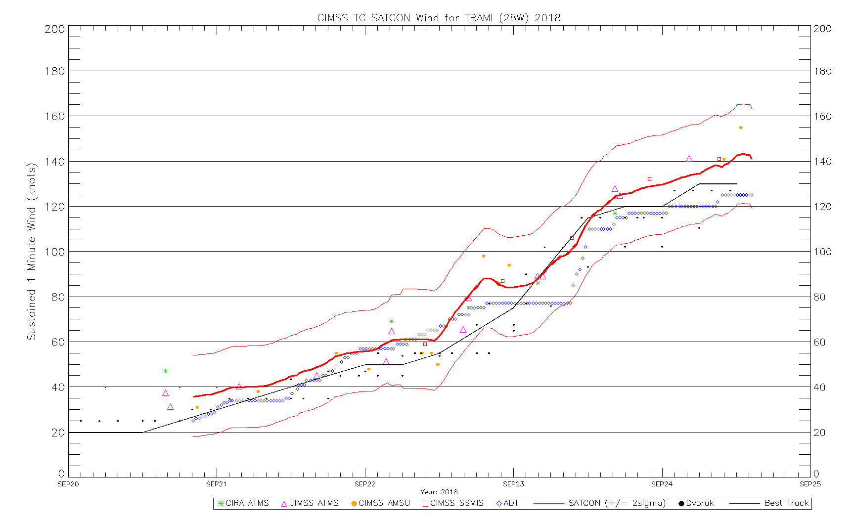
West Pacific Super Typhoon Trami
![Himawari-8 Infrared Window (10.4 µm) images [click to play animation | MP4]](https://cimss.ssec.wisc.edu/satellite-blog/wp-content/uploads/sites/5/2018/09/180923_180924_himawari8_infrared_Super_Typhoon_Trami_anim.gif)
Himawari-8 “Clean” Infrared Window (10.4 µm) images [click to play animation | MP4]
With the arrival of daylight late on 24 September UTC (25 September local time), the satellite presentation of then Category 5 Trami was quite striking, with surface mesovorticies within the large eye seen on both Visible and Infrared rapid-scan (2.5-minute interval) images (below). The deep-layer mean steering flow was also very light, allowing the forward motion of Trami to slow considerably.
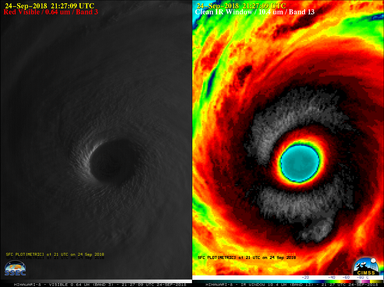
Himawari-8 “Red” Visible (0.64 µm, left) and “Clean” Infrared Window (10.4 µm, right) images [click to play animation | MP4]
![Himawari-8 Infrared Window (10.4 µm) images, with deep-layer wind shear analysis at 00 UTC [click to enlarge]](https://cimss.ssec.wisc.edu/satellite-blog/wp-content/uploads/sites/5/2018/09/180924_himawari8_infrared_00utc_shear_Trami_anim.gif)
Himawari-8 Infrared Window (10.4 µm) images, with deep-layer wind shear analysis at 00 UTC [click to enlarge]
![NOAA-20 VIIRS Day/Night Band (0.7 µm) and Infrared Window (11.45 µm) images [click to enlarge]](https://cimss.ssec.wisc.edu/satellite-blog/wp-content/uploads/sites/5/2018/09/180925_1634utc_noaa20_DayNightBand_InfraredWindow_Trami_anim.gif)
NOAA-20 VIIRS Day/Night Band (0.7 µm) and Infrared Window (11.45 µm) images [click to enlarge]
Though the eye had become more cloud-filled, distinct surface mesovortices were still present — captured in stunning detail by an astronaut on the International Space Station:
As if somebody pulled the planet's gigantic plug. Staring down the eye of yet another fierce storm. Category 5 Super Typhoon Trami is unstoppable and heading for Japan and Taiwan. Be safe down there! #TyphoonTrami pic.twitter.com/4VmY2hhj2c
— Alexander Gerst (@Astro_Alex) September 25, 2018