Hurricane Chris
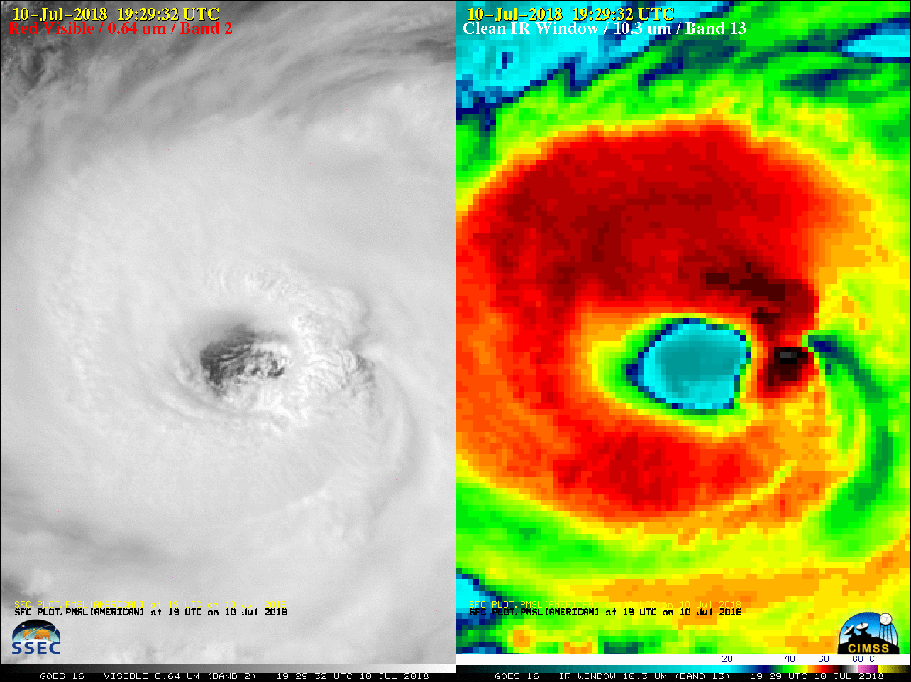
GOES-16 “Red” Visible (0.64 µm, left) and “Clean” Infrared Window (10.3 µm, right) images [click to play MP4 animation]
A toggle between 375-meter resolution NOAA-20 Visible (0.64 µm) and Infrared Window (11.45 µm) images (below) revealed cloud-top infrared brightness temperatures as cold as -81ºC (violet enhancement) in a convective burst just northeast of the eye. [Note: the 1821 UTC NOAA-20 images are incorrectly labeled as Suomi NPP images]
![NOAA-20 VIIRS Visible (0.64 µm) and Infrared Window (11.45 µm) images [click to enlarge]](https://cimss.ssec.wisc.edu/satellite-blog/wp-content/uploads/sites/5/2018/07/180710_1821utc_suomi_npp_viirs_visible_infrared_Chris_anim.gif)
NOAA-20 VIIRS Visible (0.64 µm) and Infrared Window (11.45 µm) images [click to enlarge]
![GPM GMI Microwave (85 GHz) image [click to enlarge]](https://cimss.ssec.wisc.edu/satellite-blog/wp-content/uploads/sites/5/2018/07/180710_1326utc_gpm_gmi_microwave_Chris.jpeg)
GPM GMI Microwave (85 GHz) image [click to enlarge]
![MIMIC-TC morphed microwave image product [click to enlarge]](https://cimss.ssec.wisc.edu/satellite-blog/wp-content/uploads/sites/5/2018/07/180710_mimic_Chris_anim.gif)
MIMIC-TC morphed microwave image product [click to enlarge]