County Fire in central California
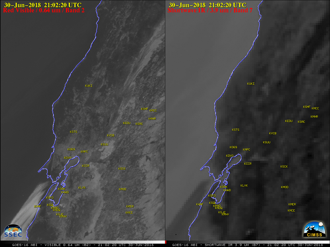
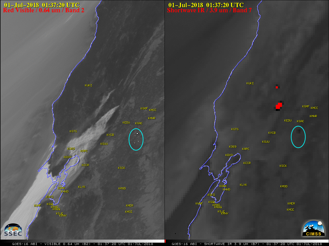
GOES-16 “Red” Visible (0.64 µm, left) and Shortwave Infrared (3.9 µm, right) images, with airport identifiers plotted in yellow [click to play animation | MP4]
During the subsequent overnight hours, the thermal signature exhibited on GOES-16 Near-Infrared “Snow/Ice” (1.61 µm), Near-Infrared “Cloud Particle Size” (2.24 µm) and Shortwave Infrared (3.9 µm) images (below) revealed the rapid southward spread of the fire along the Napa/Yolo county line — the fire began in far western Yolo County, and eventually moved into far eastern Napa County. The smaller, less intense fire signature seen just to the northwest was that of the Pawnee Fire.

GOES-16 Near-Infrared “Snow/Ice” (1.61 µm, left), Near-Infrared “Cloud Particle Size” (2.24 µm, center) and Shortwave Infrared (3.9 µm, right) images, with airport identifiers plotted in yellow and Napa/Yolo County outlines plotted in blue [click to play animation | MP4]
![Suomi NPP VIIRS Day/Night Band (0.7 µm) and Shortwave Infrared (3.74 µm) images, with surface reports plotted in cyan [click to enlarge]](https://cimss.ssec.wisc.edu/satellite-blog/wp-content/uploads/sites/5/2018/07/180701_1043utc_suomi_npp_viirs_DayNightBand_ShortwaveInfrared_County_Fire_CA_anim.gif)
Suomi NPP VIIRS Day/Night Band (0.7 µm) and Shortwave Infrared (3.74 µm) images, with surface reports plotted in cyan [click to enlarge]
![Suomi NPP VIIRS Day/Night Band (0.7 µm) images [click to enlarge]](https://cimss.ssec.wisc.edu/satellite-blog/wp-content/uploads/sites/5/2018/07/180701_suomi_npp_viirs_DayNightBand_County_Fire_CA_anim.gif)
Suomi NPP VIIRS Day/Night Band (0.7 µm) images [click to enlarge]
![Plots of rawinsonde data from Oakland, California [click to enlarge]](https://cimss.ssec.wisc.edu/satellite-blog/wp-content/uploads/sites/5/2018/07/180701_KOAK_RAOBS.GIF)
Plots of rawinsonde data from Oakland, California [click to enlarge]
![Terra MODIS True Color and False Color RGB images [click to enlarge]](https://cimss.ssec.wisc.edu/satellite-blog/wp-content/uploads/sites/5/2018/07/180701_1817utc_terra_modis_truecolor_falsecolor_County_Fire_CA_anim.gif)
Terra MODIS True Color and False Color RGB images [click to enlarge]
![Aqua MODIS True Color and False Color RGB images [click to enlarge]](https://cimss.ssec.wisc.edu/satellite-blog/wp-content/uploads/sites/5/2018/07/180701_2136utc_aqua_modis_truecolor_falsecolor_County_Fire_CA_anim.gif)
Aqua MODIS True Color and False Color RGB images [click to enlarge]
===== 03 July Update =====
![Landsat-8 False Color RGB image [click to enlarge]](https://cimss.ssec.wisc.edu/satellite-blog/wp-content/uploads/sites/5/2018/07/180703_1845utc_landsat8_falsecolor_County_Fire_CA_burn_scar.jpeg)
Landsat-8 False Color RGB image [click to enlarge]