Outflow boundary in the Bay of Campeche
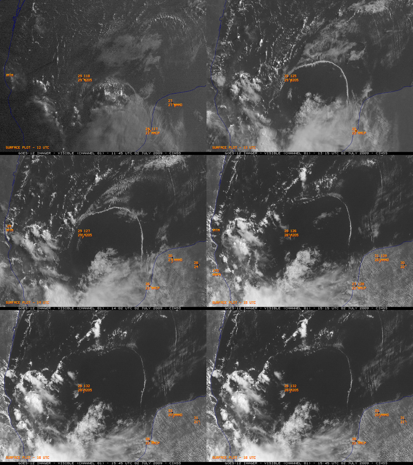
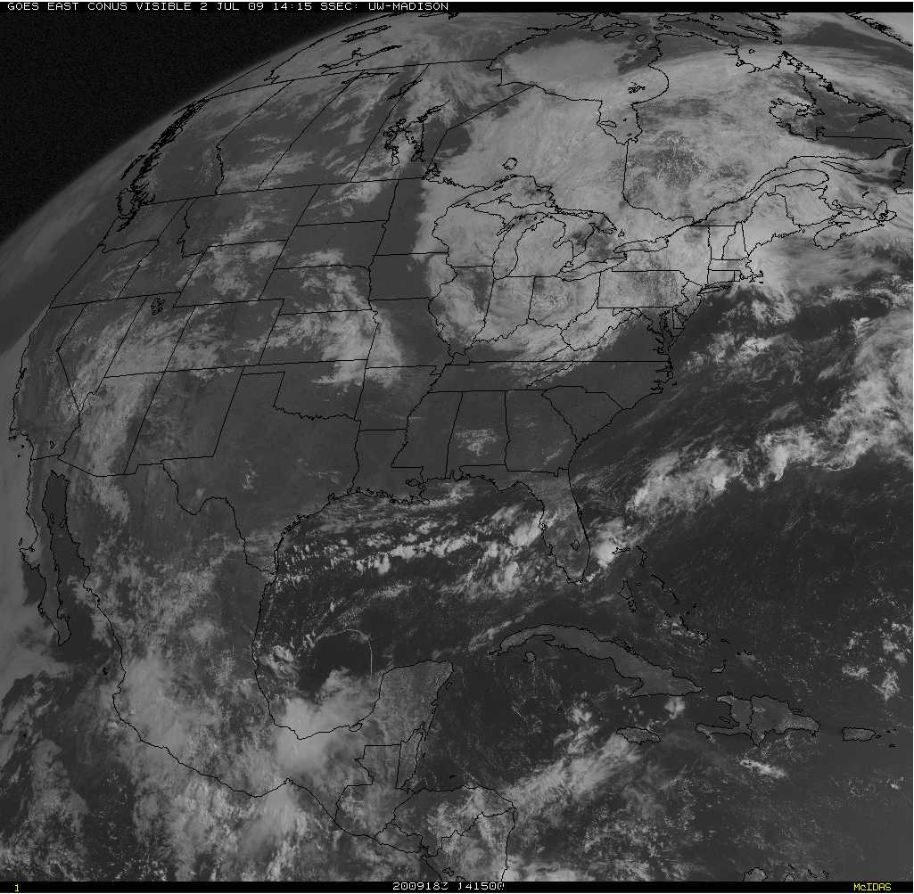
GOES-12 visible images (above) revealed the northward propagation of an large convective outflow boundary across the Bay of Campeche (in the far southwestern Gulf of Mexico) on 02 July 2009. A larger-scale GOES-12 visible image (below) showed that at one point this outflow occupied an area approximately the size of the state of Wisconsin!
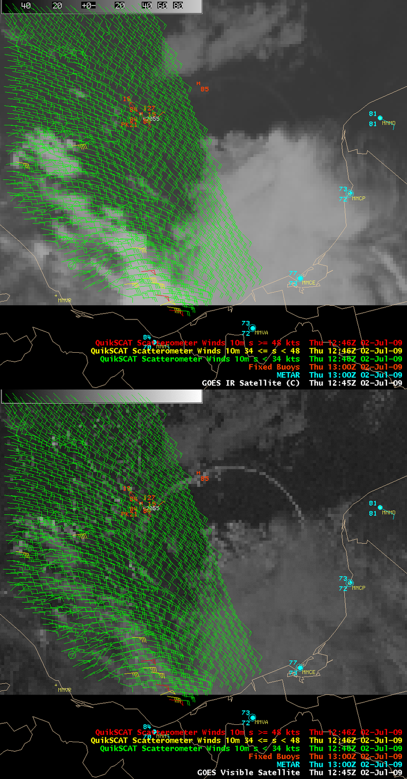
An overpass of the QuikSCAT satellite provided SeaWinds near-surface wind data (below) which showed that there was southeasterly flow across much of the Bay of Campeche region, but the wind speeds increased from about 10-15 knots ahead of the outflow boundary to 15-25 knots behind the outflow boundary (the winds at Buoy 42055 gusted to 21 knots around 12 UTC). The QuikSCAT wind vectors showing speeds of 34-50 knots (yellow to red colors) were not valid, due to rain flags greater than 90%. The air temperature and dew point values barely budged with the passage of this outflow boundary, due in part to the very warm (84º F or 29º C) water temperature.
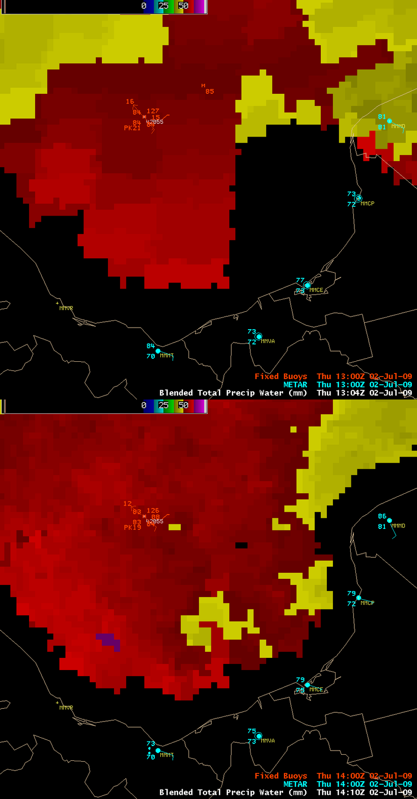
AWIPS images of the Blended Total Precipitable Water (TWP) product (below) suggest that the TPW dropped from about 57 mm (2.24 inches, red color enhancement) to around 46 mm (1.81 inches, yellow color enhancement) in the wake of this outflow boundary.


