Cyclone Gita in the South Pacific Ocean
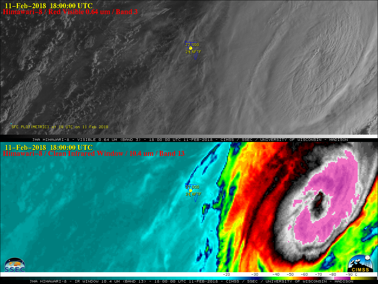
Himawari-8 “Red” Visible (0.64 µm, top) and “Clean” Infrared Window (10.4 µm, bottom) images, with hourly plots of surface reports [click to play Animated GIF | MP4 also available]
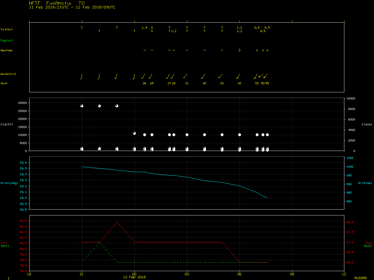
A longer animation of Himawari-8 Infrared images (below) revealed that the center of Gita moved just south of the main island of Tongatapu. Surface observations from Fua’Amotu (NFTF) ended after 0735 UTC.
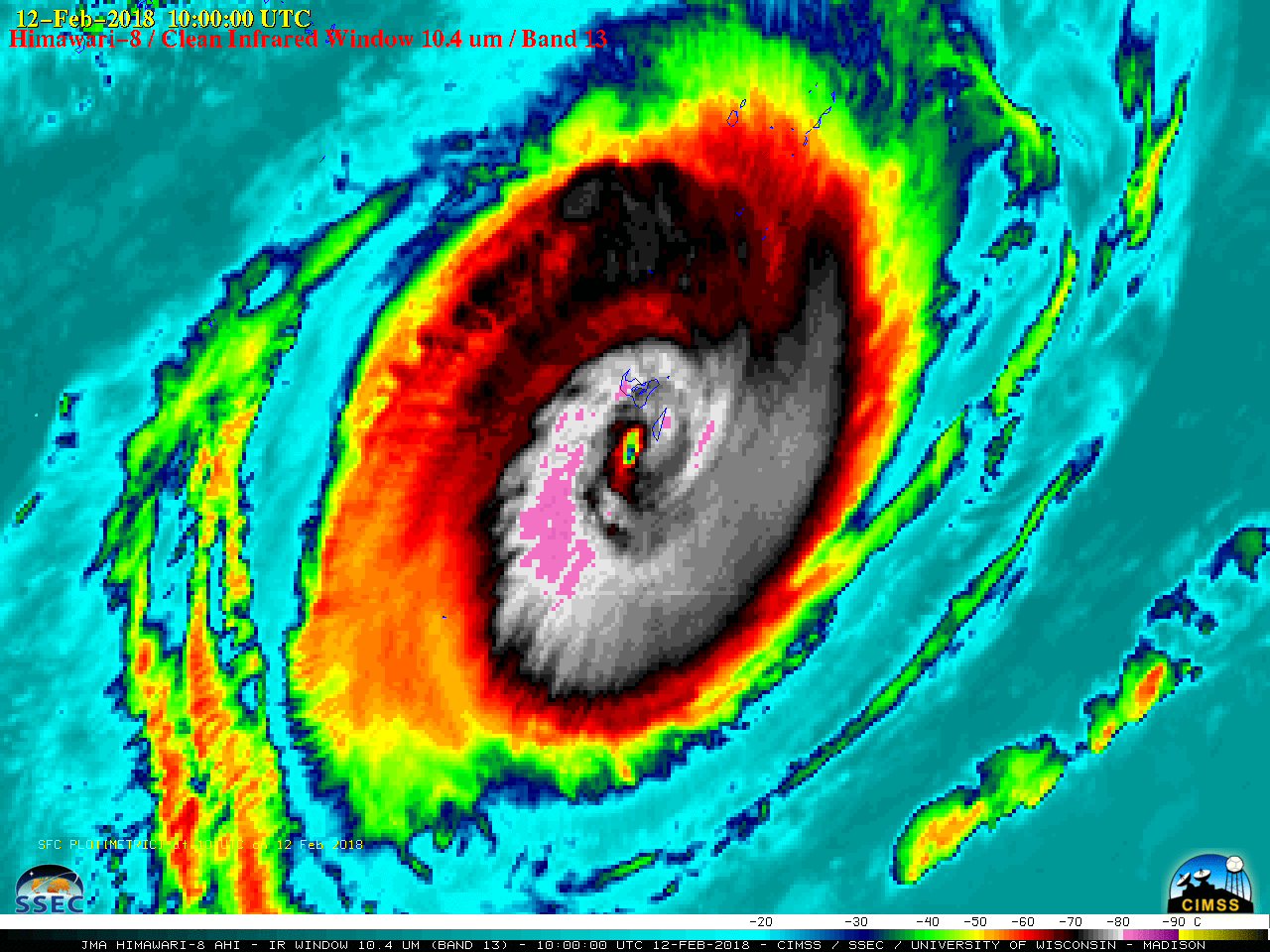
Himawari-8 “Clean” Infrared Window (10.4 µm) images, with hourly surface plots [click to play Animated GIF | MP4 also available]
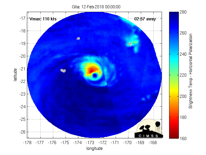
MIMIC-TC morphed microwave imagery
Metop ASCAT scatterometer surface winds (below) showed Gita around the time that the storm center was just south of Tongatapu at 0850 UTC.
![Metop ASCAT scatterometer surface winds [click to enlarge]](https://cimss.ssec.wisc.edu/satellite-blog/wp-content/uploads/sites/5/2018/02/180212_0850utc_ascat_Gita.jpeg)
Metop ASCAT scatterometer surface winds [click to enlarge]