Explosive cyclogenesis off the East Coast of the United States
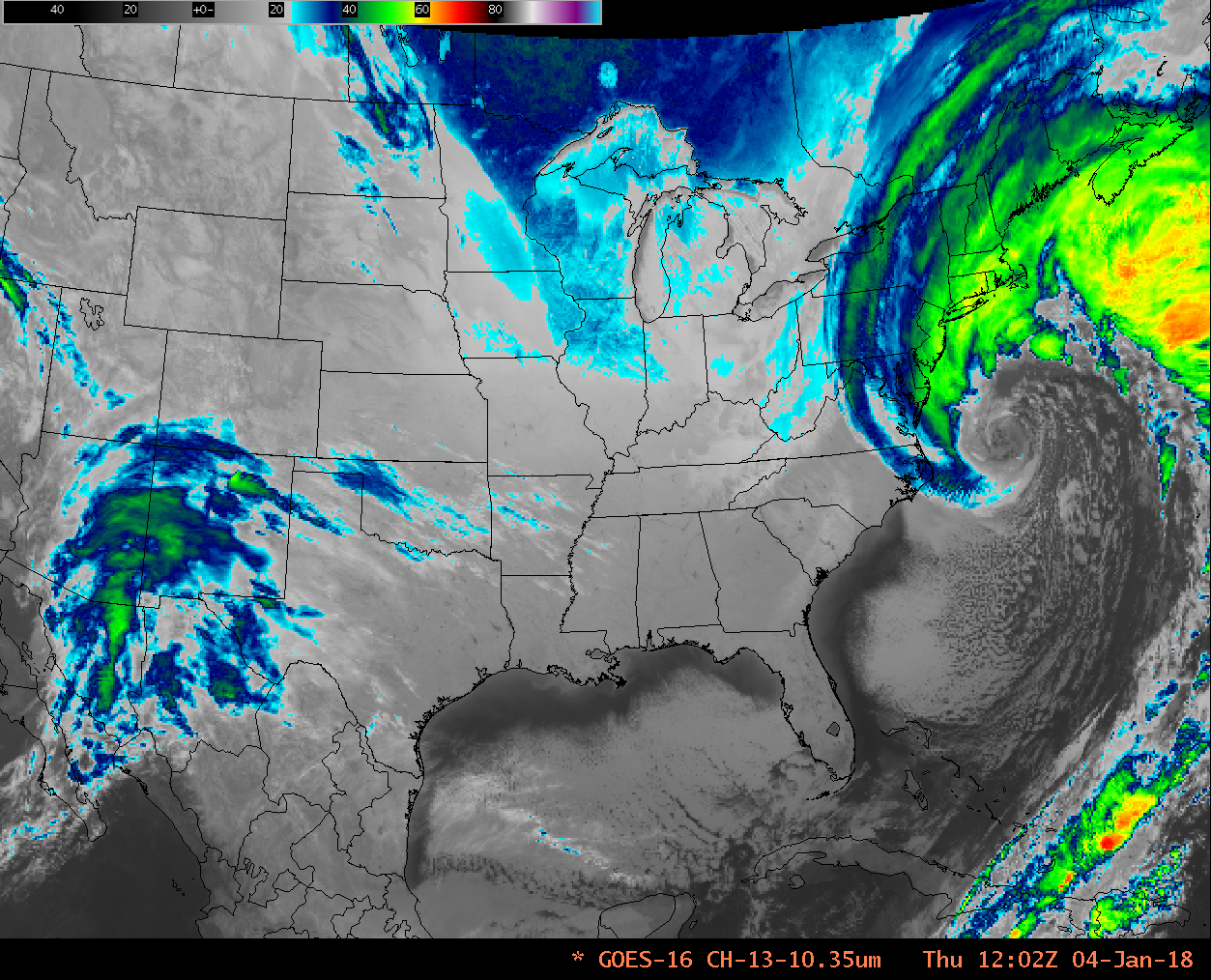
A strong extratropical cyclone that deposited snow in the deep south developed explosively during the early morning hours of 4 January 2018. The GOES-16 Clean Window (10.3 µm) animation, above, from 0102 – 1337 UTC on 4 January, brackets the explosive development: from 993 hPa at 0000 UTC to 968 mb at 0900 UTC, a strengthening that easily meets the “Bomb” criteria set forth by Sanders and Gyakum (1980). The Clean Window animation shows the strong surface circulation with well-defined conveyor belts. Convection develops at the leading edge of the dry slot that is approaching southern New England at the end of the animation. The Low-Level Water Vapor (7.3 µm) animation for the same time, below, suggests very strong descent behind the storm, where brightness temperatures warmer than -10º C (orange in the enhancement used) are widespread.
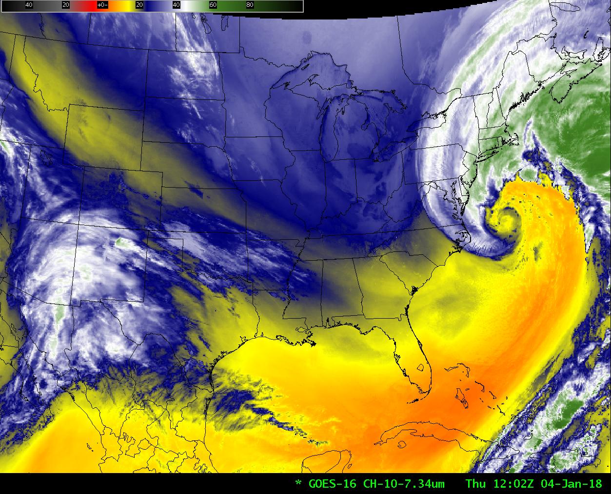
GOES-16 Low-Level Water Vapor (7.3 µm) Infrared Imagery, 0102-1332 UTC on 4 January 2018 (Click to animate)
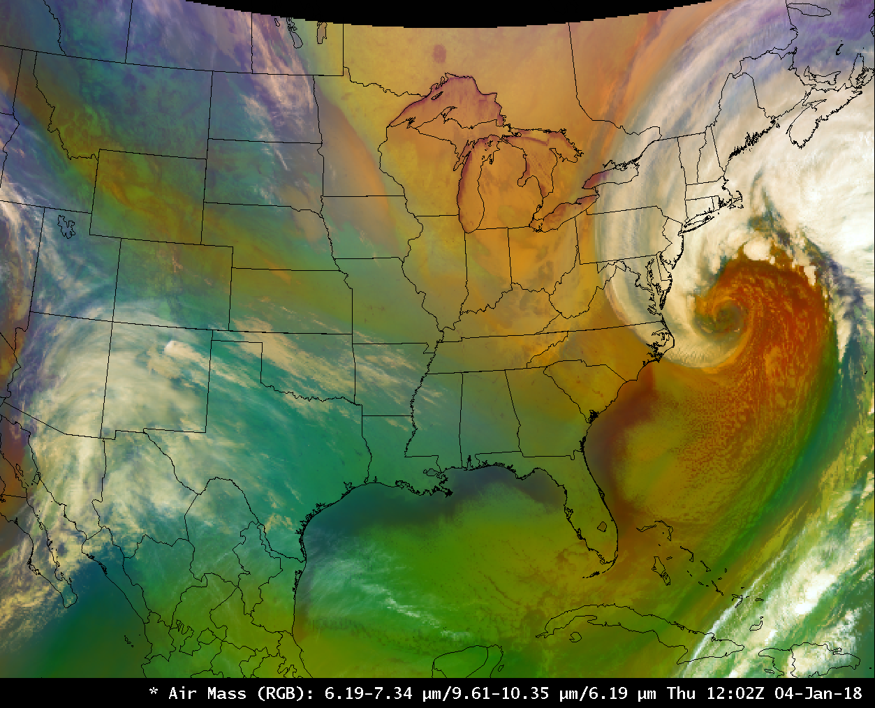
This storm can also be viewed using Red-Green-Blue composites (in addition to the single-channel animations shown above). The Airmass RGB, below, combines the Split Water Vapor Difference (6.2 µm – 7.3 µm) as Red, Split Ozone (9.6 µm – 10.3 µm) as Green, and Upper level Water Vapor (6.2 µm) as Blue. (Other storms analyzed with the Airmass RGB can be seen here, here, and here). The strong red signal in the Airmass RGB south of the storm suggests very strong sinking motion.
ASCAT Scatterometer winds over the system at 0205 UTC showed an elongated surface circulation with multiple observations of winds exceeding 50 knots (in red), and a large region (in yellow) of winds exceeding 35 knots.
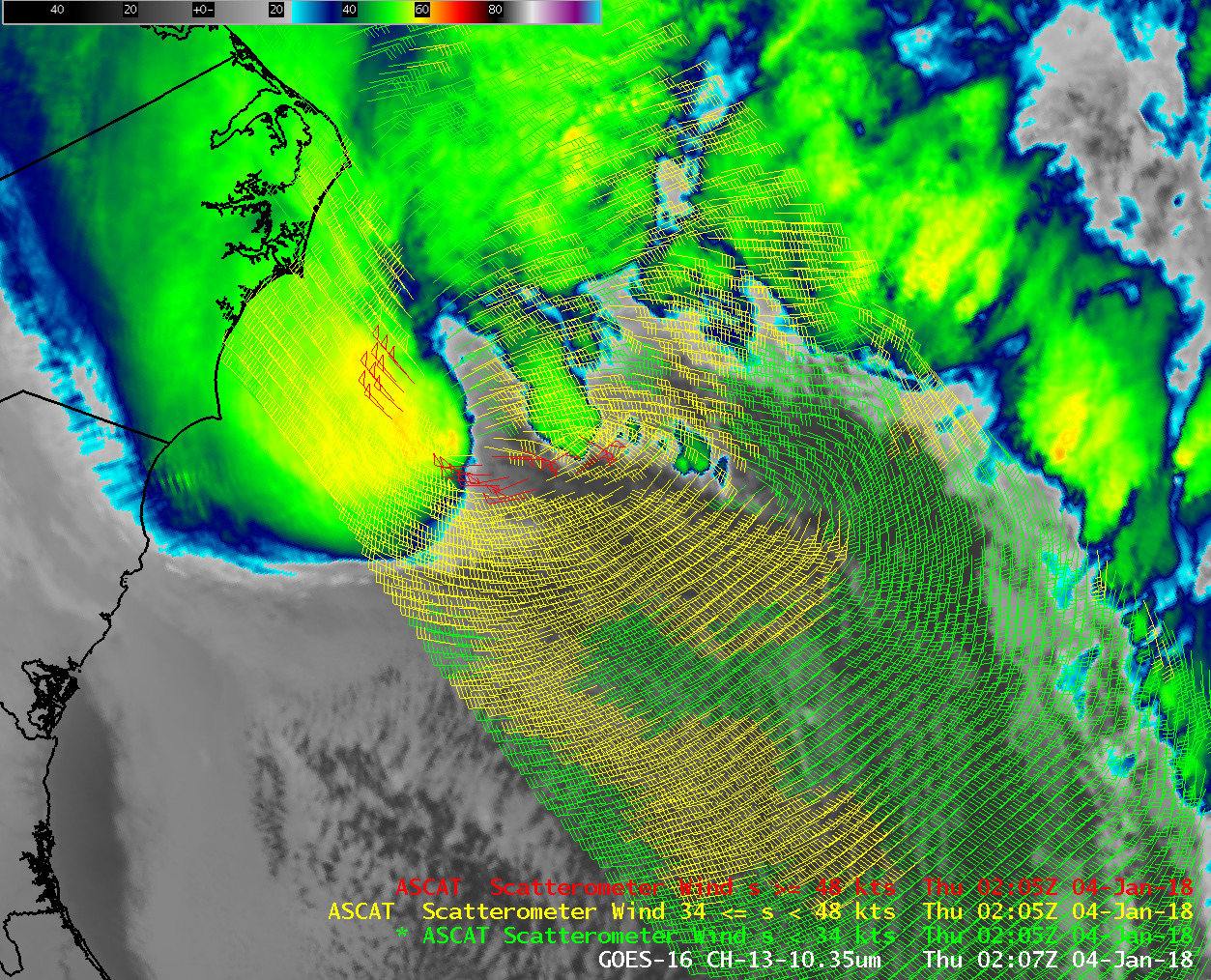
GOES-16 ABI Clean Window (10.3 µm) and ASCAT Scatterometer winds, 0205 UTC on 4 January 2018 (Click to enlarge)
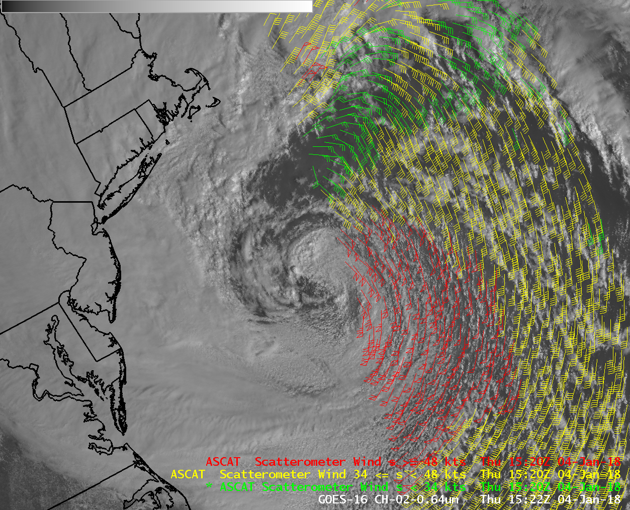
GOES-16 ABI Red Visible (0.64 µm) and ASCAT Scatterometer winds, 1520 UTC on 4 January 2018 (Click to enlarge)
The 1520 UTC ASCAT pass, above, sampled half the storm, and hurricane-force winds were indicated.
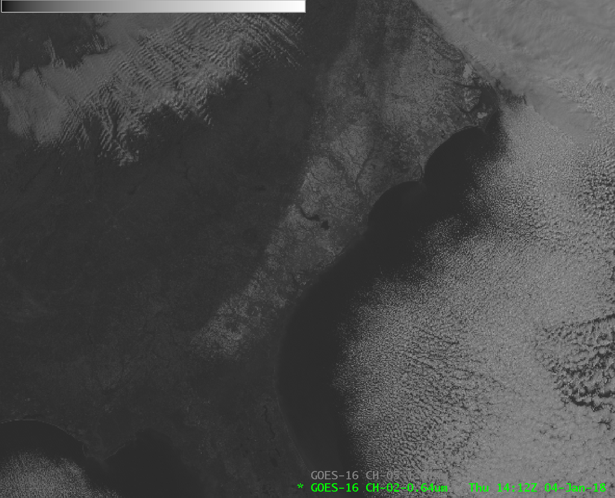
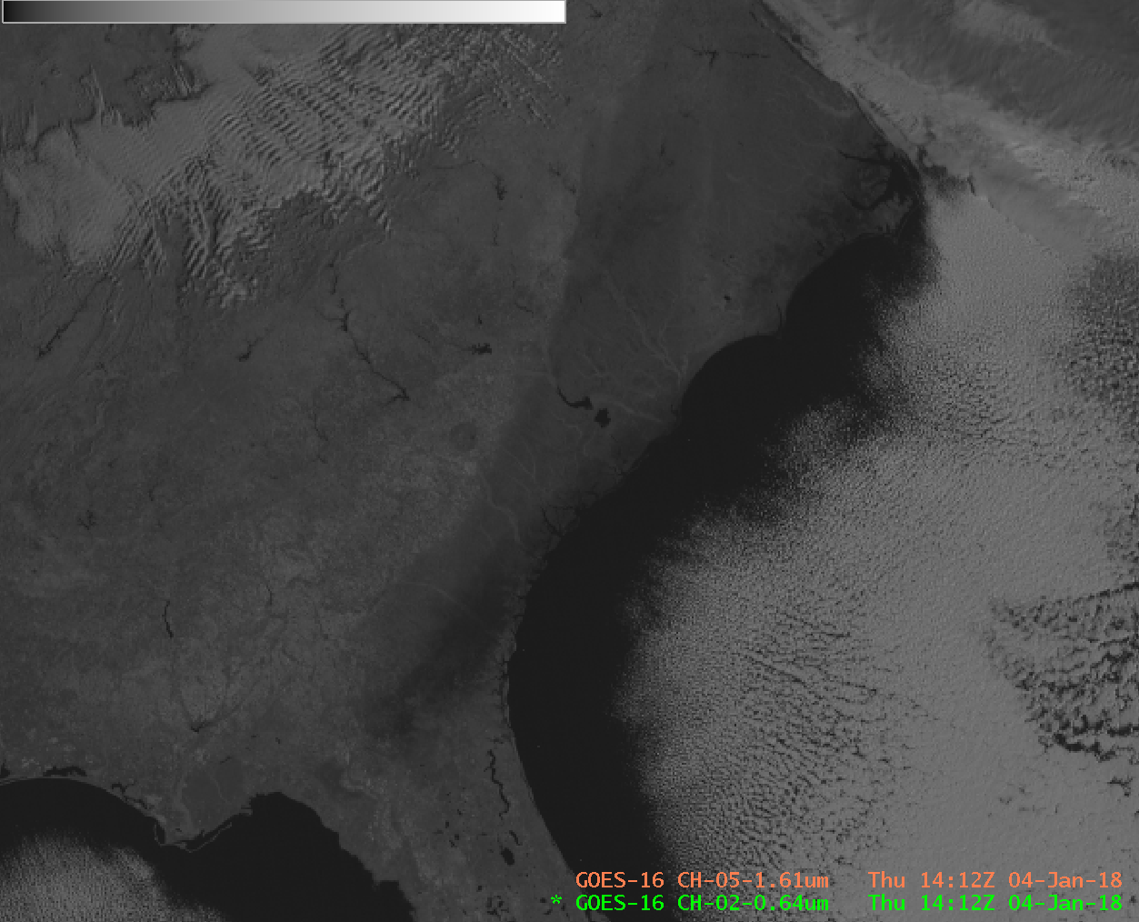
The snow that was deposited in the Deep South by this storm (also discussed here) persisted through a cold night and was visible in the GOES-16 Visible (0.64 µm) imagery, below. Highly reflective snow can be difficult in a still image to distinguish from clouds — but the Snow/Ice Channel on GOES-16 (1.61 µm) detects energy at a wavelength that is strongly absorbed by ice. Thus, snow (and ice) on the ground (or in clouds), has a different representation. (Here are toggles between the two images, with and without a map). The snow cover over coastal Georgia, South and North Carolina appears dark in the Snow/Ice channel because the snow is absorbing, not reflecting, the 1.61 µm radiation. It is noteworthy that the 1.61 µm image is especially dark over far southeastern Georgia northeastward along the immediate coastline of South Carolina. These are regions where freezing rain and sleet fell, versus predominantly snow to the north and west (as also noted here; The National Weather Service in Tallahassee tweeted out an ice/snow accumulation map that also agrees with the 1.61 µm image). Ice in the cirrus clouds northeast of North Carolina is also apparent in the Snow/Ice 1.61 µm imagery.
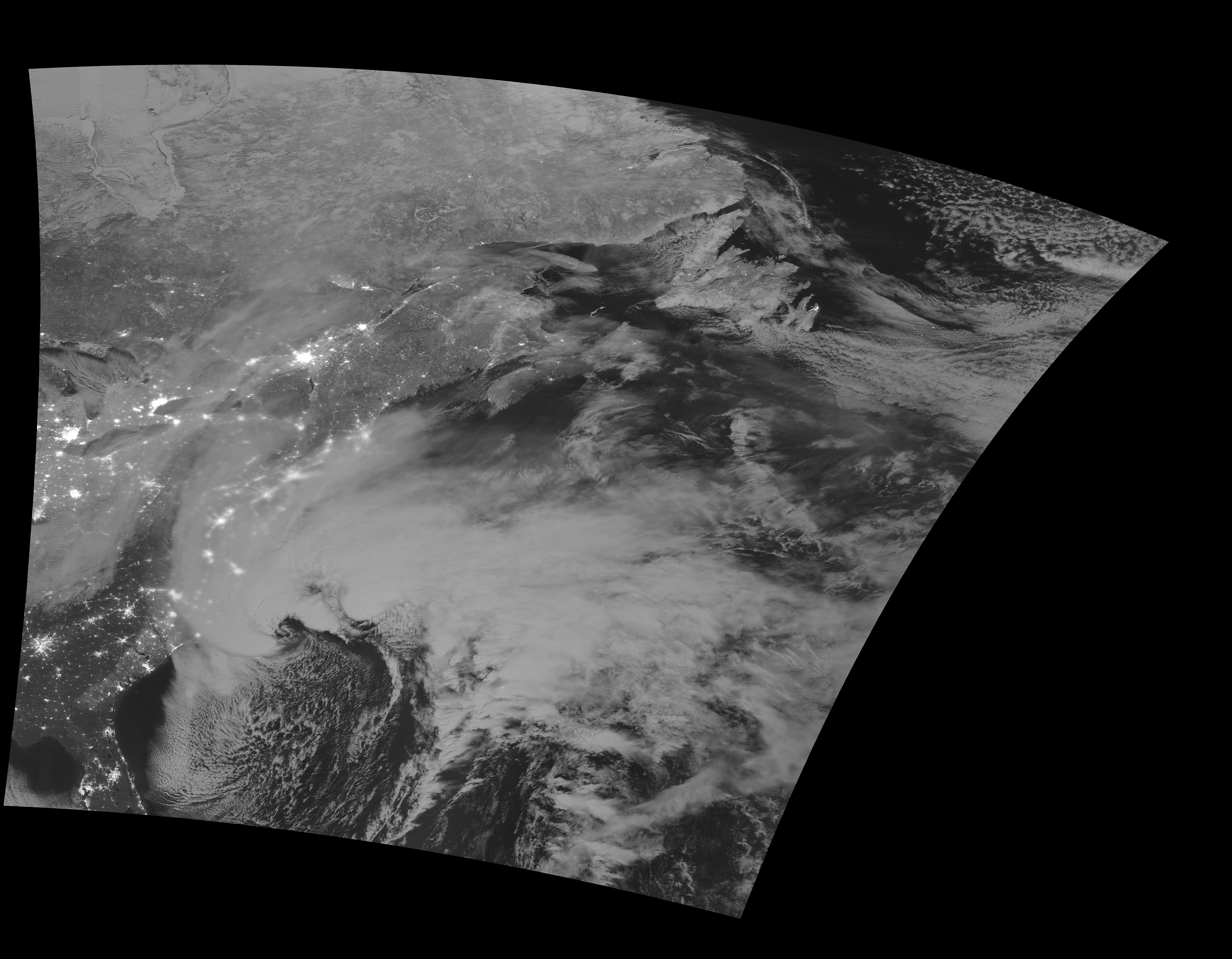
Suomi NPP overflew the storm shortly after midnight on 4 January; Day Night band visible imagery (courtesy Kathleen Strabala, CIMSS), below, shows a well-developed cyclone covering much of the northeast Atlantic Ocean. Snow cover is apparent over the deep south of the United States.
(Added, 5 January 2018: This website shows a during-the-day CIMSS True Color Image animation of the storm on 4 January 2018. Animation courtesy Dave Stettner, CIMSS).


