Aircraft hole punch and distrail cloud features over southern Lake Michigan
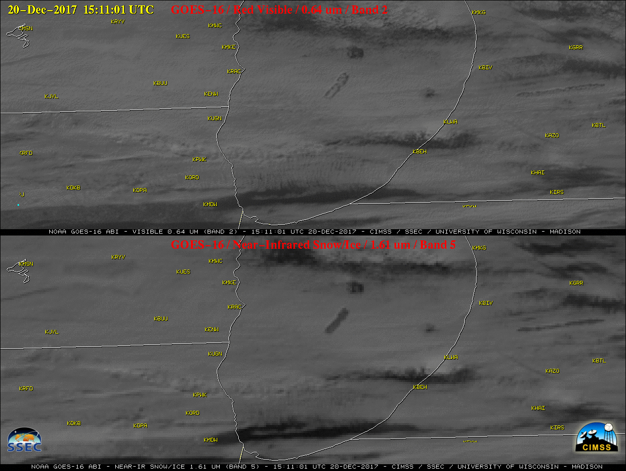
GOES-16 “Red” Visible (0.64 µm, top) and Near-Infrared “Snow/Ice” (1.61 µm. bottom) images, with surface station identifiers plotted in yellow [click to play MP4 animation]
A good example of a hole punch cloud adjacent to a longer distrail feature was seen over far southeastern Minnesota and the Minnesota/Wisconsin border, using 250-meter resolution Aqua MODIS true-color and false-color Red-Green-Blue (RGB) images from the MODIS Today site (below). Glaciated (ice crystal) cloud features appeared as darker shades of cyan in the false-color image.
![Aqua MODIS true-color and false-color RGB images [click to enlarge]](https://cimss.ssec.wisc.edu/satellite-blog/wp-content/uploads/sites/5/2017/12/171220_aqua_modis_truecolor_falsecolor_MN_WI_hole_punch_distrail_anim.gif)
Aqua MODIS true-color and false-color RGB images [click to enlarge]
![Landsat-8 false-color RGB image [click to enlarge]](https://cimss.ssec.wisc.edu/satellite-blog/wp-content/uploads/sites/5/2017/12/171220_1635utc_landsat8_falsecolor_anim.gif)
Landsat-8 false-color RGB image [click to enlarge]
===== 21 December Update =====
Another example of numerous aircraft hole punch and distrail cloud features was seen on Terra MODIS true-color and false-color RGB images on 21 December. over northern Illinois and northern Indiana (below).
![Terra MODIS true-color and false-color images [click to enlarge]](https://cimss.ssec.wisc.edu/satellite-blog/wp-content/uploads/sites/5/2017/12/171221_terra_modis_truecolor_falsecolor_IL_IN_hole_punch_clouds_anim.gif)
Terra MODIS true-color and false-color RGB images [click to enlarge]