Farewell to GOES-13 (for now…)
15 April 2009 was the last full day of GOES-13 imagery — the satellite was placed back into on-orbit storage on the morning of 16 April. GOES-13 had been brought out of storage during the Summer of 2008, to act as “GOES Central” (at 105º West longitude) and provide imagery through the Fall eclipse period. Larger on-board batteries allow GOES-13 to make imagery available during eclipse periods (when the satellite is in the Earth’s shadow, and the solar panels cannot provide the power necessary to operate the instruments) – but other improvements to GOES-13 include better image-to-image navigation, and the 4-km resolution water vapor channel that debuted on GOES-12.
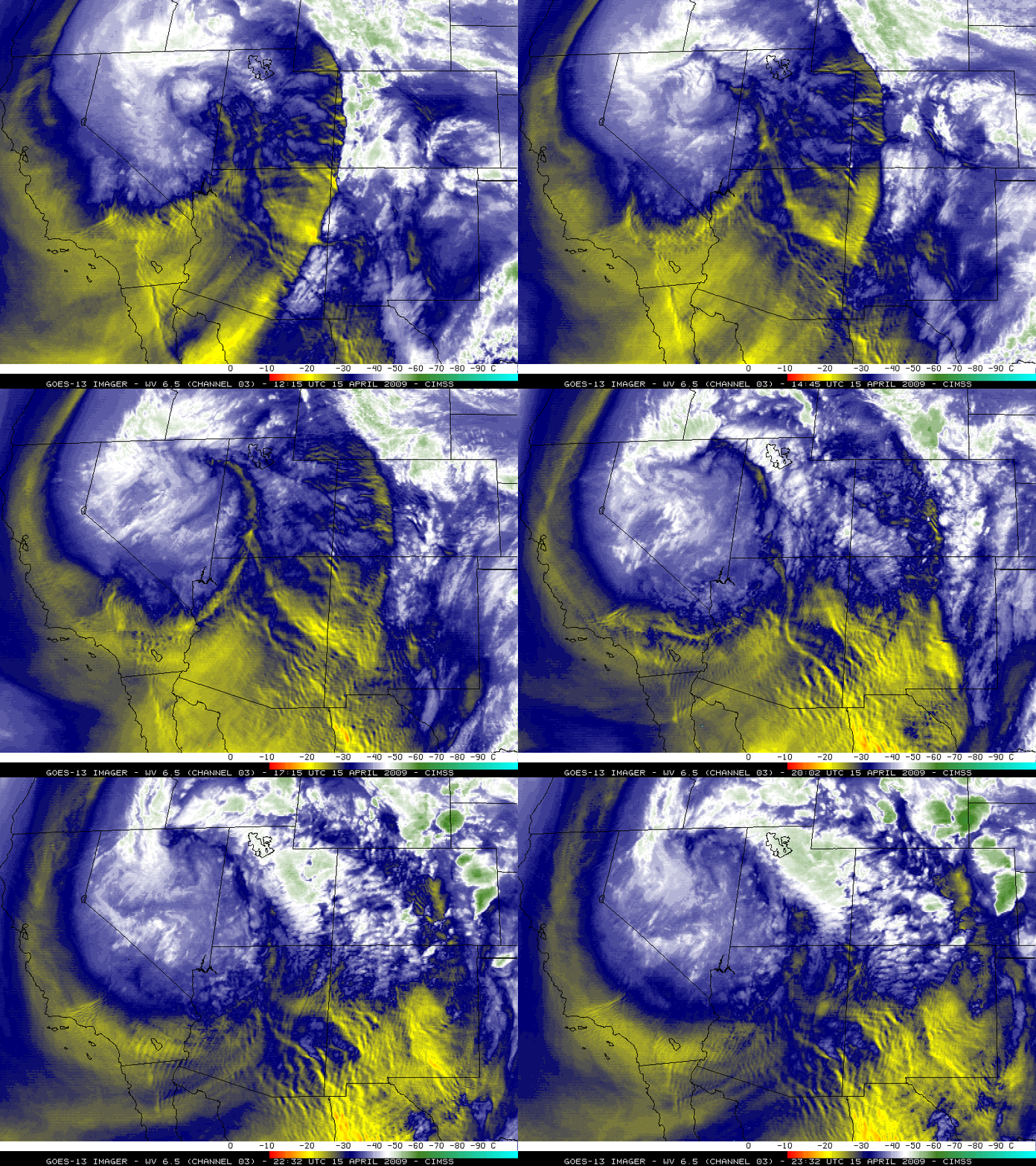
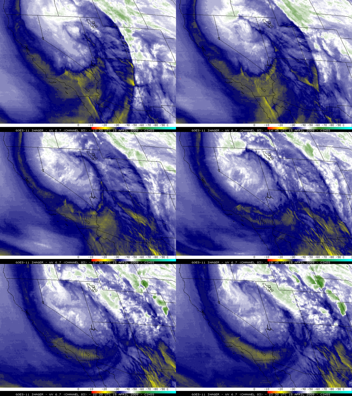
The 4-km resolution GOES-13 6.5 µm water vapor imagery (above) displayed widespread mountain wave signatures across much of the western US on 15 April — and many of the smaller-scale areas of mountain waves were unable to be resolved using the 8-km resolution GOES-11 6.7 µm water vapor imagery (below).
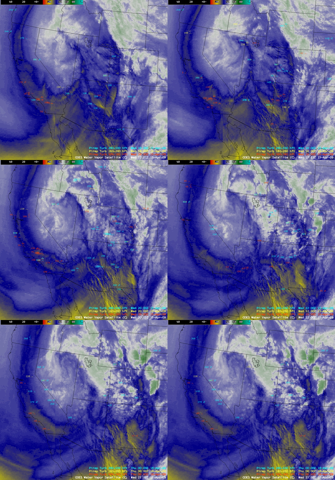
Such mountain wave signatures are often a good indicator of the likelihood of turbulence — and there were indeed a large number of pilot reports (PIREPS) of turbulence (including at least 11 reports of severe turbulence) across much of the western US, as seen on AWIPS images of the GOES-11/GOES-12 water vapor channel data (below).
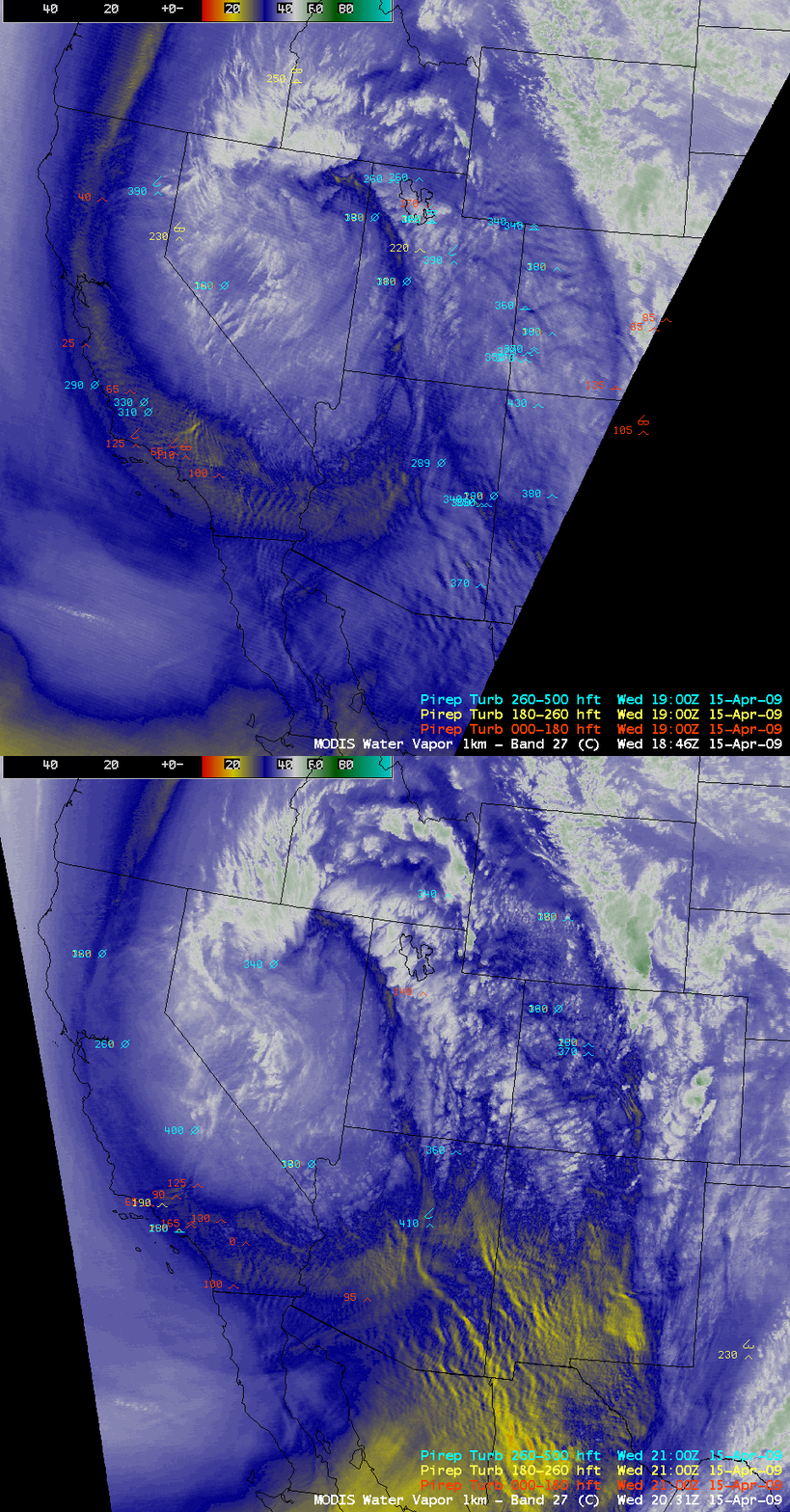
AWIPS images of the 1-km resolution MODIS 6.7 µm water vapor channel data (below) displayed even better mountain wave details at 18:46 and 20:31 UTC.


