Super Typhoon Meranti
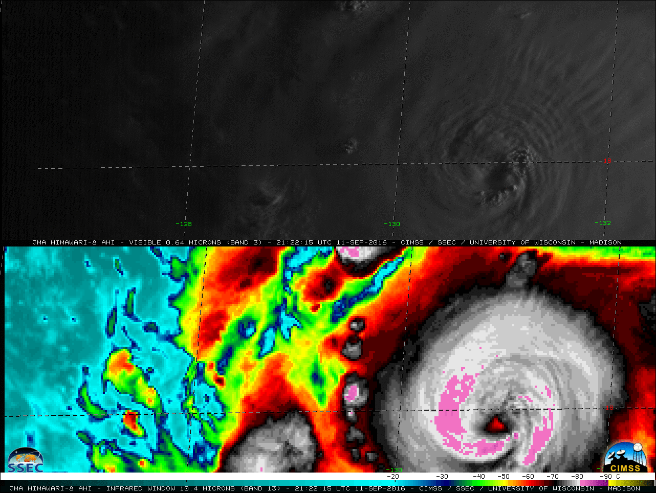
![Himawari-8 0.64 µm Visible (top) and 10.4 µm Infrared Window (bottom) images [click to play MP4 animation]](https://cimss.ssec.wisc.edu/satellite-blog/wp-content/uploads/sites/5/2016/09/480x1280_H8F_B313_HIM08_VIS_IR_MERANTI_11-12SEP2016_2016256_082715_0002PANELS.GIF)
Himawari-8 0.64 µm Visible (top) and 10.4 µm Infrared Window (bottom) images [click to play MP4 animation]
![Himawari-8 Infrared Window (10.4 µm) image at 1230 UTC on 12 September, with 11 September images of Sea Surface Temperature and Ocean Heat Content [click to enlarge]](https://cimss.ssec.wisc.edu/satellite-blog/wp-content/uploads/sites/5/2016/09/160911-12_STY_Meranti_infrared_sst_ohc_anim.gif)
Himawari-8 Infrared Window (10.4 µm) image at 1230 UTC on 12 September, with 11 September images of Sea Surface Temperature and Ocean Heat Content [click to enlarge]
![Himawari-8 Infrared Window (10.4 µm) images, with satellite-derived 850-200 hPa deep layer wind shear [click to play animation]](https://cimss.ssec.wisc.edu/satellite-blog/wp-content/uploads/sites/5/2016/09/160912_himawari8_ir_shear_STY_Meranti_anim.gif)
Himawari-8 Infrared Window (10.4 µm) images, with satellite-derived 850-200 hPa deep layer wind shear [click to play animation]
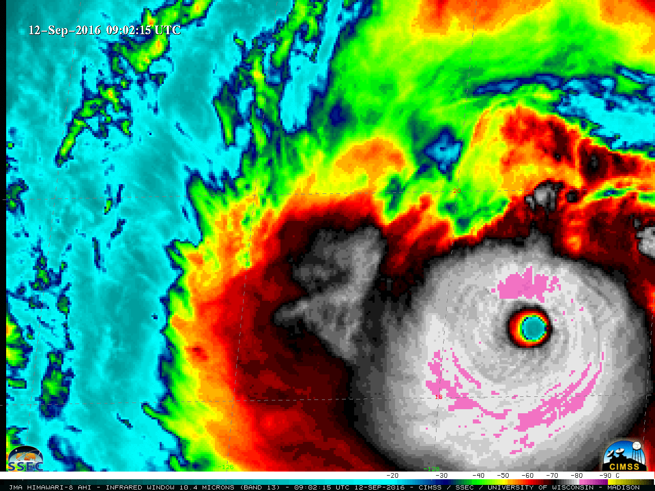
![Himawari-8 Infrared Window (10.4 µm) images [click to play MP4 animation]](https://cimss.ssec.wisc.edu/satellite-blog/wp-content/uploads/sites/5/2016/09/960x1280_H8F_B13_HIM08_IR_MERANTI_12SEP2016_2016256_120215_0001PANEL.GIF)
Himawari-8 Infrared Window (10.4 µm) images [click to play MP4 animation]
![Himawari-8 Infrared Window (10.4 µm) and DMSP-15 SSMIS Microwave (85 GHz) images [click to enlarge]](https://cimss.ssec.wisc.edu/satellite-blog/wp-content/uploads/sites/5/2016/09/160912_1830utc_himawari8_ir_1847utc_ssmis_mw_Meranti_anim.gif)
Himawari-8 Infrared Window (10.4 µm) and DMSP-15 SSMIS Microwave (85 GHz) images [click to enlarge]
![Himawari-8 0.64 µm Visible (top) and 10.4 µm Infrared Window (bottom) images [click to play MP4 animation]](https://cimss.ssec.wisc.edu/satellite-blog/wp-content/uploads/sites/5/2016/09/480x1280_H8F_B313_HIM08_VIS_IR_MERANTI_12SEP2016_2016256_222545_0002PANELS.GIF)
Himawari-8 0.64 µm Visible (top) and 10.4 µm Infrared Window (bottom) images [click to play MP4 animation]
===== 13 September Update =====
![Himawari-8 Infrared Window (10.4 µm) images [click to play MP4 animation]](https://cimss.ssec.wisc.edu/satellite-blog/wp-content/uploads/sites/5/2016/09/960x1280_H8F_B13_HIM08_IR_MERANTI_13SEP2016_2016257_150215_0001PANEL.GIF)
Himawari-8 Infrared Window (10.4 µm) images [click to play MP4 animation]
![Himawari-8 Infrared Window (11.45 µm) images [click to enlarge]](https://cimss.ssec.wisc.edu/satellite-blog/wp-content/uploads/sites/5/2016/09/160913_himwari8_infrared_Merantri_Itbayat_anim.gif)
Himawari-8 Infrared Window (11.45 µm) images [click to enlarge]
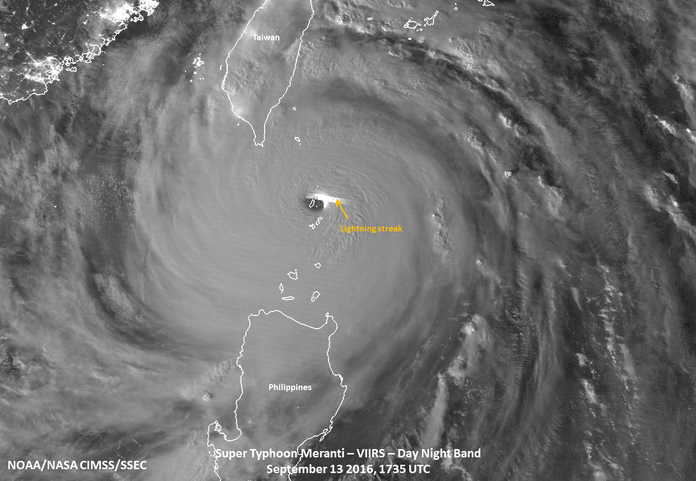
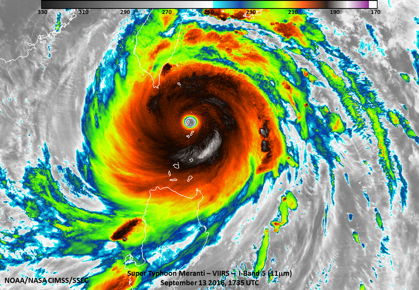
Suomi NPP overflew Meranti around 1730 UTC, just as the eye of the storm was passing over Itbayat. In a toggle between VIIRS Infrared Window (11.45 µm) and Day/Night Band (0.7 µm) images (below; courtesy of William Straka, SSEC) ample lunar illumination provided a very good “visible image at night” which also included a bright lightning streak emanating from the eastern eyewall of the Category 5 storm. The image pair also shows a good example of the “stadium effect” eye geometry (where the eye diameter at the surface is smaller, and opens to a wider distance with increasing height). A larger-scale view of the entire storm from the Day/Night Band is available here; the corresponding 11.45 µm Infrared image is available here.
![Suomi NPP VIIRS Infrared Window (11.45 µm) and Day/Night Band visible (0.70 µm) imagery of Meranti, 1735 UTC on 13 September 2016 [click to enlarge]](https://cimss.ssec.wisc.edu/satellite-blog/wp-content/uploads/sites/5/2016/09/160913_1735utc_suomi_npp_viirs_Infrared_Day_Night_Band_Meranti_Itbayat_anim.gif)
Suomi NPP VIIRS Infrared Window (11.45 µm) and Day/Night Band visible (0.70 µm) imagery of Meranti, 1735 UTC on 13 September 2016 [click to enlarge]
![DMSP-15 SSMI Microwave (85 GHz) and Himawari-8 Infrared Window (11.45 µm) images [click to enlarge]](https://cimss.ssec.wisc.edu/satellite-blog/wp-content/uploads/sites/5/2016/09/160913_1831utc_dmsp15_ssmi_microwave_1830utc_himawari8_infrared_Meranti_anim.gif)
DMSP-15 SSMI Microwave (85 GHz) and Himawari-8 Infrared Window (11.45 µm) images [click to enlarge]
This formation of concentric eyewalls was nicely depicted by the MIMIC-TC product (below).
![MIMIC-TC product [click to play animation]](https://cimss.ssec.wisc.edu/satellite-blog/wp-content/uploads/sites/5/2016/09/160913_mimic_tc_Meranti_anim.gif)
MIMIC-TC product [click to play animation]
=====14 September Update =====
![Suomi NPP VIIRS Day/Night Band (0.7 µm) and Infrared Window (11.45 µm) images [click to enlarge]](https://cimss.ssec.wisc.edu/satellite-blog/wp-content/uploads/sites/5/2016/09/160914_1716utc_suomi_npp_viirs_dnb_ir_Meranti_landfall_anim.gif)
Suomi NPP VIIRS Day/Night Band (0.7 µm) and Infrared Window (11.45 µm) images [click to enlarge]
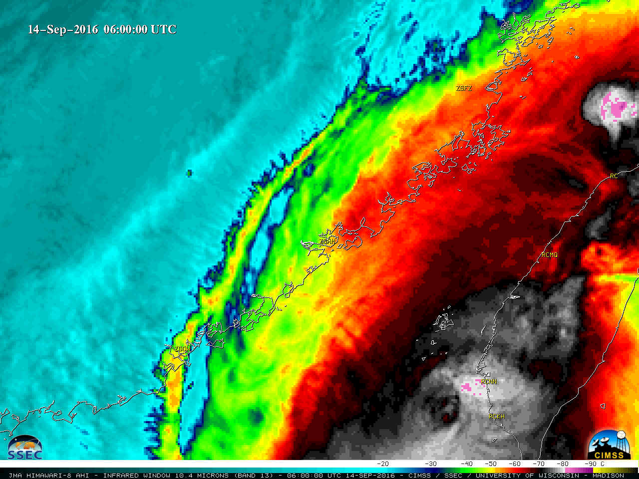
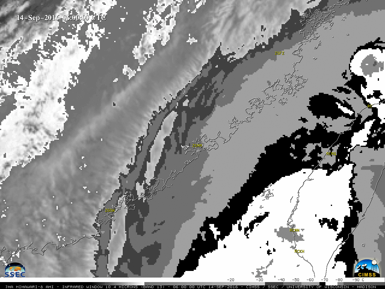
Less than 2 hours prior to landfall (which was around 1905 UTC on 14 September, over Xiamen City in the Fujian Province of China), a toggle between Suomi NPP VIIRS Day/Night Band (0.7 µm) and Infrared Window (11.45 µm) images at 1716 UTC (above) still showed well-defined curved banding structures around the center of of the Category 2 typhoon.
Himawari-8 Infrared Window (10.4 µm) images from pre-landfall at 0600 UTC on 14 September to post-landfall at 0600 UTC on 15 September (below; also available as a 47 Mbyte animated GIF) showed that Meranti quickly dissipated as it moved inland over mainland China. The images are centered on Xiamen (station identifier ZSAM); alternate animation versions with the BD grayscale enhancement are available in MP4 and animated GIF format.
![Himawari-8 Infrared Window (10.4 µm) images [click to play MP4 animation]](https://cimss.ssec.wisc.edu/satellite-blog/wp-content/uploads/sites/5/2016/09/960x1280_AHIM08_B13_HIM08_IR_MERANTI_14-15SEP2016_2016258_190000_0001PANEL.GIF)
Himawari-8 Infrared Window (10.4 µm) images [click to play MP4 animation]
![DMSP-18 SSMIS Microwave (85 GHz) and Himawari-8 Infrared Window (11.45 µm) images [click to enlarge]](https://cimss.ssec.wisc.edu/satellite-blog/wp-content/uploads/sites/5/2016/09/160914_2314utc_dmsp18_ssmis_mw_2300utc_himawari8_ir_Meranti_post_landfall_anim.gif)
DMSP-18 SSMIS Microwave (85 GHz) and Himawari-8 Infrared Window (11.45 µm) images [click to enlarge]