Mountain wave signatures on water vapor imagery
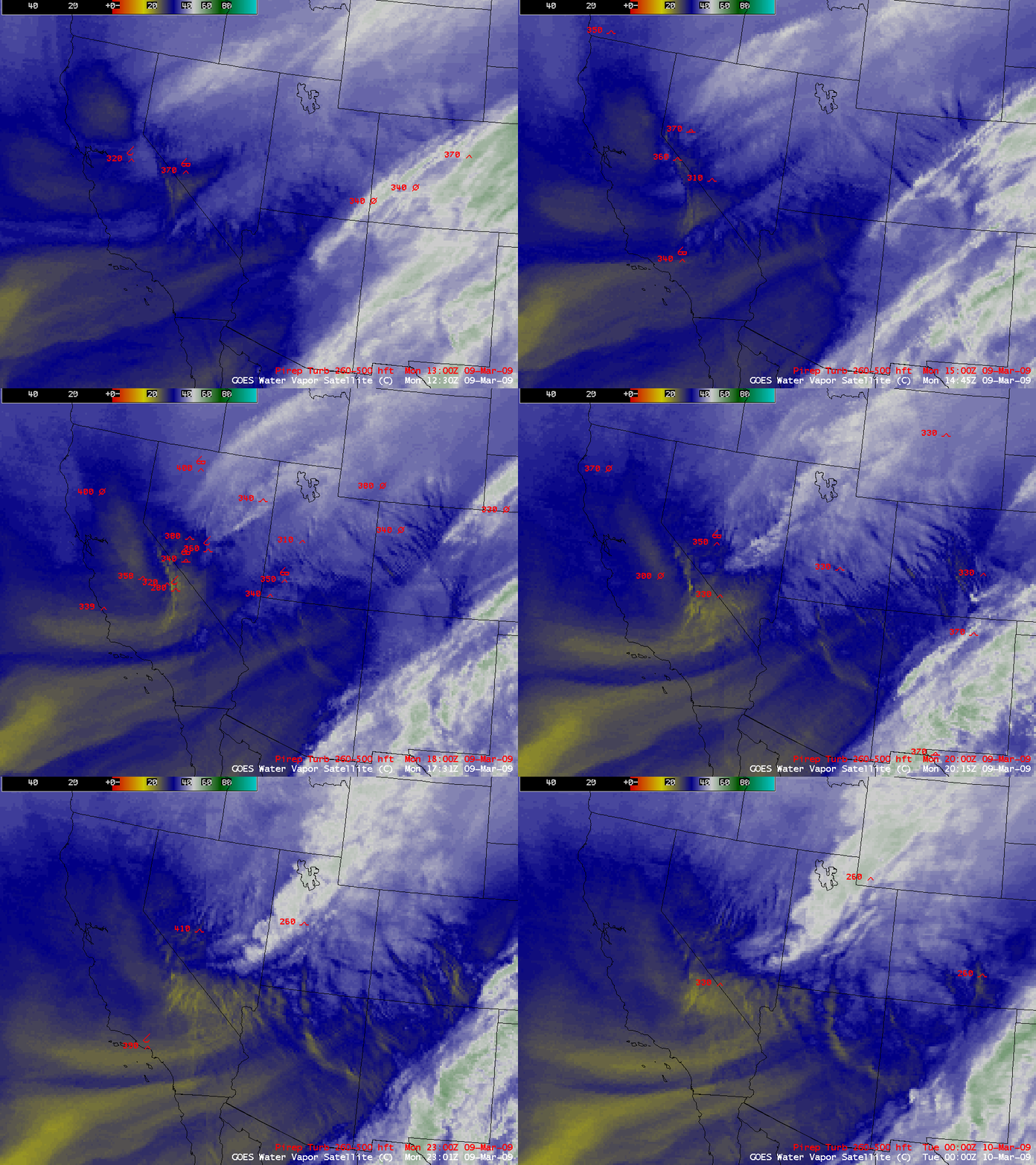
Strong winds over much of the southwestern US (surface winds gusted to 75 mph at Sierra Rotors Site 7 in California) were responsible for producing large areas of mountain waves across a good deal of that particular region on 09 March 2009. These mountain waves were seen on AWIPS composite images of the 8-km resolution GOES-11 (GOES-West) 6.7 µm and the 4-km resolution GOES-12 (GOES-East) 6.5 µm water vapor channels (above) — and there were a number of pilot reports of light to moderate turbulence within the 26,000-50,000 feet layer over the southwestern US.
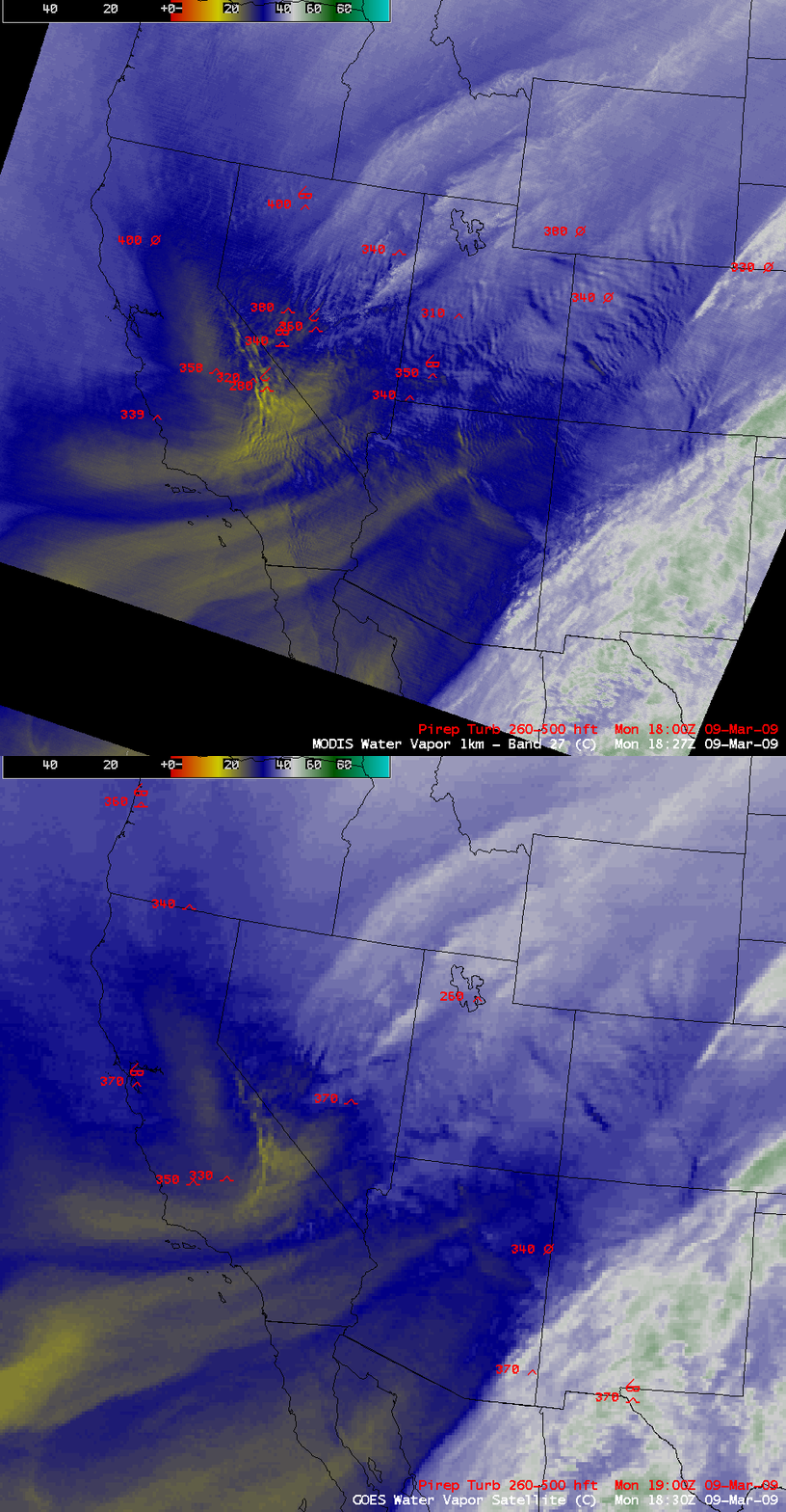
A comparison of the 1-km resolution MODIS 6.7 µm with the 8-km resolution GOES-11 water vapor imagery at around 18:30 UTC (above) showed a marked improvement in the ability to detect the location and areal coverage of the mountain waves.
A similar comparison of the the 1-km resolution MODIS 6.7 µm with a composite of the 8-km resolution GOES-11 6.7 µm (GOES-West) plus the 4-km resolution GOES-12 6.5 µm (GOES-East) water vapor images (above) demonstrated the improvement in mountain wave detection capability with the newer 4-km water vapor channel on the newer GOES-12 (and also the GOES-13) satellites — but as expected, neither are as capable as the 1-km MODIS water vapor channel in terms of displaying mountain wave signatures.
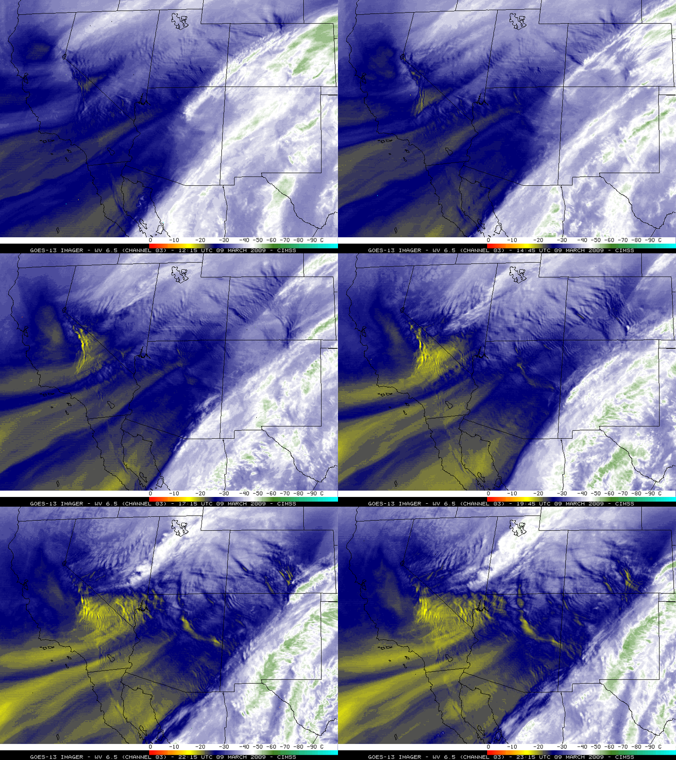
GOES-13 shares the same 4-km resolution 6.5 µm water vapor channel as GOES-12, but in this case GOES-13 had the advantage of a more direct satellite view angle (GOES-13 is positioned over the Equator at 105º W longitude). As a result, the GOES-13 water vapor imagery (above) did a very good job of depicting the areal coverage (as well as the temporal evolution) of the mountain wave signatures. Note how some wave signatures were stationary (anchored to the terrain that caused them to form), while other wave signatures appeared to propagate downwind over time.


