Hurricane Patricia
GOES-15 (GOES-West) Infrared (10.7 µm) images (above; also available as an MP4 animation) displayed the formation of a ring of cold eyewall cloud-top IR brightness temperatures (in the -80 to -90º C range, violet colors) during the period of rapid intensification of Hurricane Patricia on 22 October 2015; the storm reached Category 5 intensity around 00 UTC on 23 October. Patricia then continued to intensify, reaching maximum sustained surface winds estimated at 175 knots with a minimum central pressure of 878.4 hPa or 25.94 inches of mercury (making this the strongest tropical cyclone on record for the National Hurricane Center area of responsibility, which is the North Atlantic Ocean and the eastern North Pacific Ocean). The storm weakened somewhat prior to making landfall (although still as a Category 5 hurricane) around 2315 UTC on 23 October.Multi-day YouTube animations showing the formation of Patricia are available here (0.63 µm visible imagery from GOES-13) and here (10.7 µm infrared imagery from GOES-13). The multi-day location of Patricia’s 850 hPa relative vorticity signature (derived from satellite atmospheric motion vector data) can be seen here.
A plot of the Advanced Dvorak Technique intensity estimate (below) showed the rate of rapid intensification on 22-23 October. At one point Patricia’s central pressure deepened 100 hPa in 24 hours, and 73 hPa in 12 hours, making it the fastest-intensifying tropical cyclone on record in the Western Hemisphere.
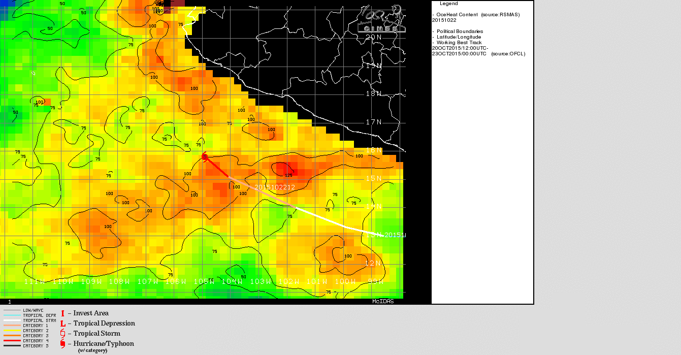
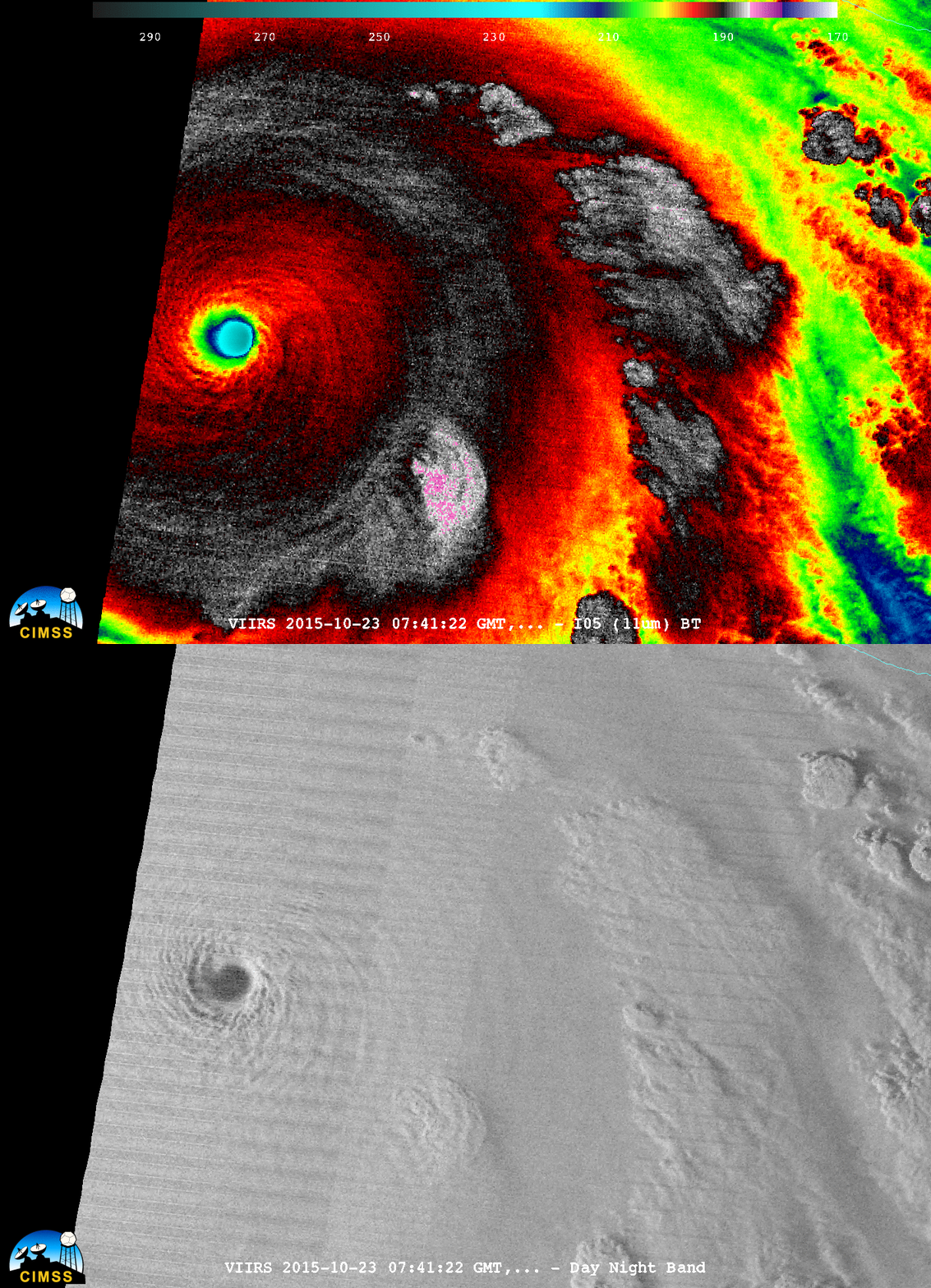
GOES-15 Visible (0.63 µm) images (below; also available as an MP4 animation) revealed the small “pinhole” eye of Patricia during rapid intensification on 22 October. As Patricia was rapidly intensifying from a Category 1 to Category 5 intensity, the tropical cyclone was moving over a region of high Ocean Heat Content (below), and Sea Surface Temperature values were as high as 31º C.A comparison of Suomi NPP VIIRS Infrared (11.45 µm) and Day/Night Band (0.7 µm) images at 0741 UTC on 23 October is shown below (courtesy of William Straka, SSEC). With ample illumination from the Moon (which was in the Waxing Gibbous phase, at 78% of Full), the “visible image at night” capability of the Day/Night Band provided a detailed view of cloud-top gravity waves surrounding the eye.
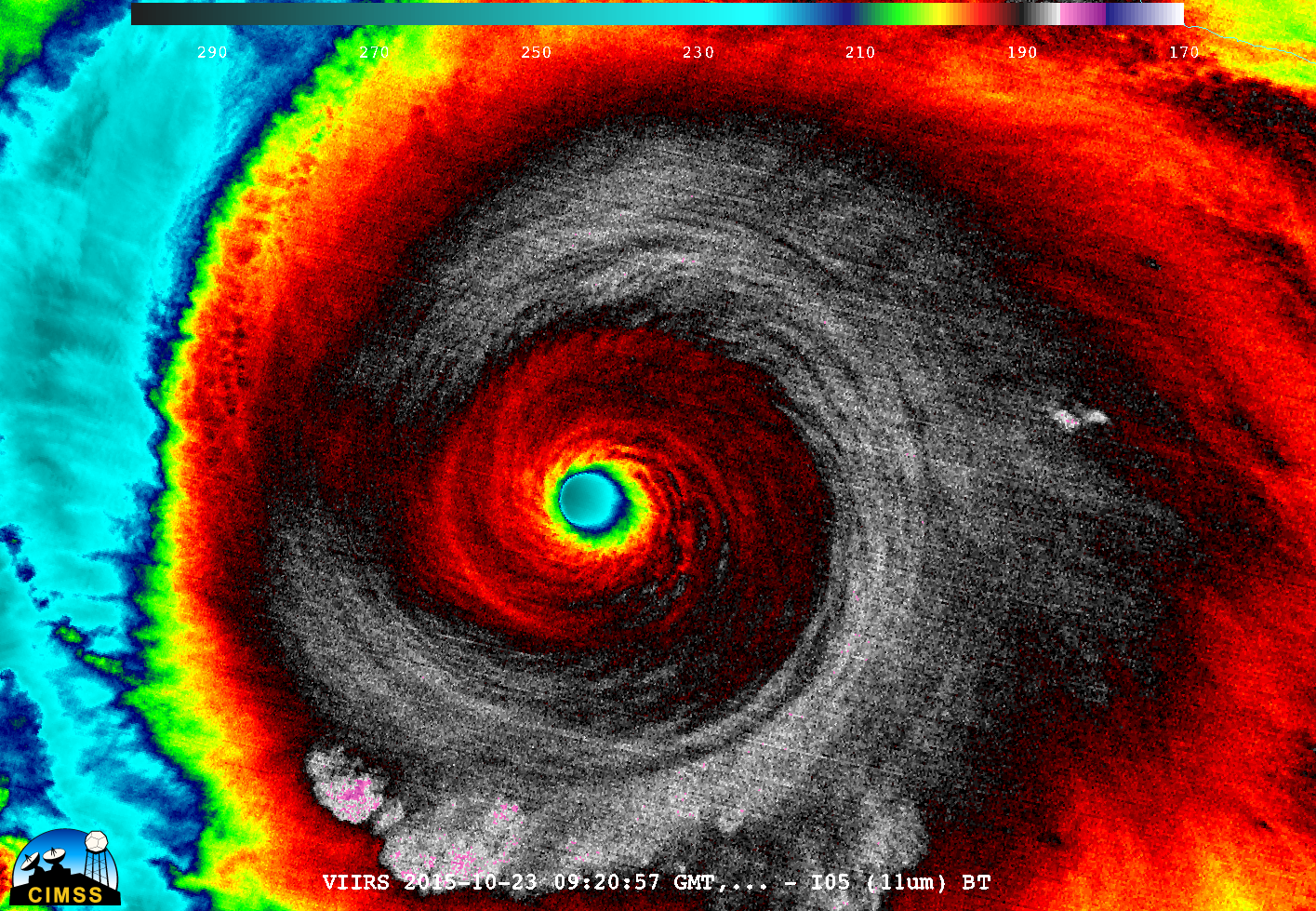
A later VIIRS Infrared (11.45 µm) image at 0920 UTC is shown below.
A comparison of GOES-15 (GOES-West) and GOES-13 (GOES-East) Visible (0.63 µm) images (below) showed the eye of Patricia from sunrise on 23 October until landfall along the west coast of Mexico around 2315 UTC. A mesonet station at the Chamela-Cuixmala Biosphere Reserve (located approximately 10 miles northwest of the eye landfall position) reported maximum sustained winds of 185 mph at 2350 UTC, with a peak wind gust of 210.9 mph at 2310 UTC.
MIMIC morphed microwave imagery (below) showed the development and motion of the very compact eye during the 22-23 October period. There was also a signature of the formation of a secondary outer eyewall, suggesting that an eyewall replacement cycle was underway as Patricia was approaching the west coast of Mexico. View a 23 October weather briefing held at CIMSS to discuss Hurricane Patricia here.===== 25 October Update =====
Following the landfall of Patricia late in the day on 23 October, and increase in offshore sediment could be seen in Suomi NPP VIIRS true-color Red/Green/Blue (RGB) images (from the RealEarth web map server) on 24 and 25 October (below), a result of runoff from heavy rains inland.


![Advanced Dvorak Technique (ADT) intensity estimate plot [click to enlarge]](https://cimss.ssec.wisc.edu/satellite-blog/wp-content/uploads/sites/5/2015/10/151020-23_adt_Patricia.gif)


![MIMIC morphed microwave imagery [click to enlarge]](https://cimss.ssec.wisc.edu/satellite-blog/wp-content/uploads/sites/5/2015/10/151022-23_mimic_Patricia_anim.gif)
![Suomi NPP VIIRS true-color images from 23, 24, and 25 October [click to enlarge]](https://cimss.ssec.wisc.edu/satellite-blog/wp-content/uploads/sites/5/2015/10/151023-25_suomi_npp_viirs_truecolor_Patricia_sediment_anim.gif)