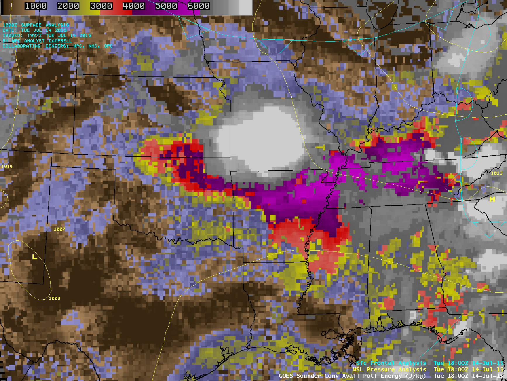
Severe thunderstorms causing damaging winds across Missouri and Arkansas
GOES-13 sounder Convective Available Potential Energy (CAPE) derived product images (above; click to play animation) showed a large cluster of of severe thunderstorms that developed in eastern Kansas and moved southeastward across southern Missouri into northern Arkansas during the day on 14 July 2015. Due to strong surface heating and ample low-level moisture ahead of the storms, the atmosphere became quite unstable with GOES sounder CAPE values reaching the 5800-6000 J/kg range (lighter violet color enhancement) by 16 UTC. A long swath of damaging winds (SPC storm reports) was produced by these storms.
The visible and infrared images below show snapshots of this severe convective cluster at 3 different times, using high-resolution data from instruments on polar-orbiting satellites: Terra MODIS at 1657 UTC, Suomi NPP VIIRS at 1851 UTC, and POES AVHRR at 1916 UTC. The coldest cloud-top IR brightness temperatures were -83º C on the MODIS image, -86º C on the VIIRS image, and -87º C on the AVHRR image.
![Terra MODIS 0.65 µm visible channel and 11.0 µm IR channel images (with SPC storm reports) at 1657 UTC [click to enlarge]](https://cimss.ssec.wisc.edu/satellite-blog/wp-content/uploads/sites/5/2015/07/150714_1657utc_terra_modis_visible_ir_MCS_anim.gif)
Terra MODIS 0.65 µm visible channel and 11.0 µm IR channel images (with SPC storm reports) at 1657 UTC [click to enlarge]


![Suomi NPP VIIRS 0.64 µm visible channel and 11.45 µm IR channel images (with SPC storm reports) at 1851 UTC [click to enlarge]](https://cimss.ssec.wisc.edu/satellite-blog/wp-content/uploads/sites/5/2015/07/150714_1851utc_suomi_npp_viirs_visible_ir_MCS_anim.gif)
![POES AVHRR 0.86 µm visible channel and 12.0 µm IR channel images (with SPC storm reports) at 1916 UTC [click to enlarge]](https://cimss.ssec.wisc.edu/satellite-blog/wp-content/uploads/sites/5/2015/07/150714_1916utc_poes_avhrr_visible_ir_MCS_anim.gif)