The long-lasting remnants of Tropical Storm Bill
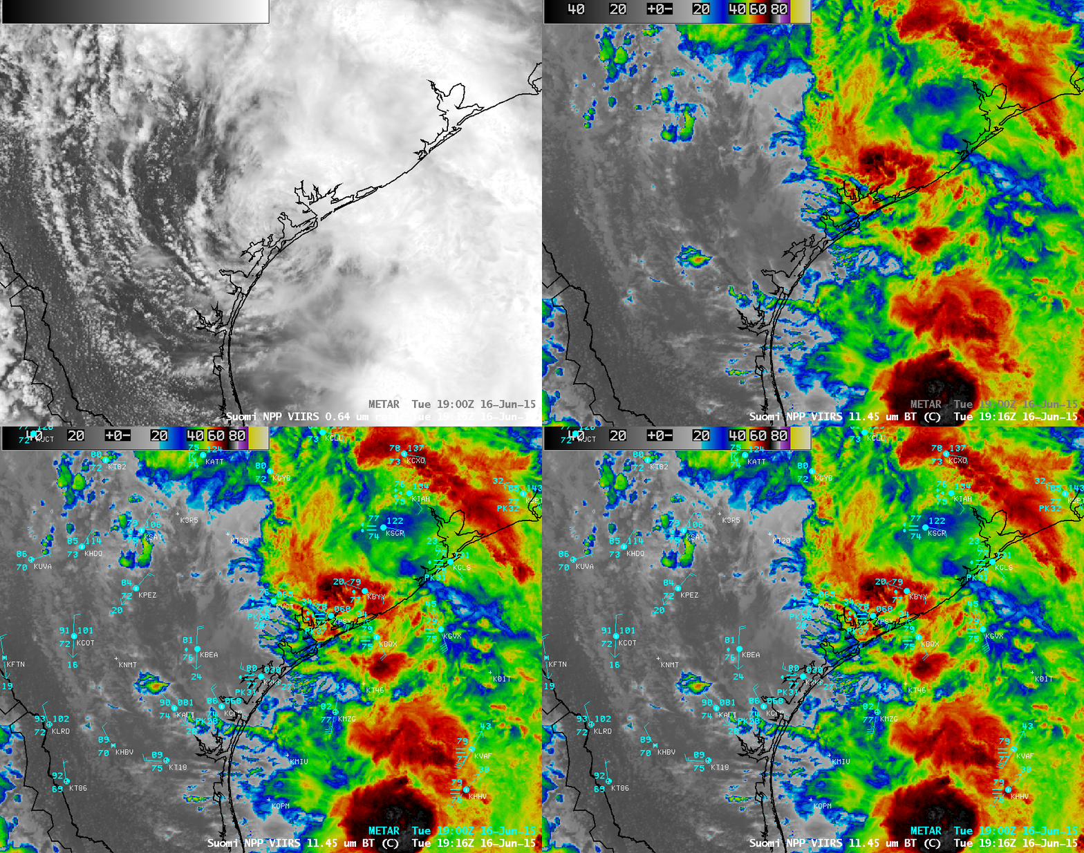
Suomi NPP VIIRS 0.64 µm visible channel and 11.45 µm IR channel images (click to enlarge)
Advisories on Tropical Storm Bill were initiated when the system organized and intensified off the coast of Texas at 03 UTC on 16 June 2015 (GOES-13 IR image animation). Bill moved inland during the afternoon hours on 16 June, as can be seen in a comparison of Suomi NPP VIIRS 0.64 µm visible channel and 11.45 µm IR channel images at 1916 UTC (above).
Late in the day on 17 June, the general appearance of downgraded Tropical Depression Bill on GOES-13 6.5 µm water vapor channel imagery (below) began to suggest that the system might be undergoing an extratropical transition (intrusion of dry air in the southern quadrant, along with a blosominig comma head signature on the northern quadrant) — but Bill maintained sufficient tropical characteristics to continue being named a tropical depression.
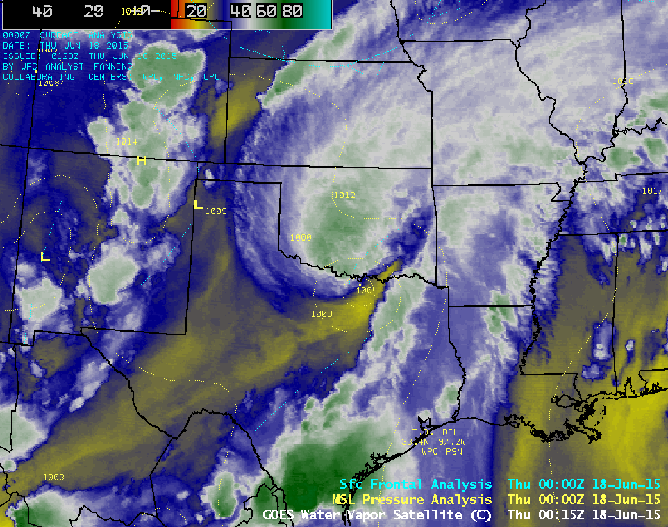
GOES-13 6.5 µm water vapor channel images, with surface pressure and frontal analyses (click to play animation)
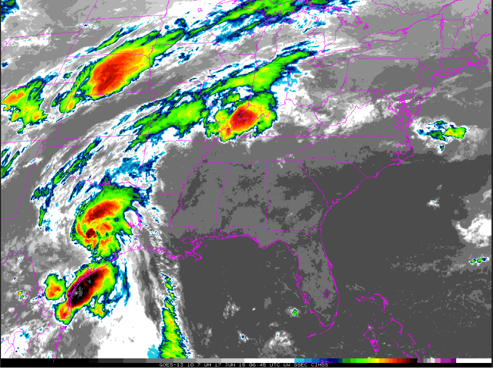
The circulation of TD Bill maintained its identity on satellite imagery as the storm remained over land for the next 3+ days, curving northeastward and moving across the Ohio River Valley region. Slow-moving TD Bill dropped over 12 inches of rain at some locations in Texas and Oklahoma, with amounts exceeding 8 inches in Missouri and 6 inches in Indiana (WPC storm total rainfall totals), before being designated a post-tropical feature at 21 UTC on 20 June (WPC advisories).
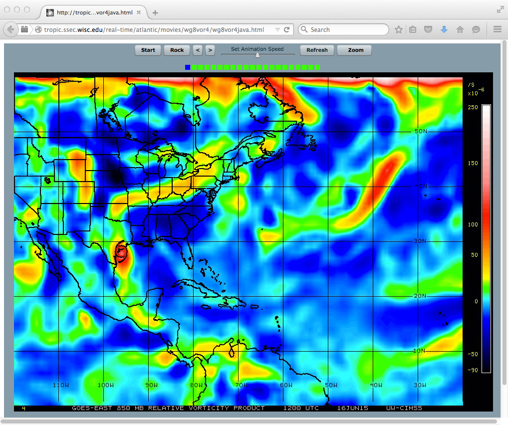
The history of Bill can be followed in a multi-day animation of GOES-13 10.7 µm IR channel imagery (above); in addition, the lower-tropospheric circulation of Bill can be followed using the CIMSS 850 hPa relative vorticity product (below).
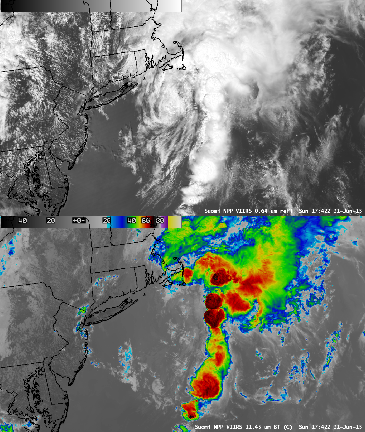
As the post-tropical remnants of Bill emerged over the Atlantic Ocean early in the day on 21 June, it still appeared to be associated with an arc of deep convection as seen on a comparison of Suomi NPP VIIRS 0.64 µm visible channel and 11.45 µm IR channel images at 1742 UTC (below). A similar comparison of Terra MODIS visible and IR images at 1514 UTC can be seen here.


