Typhoon Dolphin approaches Guam
The animation above (available here as an mp4, and here on YouTube) shows 11.22 µm infrared imagery at 2.5-minute time steps (bottom) and 10-minute time steps (top) from Himawari-8 on 14 May 2015. Category 2 intensity Typhoon Dolphin is approaching Guam, seen at the left edge of both panels in the frame. The 2.5-minute imagery gives a much better indication of the quick rise and decay of overshooting tops (IR brightness temperatures of the storm tops approach -95º C!). A 10-minute time step cannot fully resolve the evolution of these features. The 2.5-minute time step also better captures the divergent flow (and outward-propagating gravity waves) at the top of the central dense overcast. No eye was yet apparent in the infrared imagery, or on DMSP SSMI 85 GHz microwave imagery.
A similar animation from the previous day, 13 May, is shown here: gif, mp4, YouTube. The better organization of the storm on 14 May is readily apparent.
How high are the clouds in the Central Dense Overcast (CDO)? Cloud Heights are available from CLAVR-x (Clouds from AVHRR Extended). Data from Geostationary Satellites are processed and are available to download here. Values from COMS-1 and from MTSAT-2 (displayed with McIDAS-V) suggest maximum cloud heights near 55,500 feet.
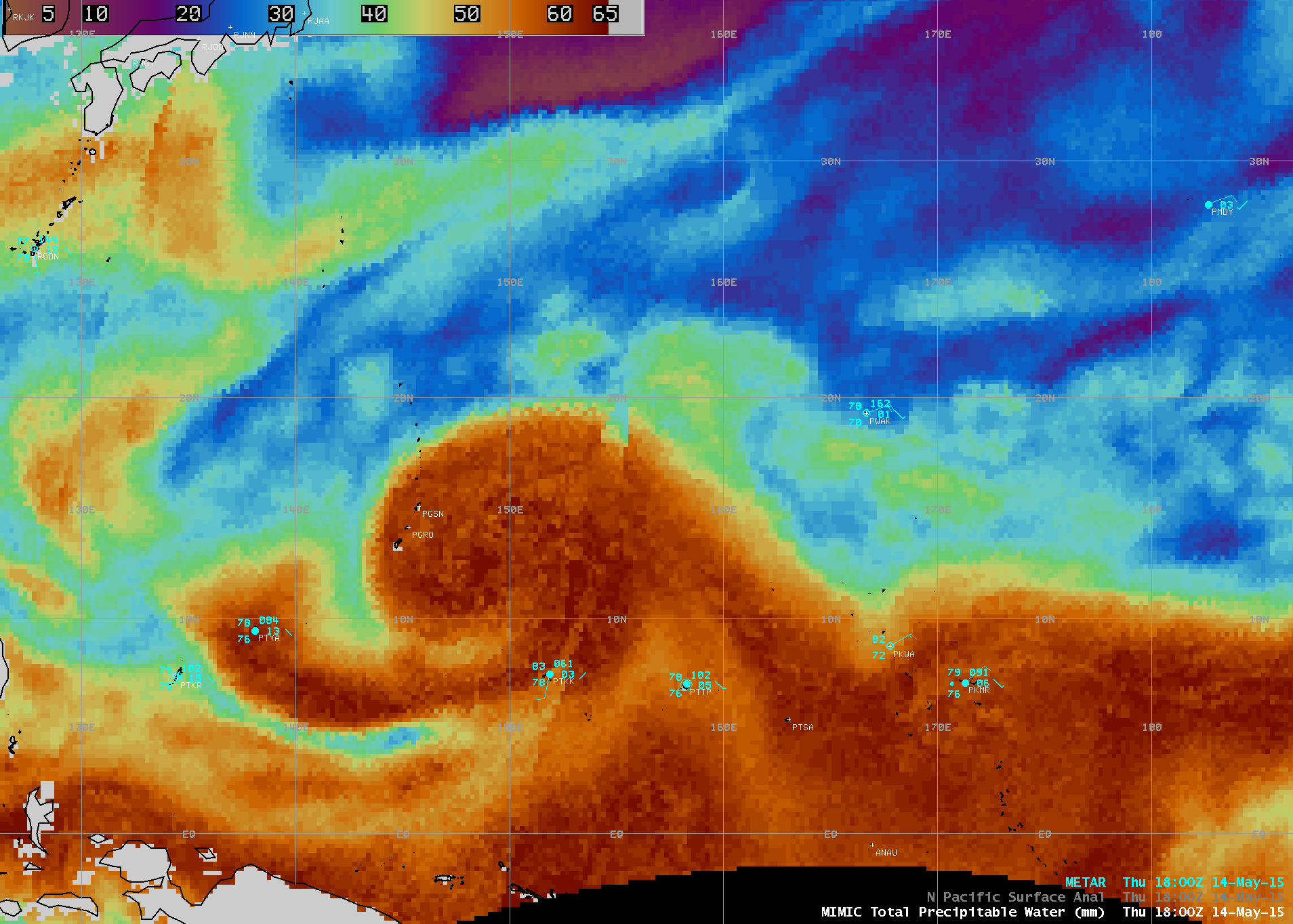
The MIMIC Total Precipitable Water (TPW) product, below, showed that Typhoon Dolphin was able to tap rich moisture from the Intertropical Convergence Zone (ITCZ) during the 13-14 May period; TPW values within the tropical cyclone circulation were often in the 60-65 mm or 2.5-2.6 inch range (darker red color enhancement).
Visible Imagery from Himawari-8, just after sunrise on 15 May, show continuous development of short-lived overshooting tops to the east of Guam. More information on the storm is available at the CIMSS Tropical Cyclones site, the JMA Tropical Cyclone site and the Joint Typhoon Warning Center.


