Himawari-8 imagery of Tropical Depression 24S / Cyclone Quang northwest of Australia
The 10-minute full-disk imagery that is available from Himawari-8 captures the evolution of Tropical Depression 24S northwest of Australia. Convection is evolving on time-scales of 10 minutes or less, so the high temporal resolution is vital to describing the storm evolution. Of particular note are the development (and decay) of central dense overcast features near the storm center, which have a timescale of less than 30 minutes. Note also the well-developed outflow channel curving anticyclonically to the south and east of the storm.
Sea surface temperature fields (from this site) show very warm ocean waters (SSTs exceed 30º C). Wind shear over the system is small; strengthening is expected.
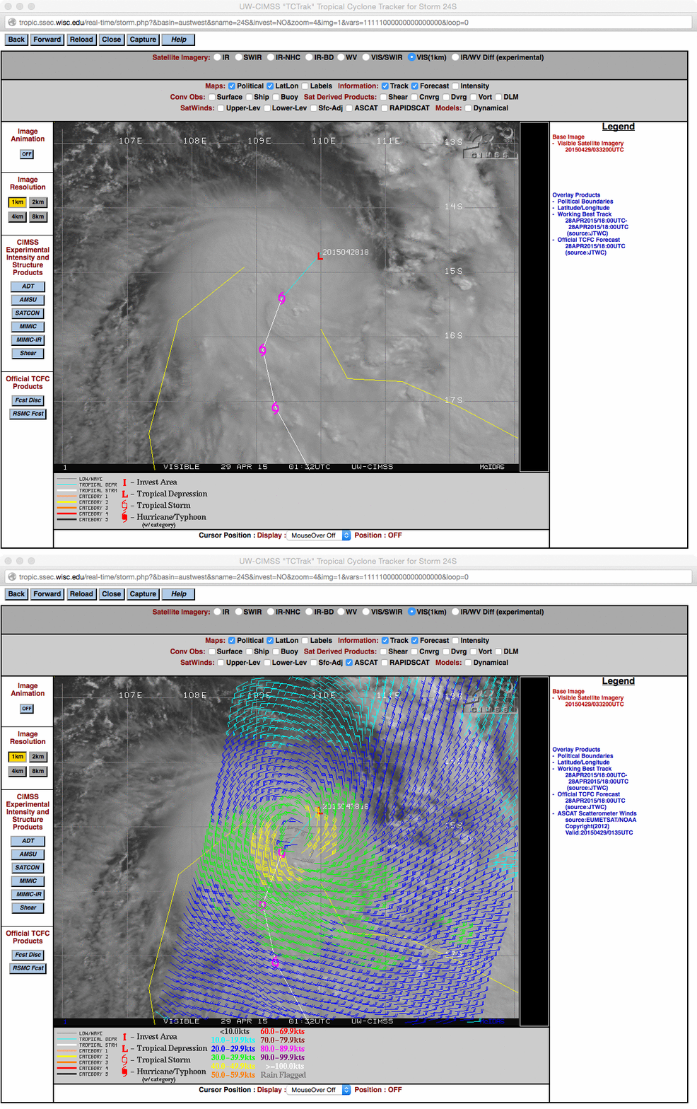
29 April Update: As anticipated, Tropical Depression 24S continued to intensify, becoming Tropical Storm Quang. A comparison of an MTSAT-2 visible image at 0132 UTC with an overlay of 0135 UTC ASCAT scatterometer winds, below, shows surface winds in the 40.0-45.9 knot range (yellow) in both the western and eastern hemispheres of the storm. A large convective burst (with overshooting tops) was apparent on the visible image, just south of the center of Quang.
Himawari-8 Infrared imagery on 29 April show eye development between 1600 and 1800 UTC. Quang was upgraded to a Cyclone at 1800 UTC. (Link)
The scanning strategy of the current operational MTSAT satellites is such that the Southern Hemisphere only receives 1 image per hour. The Himawari-8 satellite performs a Full Disk scan every 10 minutes — and as an MTSAT-2 10.8 µm IR vs Himawari-8 10.4 µm IR image comparison demonstrates (below; click image to play animation; also available as an MP4 movie file), the improved Himawari-8 spatial resolution (2 km vs 4 km) and more frequent scans allowed the formation of the eye of Quang to be more accurately followed as it rapidly intensified from a Tropical Storm to a Category 4 Severe Cyclone. A nighttime comparison of Suomi NPP VIIRS Day/Night Band and Infrared images on 29 April/1820 UTC (30 April/02:20 AM local time) can be seen here.


