Mesovortex over Lake Ontario
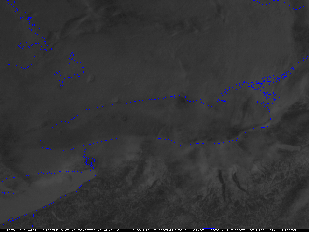
GOES-13 0.63 µm visible channel images (click to play animation)
GOES-13 (GOES-East) 0.63 µm visible channel images (above; click to play animation) revealed the presence of a mesocale vortex (“mesovortex”) propagating eastward across the ice-free waters of western Lake Ontario on on 17 February 2015. At the beginning of the animation, also note that there were numerous “hole punch clouds” seen in the stratus cloud deck that covered the western Lake Ontario region during the early morning hours; these holes were likely caused by aircraft inbound/outbound from the Toronto International Airport — particles in jet engine exhaust act as ice nuclei, causing supercooled water droplets to turn into larger, heavier ice particles which then fall out of the cloud to create holes (sometimes described as “fall streaks” due to their appearance).
A closer view using a sequence of MODIS and VIIRS true-color Red/Green/Blue (RGB) images from the SSEC RealEarth web map server site is shown below. There was a significant amount of ice in the northeastern section of Lake Ontario, as well as a ring of offshore ice around other parts of the lake.
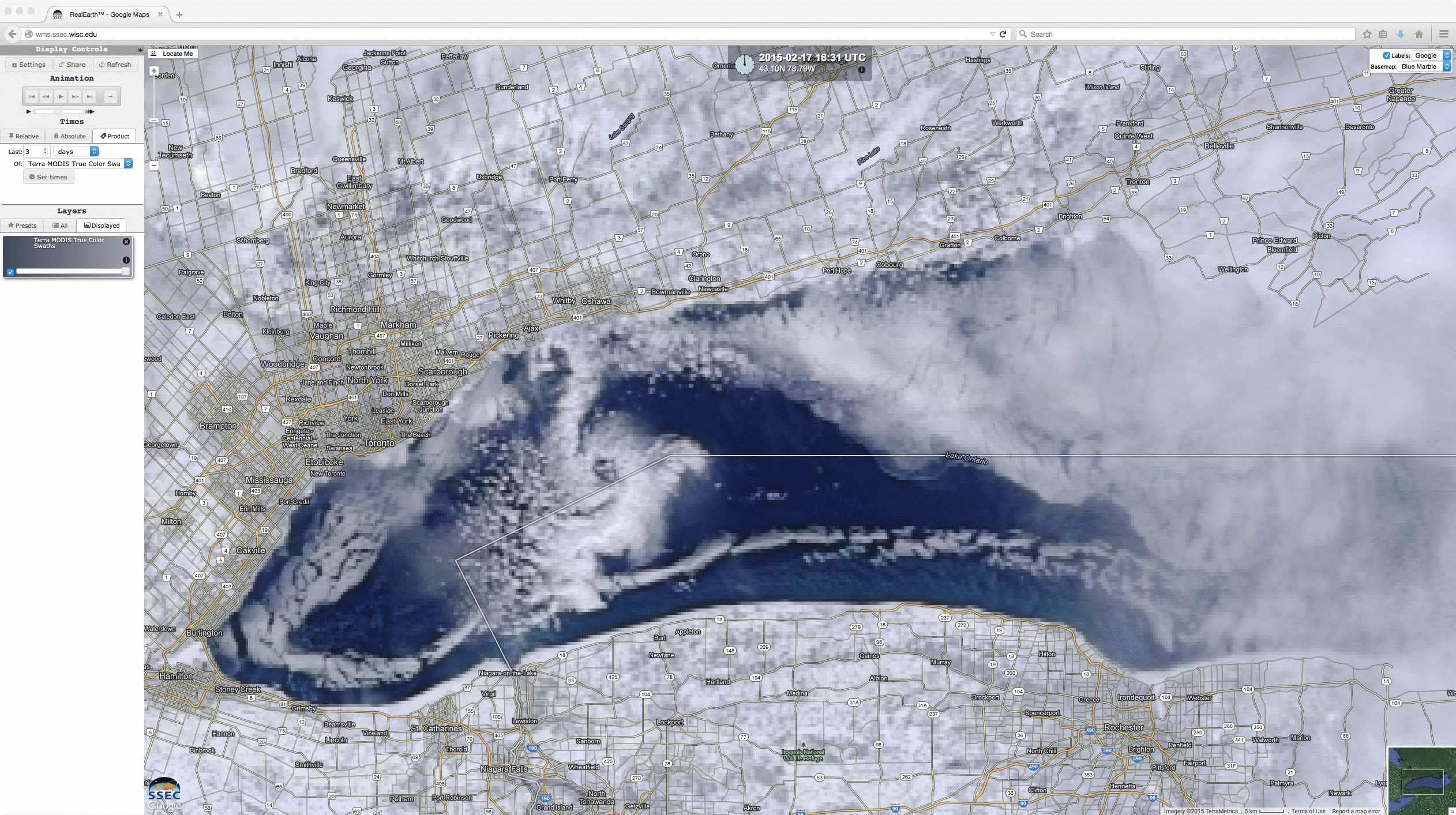
MODIS and VIIRS true-color images
A comparison of the 16:31 UTC Terra MODIS 0.65 µm visible channel and the corresponding Sea Surface Temperature product (below) showed that SST values in the ice-free portions of the mesovortex path were generally in the 30 to 34º F range.
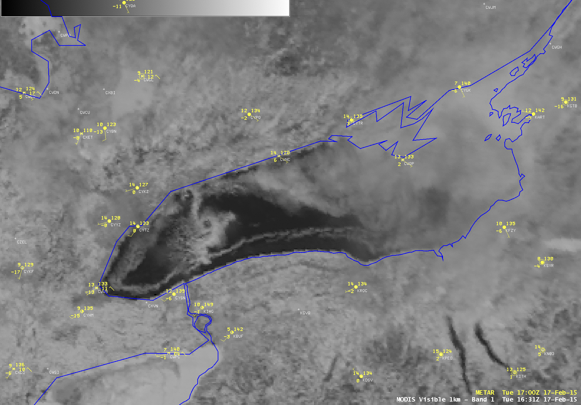
Terra MODIS 0.65 µm visible channel image and Sea Surface Temperature product