Rapid cyclogenesis off the coast of Japan, with an aircraft experiencing severe turbulence
COMS-1 6.95 µm water vapor channel images (click to play animation)
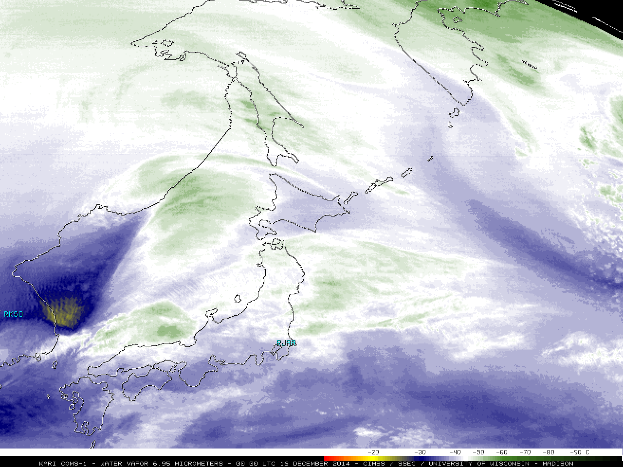
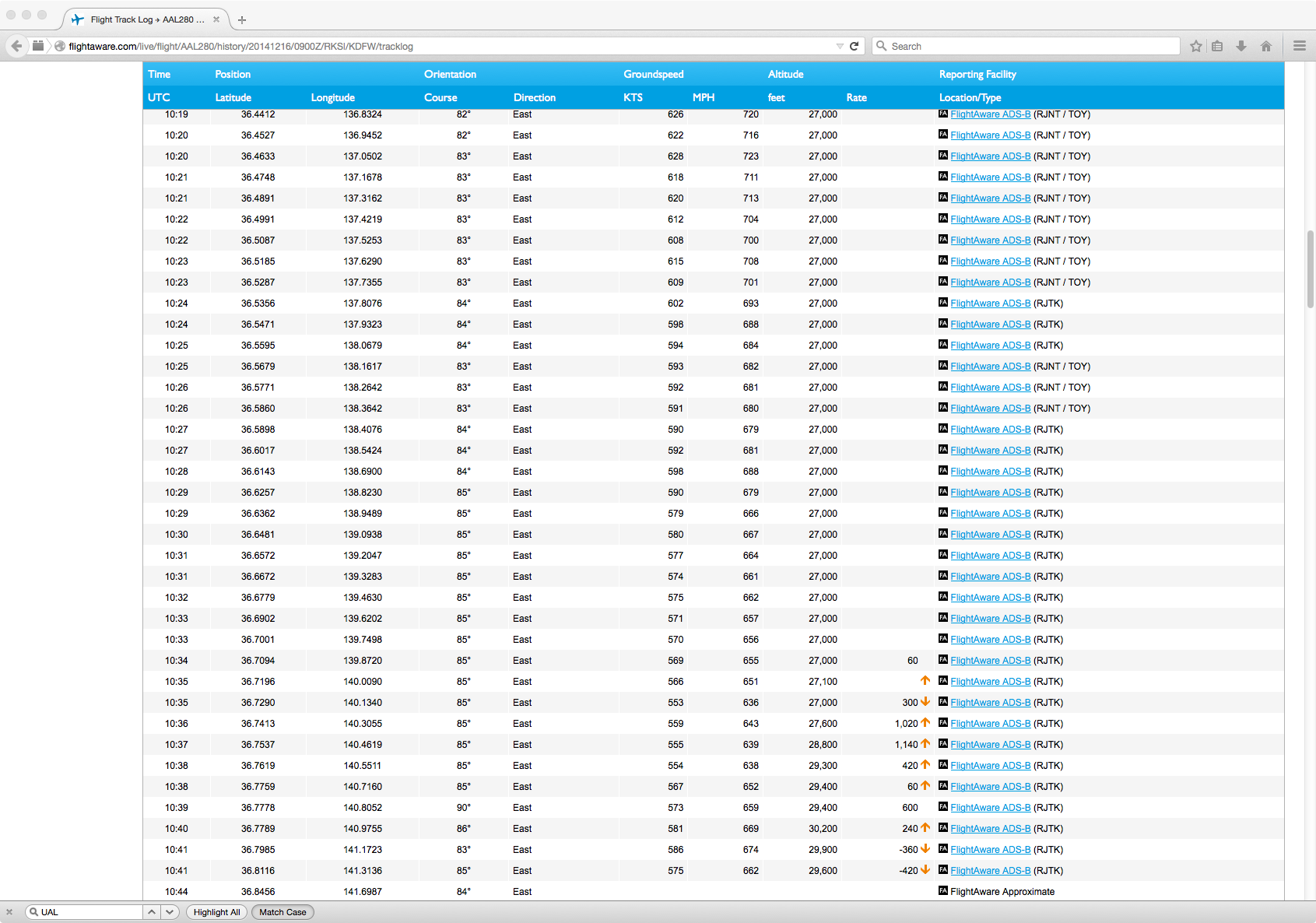
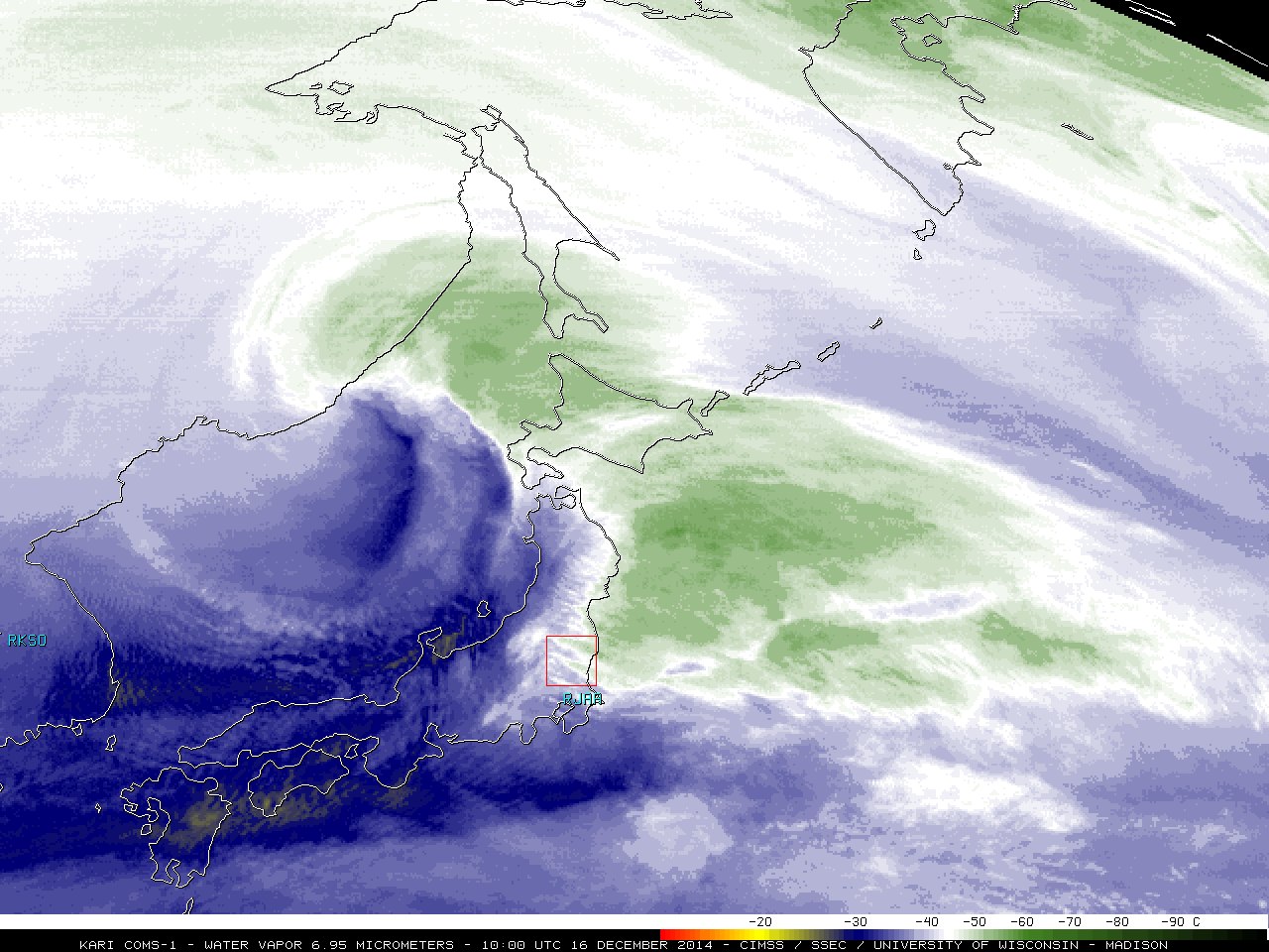
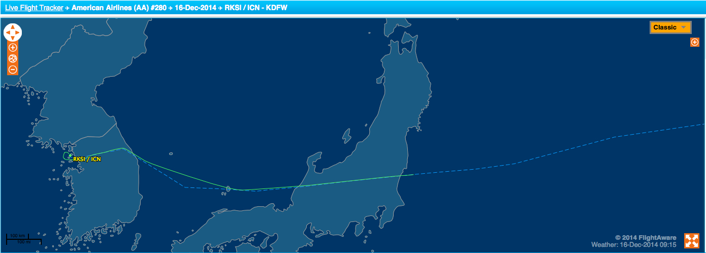
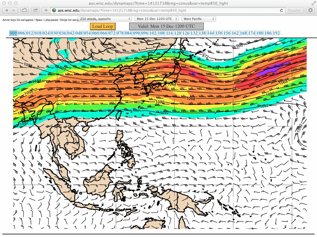
McIDAS images of KARI COMS-1 6.95 µm water vapor channel data (above; click image to play animation; also available as an MP4 movie file) showed the tell-tale signatures — well-formed dry slot; distinct comma head — of rapid cyclogenesis for a pair of storms off the west and east coasts of Japan on 16 December 2014. An American Airlines passenger jet flying from Seoul, South Korea (RKSO) to Dallas/Fort Worth, Texas experienced severe turbulence at an altitude around 27,000 feet over the eastern portion of Honshu Island, Japan (media report); several passengers and crew members were injured (with some requiring hospitalization), forcing the aircraft to divert from its course and turn back to make a landing at Tokyo Narita airport (RJAA). The turbulence encounter likely occurred near the center portion of the red square which was drawn on the images whose times were within about 30 minutes of the 10:35 UTC turbulence encounter (FlightAware track log) — note the development of a “transverse banding” signature along the western edge of the southern storm comma head feature (10:00 UTC image). After the multi-layered clouds of the comma head departed, lee waves or “mountain waves” could be seen downwind of the high terrain of Honshu Island. It should also be noted that the flight path was in the left exit region of an intensifying upper-tropospheric jet streak (250 hPa winds).
In the Turbulence Risk product shown below, the blue to violet colored areas are the Tropopause Fold Turbulence Product (an algorithm developed at CIMSS which uses geostationary water vapor channel data). These colored areas identify the sections of the upper-tropospheric air mass boundaries that are the most likely to have turbulence. However, it does not attempt to show all areas of turbulence. The transverse band formation over Japan was a signature of intense instability along the jet stream axis, which was probably the cause of the major turbulence event for American Airlines Flight 280.
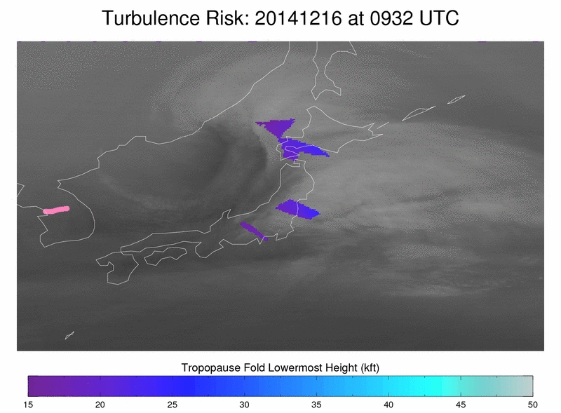
Turbulence Risk product
A dry slot exhibiting much warmer brightness temperatures (brighter yellow to orange color enhancement) was seen with the more southern of the two storms, which became the dominant system as it moved northeastward and rapidly intensified from a central pressure of 998 hPa at 06 UTC to 971 hPa at 18 UTC (below). The storm was forecast to produce a large area of hurricane-force winds over the far northwestern Pacific Ocean.
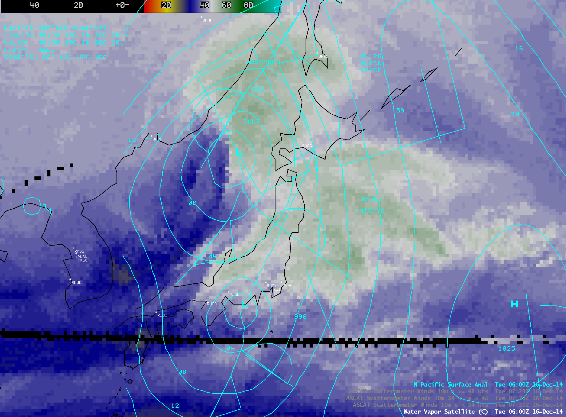
MTSAT-2 6.75 µm water vapor channel images with surface analyses at 06, 12, and 18 UTC
An AWIPS image of MTSAT-2 water vapor channel data with overlays of the NWS Ocean Prediction Center surface analysis and Metop ASCAT scatterometer winds showed surface wind speeds as high as 55 knots (63 mph) with the southern storm and 53 knots (61 mph) with the northern storm at 11:48 UTC (below). During the day wind gusts as high as 81 knots (93 mph) were reported at the Izu Islands south of Tokyo Bay.
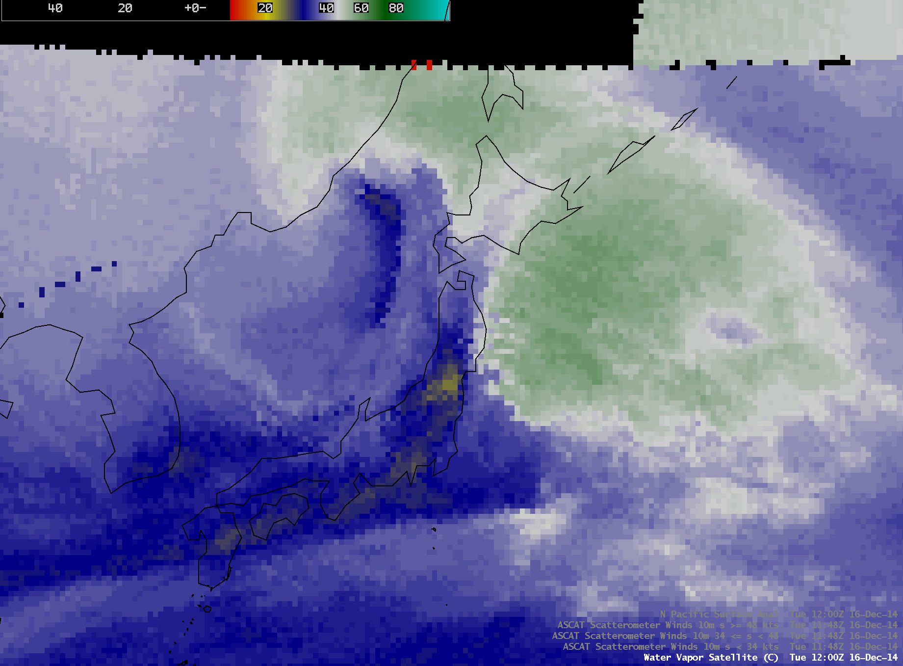
MTSAT-2 6.75 µm water vapor channel image, with Metop ASCAT scatterometer surface winds and surface analysis