Large “hole punch cloud” over Wisconsin
![GOES-13 0.63 µm visible (upper left), 3.9 µm shortwave IR (upper right), 10.7 µm IR (lower left), and 6.5 µm water vapor (lower right) images [click to play animation]](https://cimss.ssec.wisc.edu/satellite-blog/wp-content/uploads/sites/5/2014/07/140718_goes13_vis_swir_ir_wv_WI_hole_punch_cloud_anim.gif)
GOES-13 0.63 µm visible (upper left), 3.9 µm shortwave IR (upper right), 10.7 µm IR (lower left), and 6.5 µm water vapor (lower right) images [click to play animation]
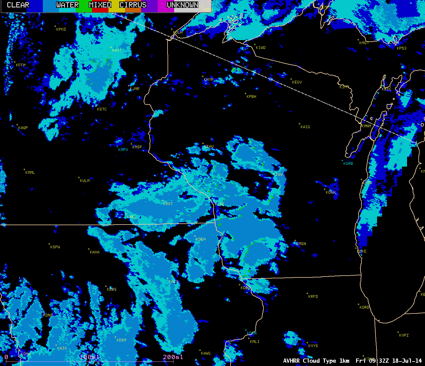
POES AVHRR Cloud Type, Cloud Top Height, and Cloud Top Temperature products at 09:32 UTC
A comparison of CLAVR-x POES AVHRR Cloud Type, Cloud Top Height (CTH), and Cloud Top Temperature (CTT) products at 09:32 UTC or 4:32 am Central time (above) showed patches of water droplet clouds with CTH values in the 3-4 km range and CTT values in the 0º C to -4º C range.
A similar comparison at 12:05 UTC or 7:05 am Central time (below) revealed two areas of “cirrus” cloud type (orange color enhancement) exhibiting CTT values in the -35º to -40º C range (darker blue color enhancement) along the northern and southern periphery of the forming hole punch cloud.
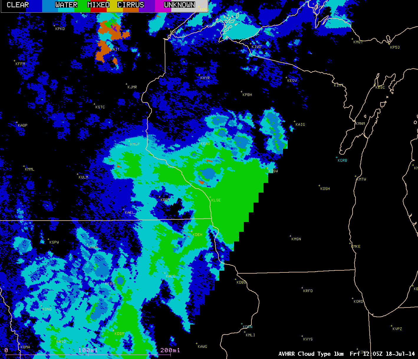
POES AVHRR Cloud Type, Cloud Top Height, and Cloud Top Temperature prodcts at 12:05 UTC
These ranges of AVHRR Cloud Top Temperature and Cloud Top Height values agreed well with the regional rawinsonde data from Davenport IA (KDVN), Minneapolis MN (KMPX) and Green Bay WI (KGRB) shown below.
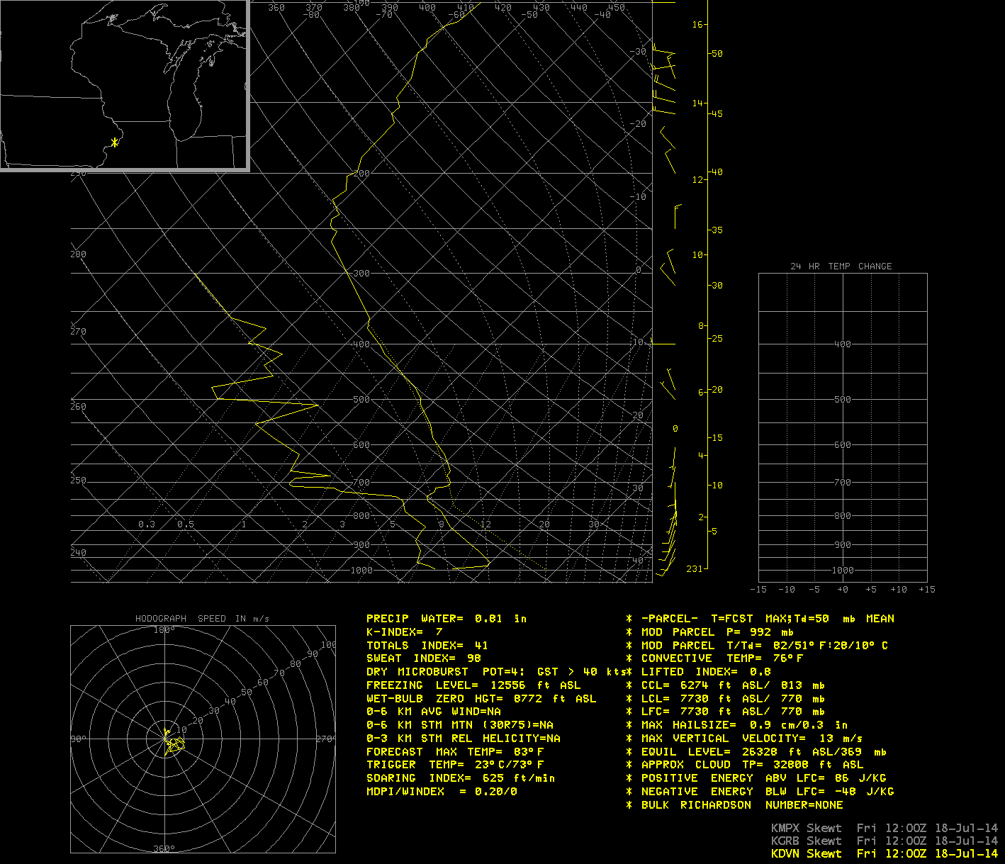
Davenport IA, Minneapolis MN, and Green Bay WI rawinsonde data at 12 UTC
Terra MODIS visible and Cloud Phase products at 17:07 UTC or 12:07 pm Central time (below) indicated that a large area of glaciated ice cloud (salmon color enhancement) existed in the center portion of the hole punch cloud feature.
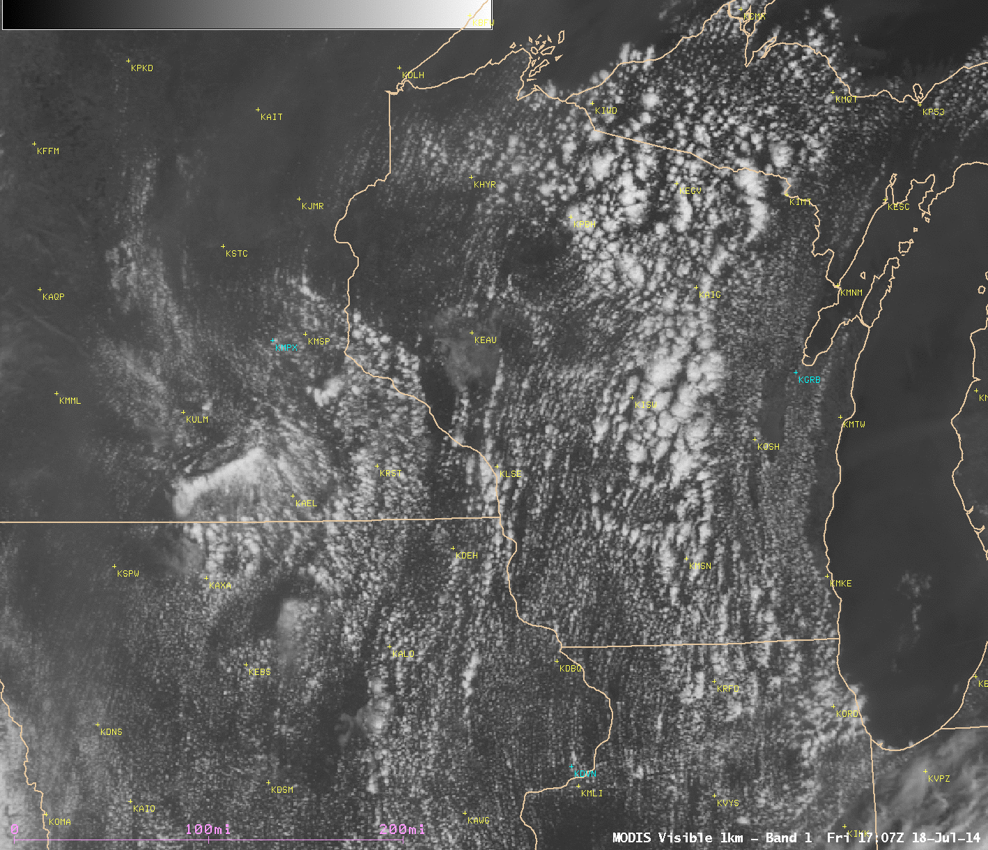
Terra MODIS 0.65 µm visible image and Cloud Phase products
The cause of this large hole punch or fall streak cloud feature — and the other similar but smaller features seen across the region — was likely aircraft that had either ascended or descended through the cloud layer; particles in the aircraft exhaust acted as ice condensation nuclei, causing the process of cloud glaciation to begin.
![GOES-15 0.62 µm visible images [click to play animation]](https://cimss.ssec.wisc.edu/satellite-blog/wp-content/uploads/sites/5/2014/07/HOLEPUNCH_G15_loop_18JULY2014.gif)
GOES-15 0.62 µm visible images [click to play animation]
![GOES-15 0.62 µm visible images [click to play animation]](https://cimss.ssec.wisc.edu/satellite-blog/wp-content/uploads/sites/5/2014/07/HOLEPUNCH_G13_loop_18JULY2014.gif)
GOES-15 0.62 µm visible images [click to play animation]