Mesoscale Convective Systems over the Upper Midwest, and a Mesoscale Convective Vortex over Wisconsin

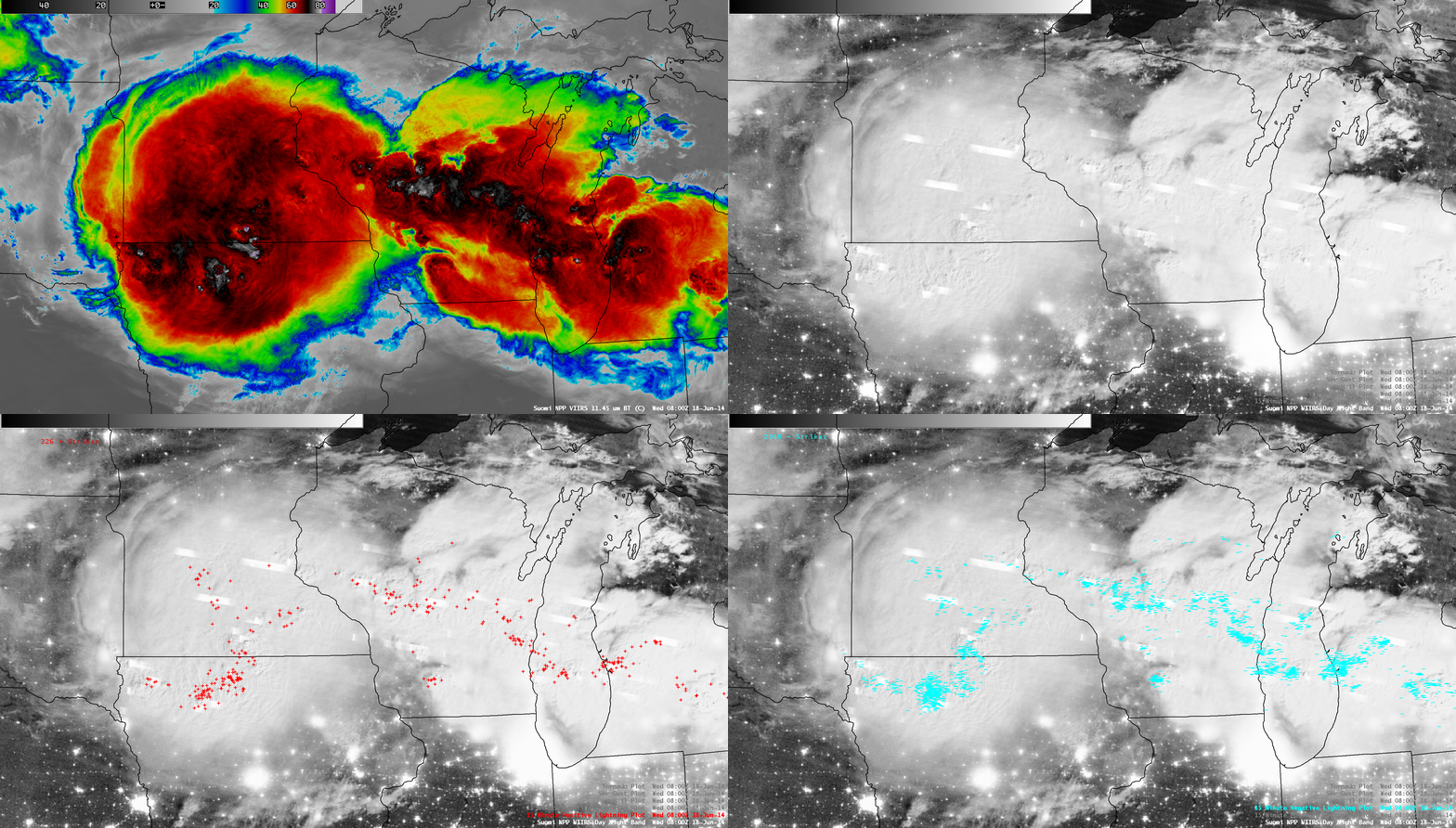
Suomi NPP VIIRS 11.45 µm IR channel and 0.7 µm Day/Night Band images, with cloud-to-ground lightning strikes
A comparison of AWIPS images of Suomi NPP VIIRS 11.45 µm IR channel and 0.7 µm Day/Night Band data (above) showed very large areas of cold cloud-top IR brightness temperatures associated with Mesoscale Convective Systems (MCSs) over the Upper Midwest region of the US at 08:00 UTC (3:00 AM Central time) on 18 June 2014. The coldest IR brightness temperature was -88º C over far southern Minnesota. Numerous bright white “streaks” were seen on the Day/Night Band (DNB) image, which indicated portions of the cloud that were illuminated by intense lightning activity. Cloud-to-ground lightning strikes are also plotted on the DNB image, showing how electrically-active these storms were at the time. The western MCS initially formed over eastern South Dakota during the previous evening, producing a few tornadoes there (SPC storm reports). The eastern MCS began to form later along the Wisconsin/Illinois border region — one aircraft flying near the northern edge of a rapidly-developing thunderstorm encountered severe turbulence.
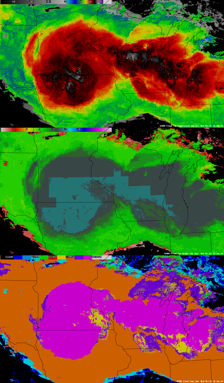
Shortly after the time of the Suomi NPP satellite overpass, a 08:21 UTC overpass of the NOAA-19 POES satellite provided AVHRR-derived CLAVR-x Cloud Top Temperature (CTT), Cloud Top Height (CTH), and Cloud Type products (below). The minimum CTT value was -84º C, and the maximum CTH value was 14 km; much of the MCS cloud shield was classified as the Overshooting Top type (magenta color).
After sunrise, McIDAS images of GOES-13 0.63 µm visible channel data (below; click image to play animation; also available as an MP4 movie file) showed that the eroding MCS cirrus shield aloft exposed a middle-tropospheric Mesoscale Convective Vortex (MCV) which continued moving eastward across Wisconsin during the day.
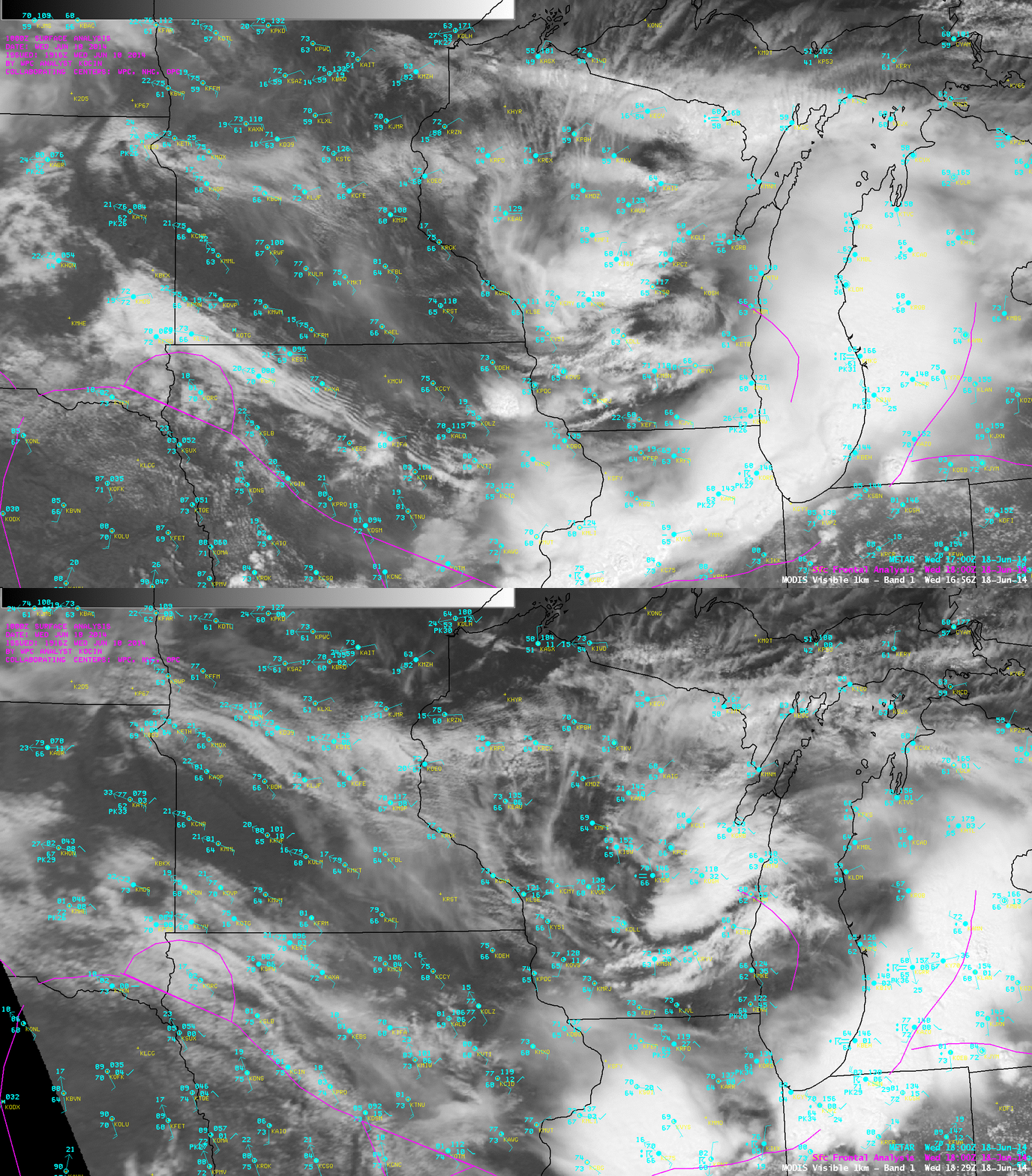
Consecutive overpasses of the Terra and Aqua satellites provided MODIS 0.65 µm visible channel images of the region (below). The convective outflow boundary from the earlier MCS activity had acted to push the warm frontal boundary (which had been acting as a focus for convective development) south of the Wisconsin/Illinois border, leaving a relatively stable boundary layer with a weak capping inversion aloft over Wisconsin — as a result, the MCV circulation did not play a role in initiating any new convective development.


