Snow in the Desert Southwest
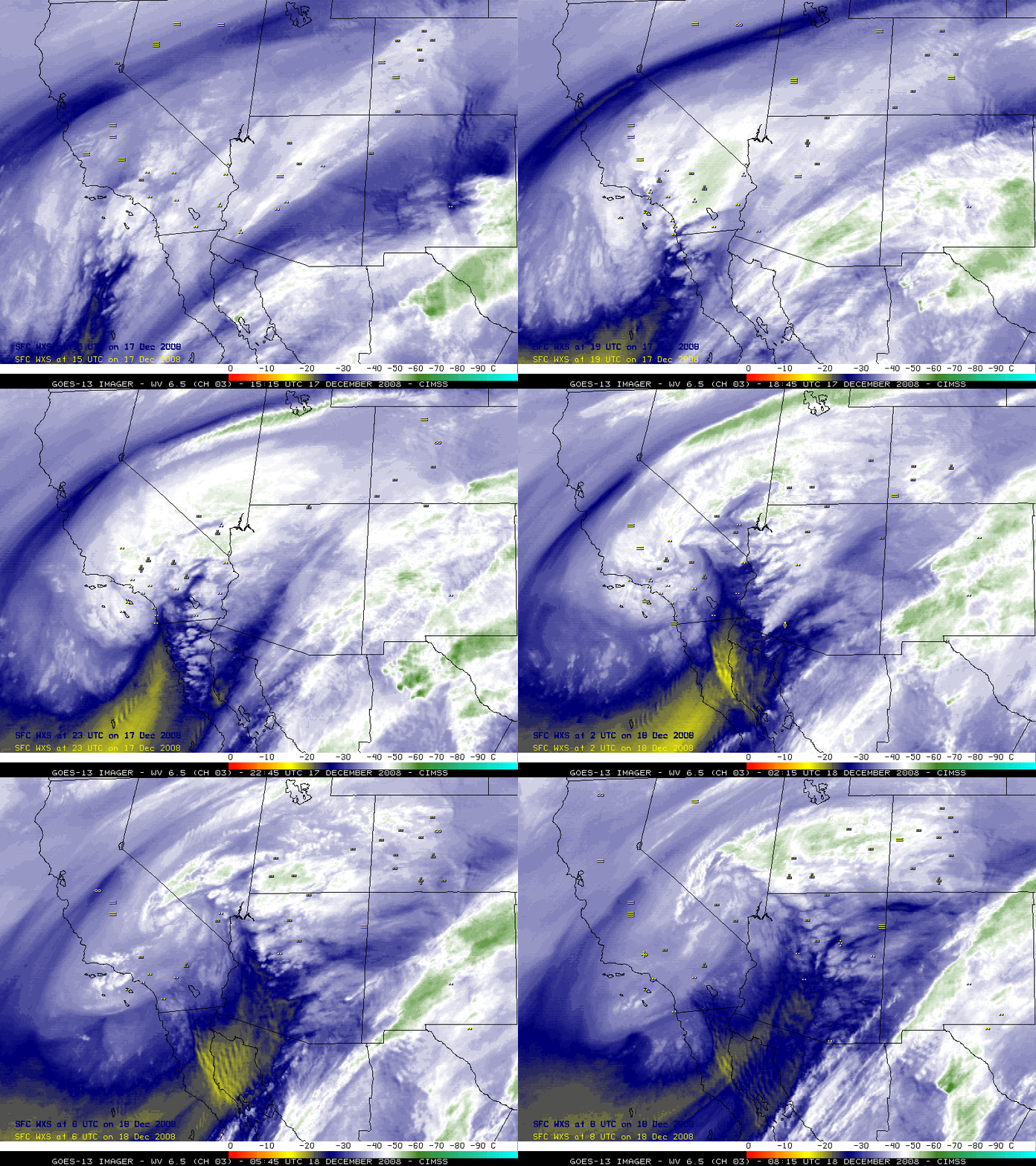
A significant snowfall event occurred over the Desert Southwest region of the US on 17 December 2008 — as much as 30.0 inches of snow was reported at Wrightwood in the mountains of southern California (just northeast of Los Angeles), and Las Vegas, Nevada received 3.6 inches (setting a new record for the most snowfall during any December). Malibu Hills, California even received 0.5 inch of snow (at the 2000-foot level). GOES-13 6.5 µm water vapor imagery (above) showed the large and intense storm as is moved inland — note the appearance of convective elements that developed over parts of California, Arizona, and Nevada (along the leading edge of the dry slot). In addition, wave patterns downwind of Guadalupe Island and northern Baja California indicated the presence of very strong winds. These wave patterns were clearer on the 4-km resolution GOES-13 water vapor channel, compared to the 8-km resolution water vapor channel on GOES-11. Note that GOES-13 had recently replaced GOES-12 as the operational GOES East satellite.
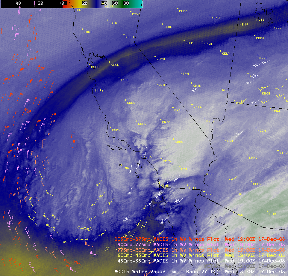
An AWIPS image of the MODIS 6.7 µm water vapor channel with an overlay of MADIS water vapor winds (below) revealed that wind speeds aloft were as strong as 78 knots at the 387 hPa level, just ahead of the advancing dry slot. The GOES-11 Sounder Total Column Ozone product also showed a well-defined lobe of elevated ozone levels (in the 350-400 Dobson Unit range) associated with the developing storm.
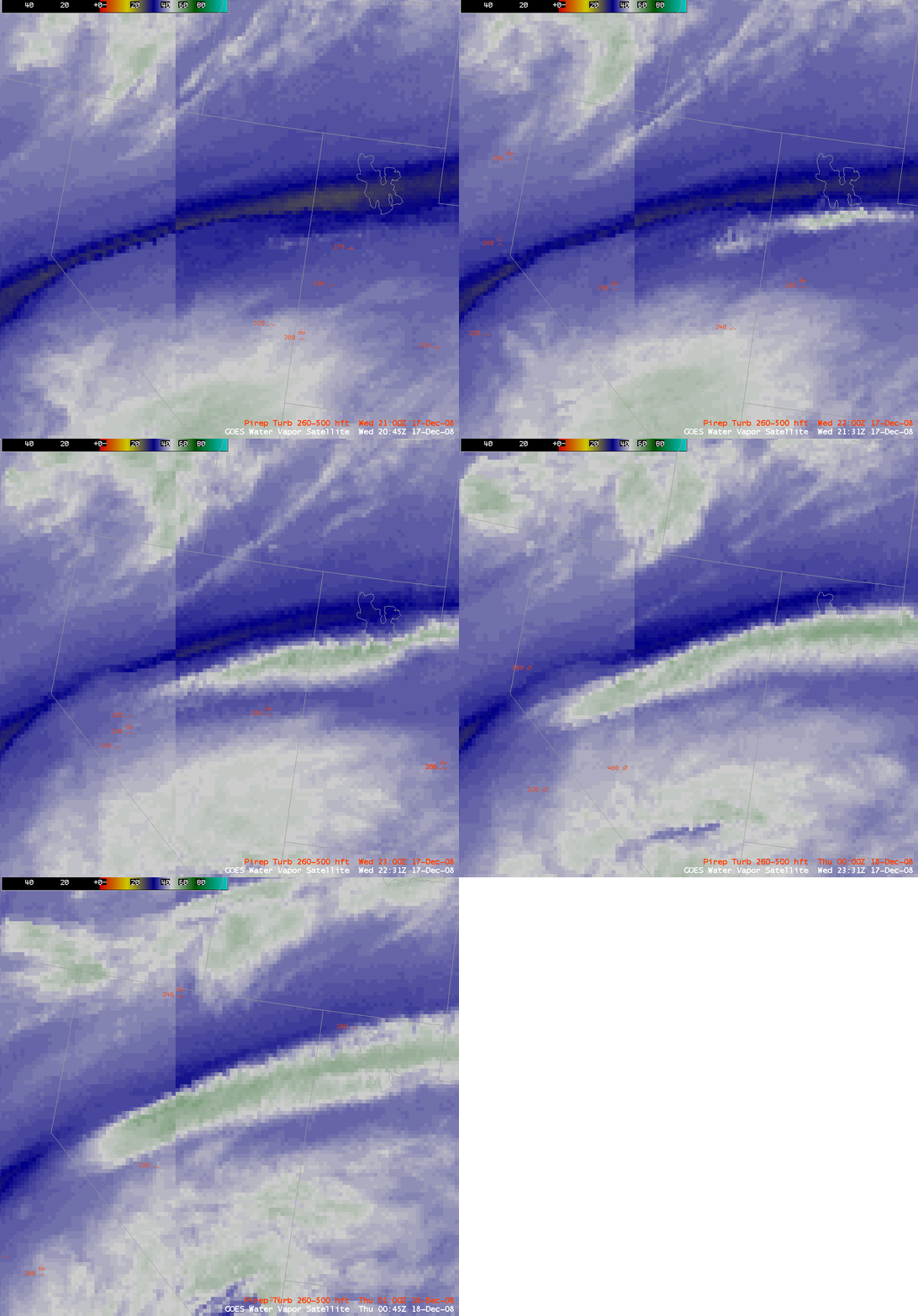
Another interesting feature seen on the water vapor imagery was an elongated band of cloudiness that developed along a very pronounced deformation zone that formed over Nevada and Utah — there were a few pilot reports of moderate turbulence in the vicinity of this deformation zone (below), with one report of moderate to severe turbulence over central Nevada at 00:44 UTC (at the 33,000-foot flight level).
AWIPS images of the 1-km resolution MODIS water vapor, IR, and visible channels (below) showed a clearer view of the convective elements that were developing along the leading edge of the dry slot. These convective elements likely enhanced local precipitation rates as they moved across the region.
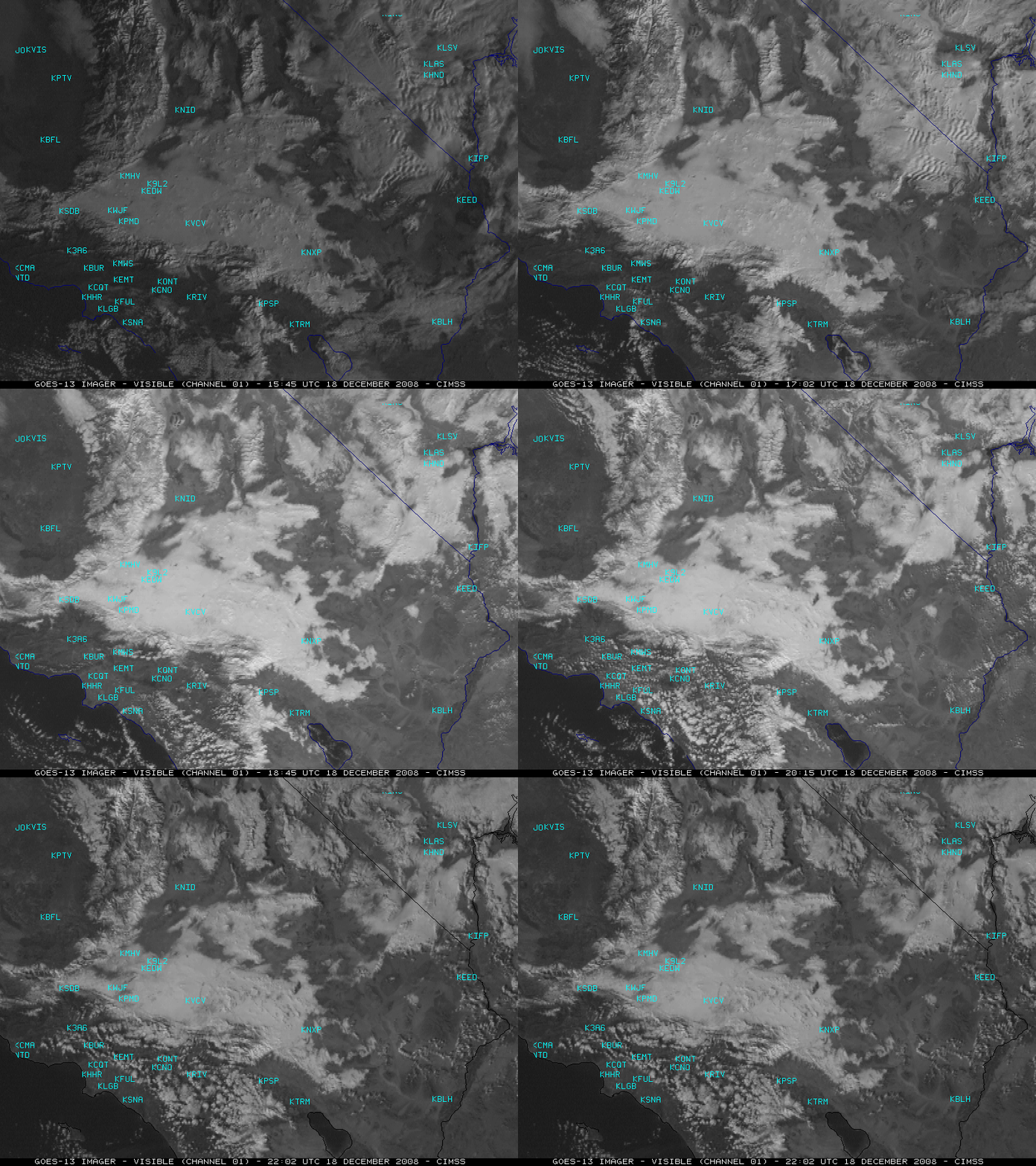
GOES-13 visible images on the following day (18 December, below) showed that extensive snow cover remained across much of the Desert Southwest, while some parts of the snow cover were seen to melt during the daytime hours. In extreme southern Nevada, note that there appeared to be very little snow on the ground in the northern portion of the Las Vegas Valley — Nellis Air Force Base in North Las Vegas (station identifier KLSV) and McCarran International Airport (station identifier KLAS) looked to be relatively snow-free, while Henderson (KHND) located just to the southeast still had enough snow on the ground to appear brighter white on the visible imagery. Up to 8 inches of snow accumulation was reported in the Henderson area — the Henderson Airport reported moderate snow for a time, with surface visibility reduce to 1/4 mile.
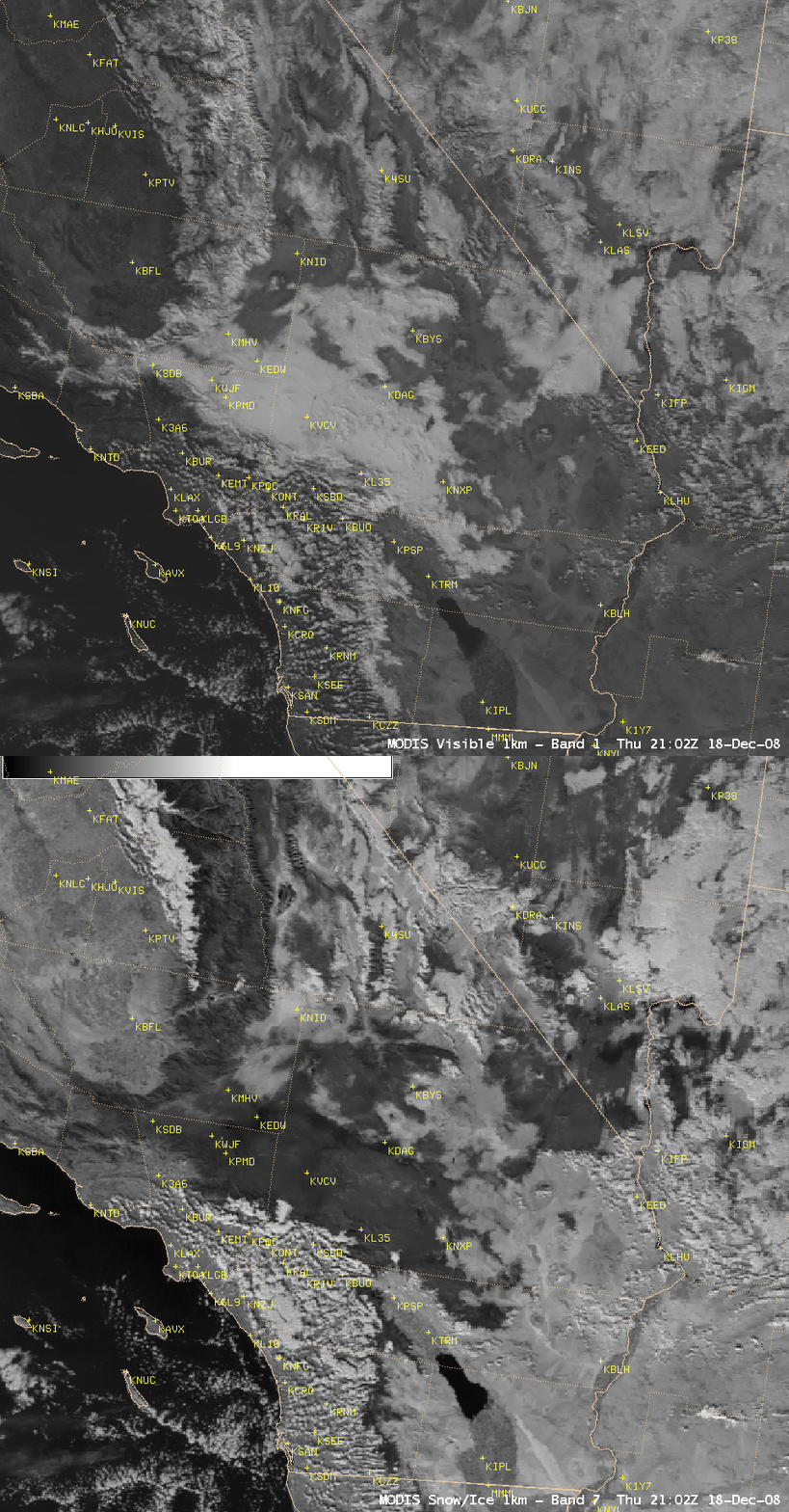
A comparison of AWIPS images of the MODIS visible and the near-IR “snow/ice” channel (below) confirms the presence of and the areal coverage of snow cover — snow and ice (along with water in oceans and lakes) are strong absorbers at the 2.1 µm wavelength, so they appear as darker features on the “snow/ice” image (in contrast to supercooled water droplet clouds, which appear as brighter white features). Note the even darker appearance on the MODIS snow/ice image in the Henderson area (just southeast of KLAS), where higher amounts of snow fell. A darker signal is also apparent on the snow/ice image in the Barstow-Dagget (KDAG) and Edwards Air Force Base (KEDW) areas — the center of the storm circulation moved directly over that particular region, which may have helped to enhance local precipitation rates.
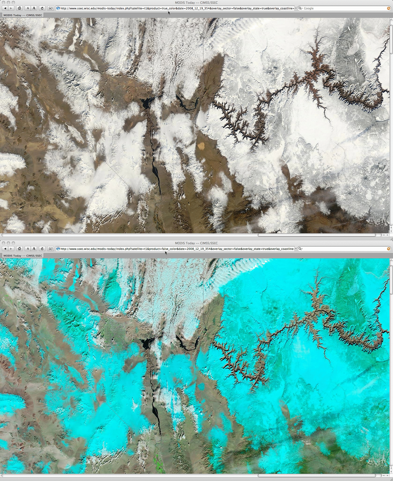
19 December Update: 250-meter resolution MODIS true color and false color imagery from the SSEC MODIS Today site (below) showed a stunning view of the area from Las Vegas, Nevada…to Lake Mead/Lake Mojave along the Nevada/Arizona border…to the Grand Canyon in Arizona, where significant snow cover still remained in many areas.


