Lake Michigan: ice motion, cloud streets, and a mesovortex
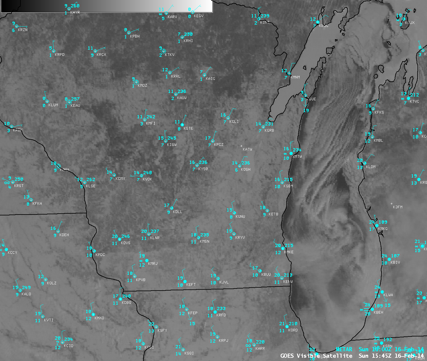
AWIPS images of GOES-13 0.63 µm visible channel data (above; click image to play animation) displayed a number of interesting Lake Michigan features on 16 February 2014: (1) the motion of lake ice in the northern and far eastern portions of the lake, (2) the formation of parallel cloud streets over the ice-free waters of the central part of lake, and (3) the development of a mesoscale vortex (or “mesovortex”) over the southern end of the lake.
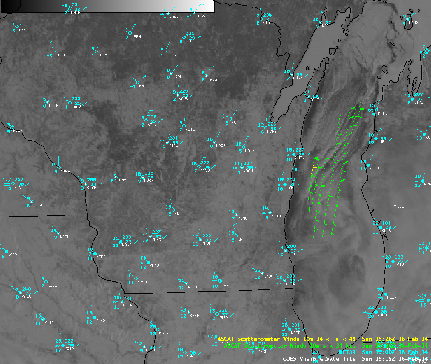
Northerly winds were blowing down the long axis of Lake Michigan in the wake of a departing area of low pressure; Metop ASCAT surface scatterometer wind speeds were as high as 35 knots at 15:26 UTC (below).
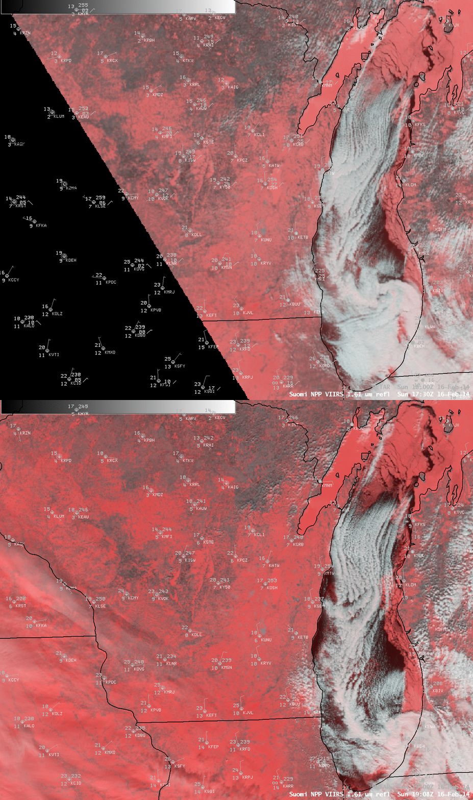
False-color Red/Green/Blue (RGB) images created from Suomi NPP VIIRS 0.64 µm visible and 1.61 µm “snow/ice channel” data (below) helped to disctiminate between snow cover and ice fearures (which appeared as varying shades of red) and supercooled water droplet cloud features (which appeared as brighter shades of white). Even in the relatively short 1.5 hour period separating the two VIIRS RGB images, a significant amount of ice motion could be seen.
As an aside, another feature of interest seen in the GOES-13 visible images included arc-shaped aircraft dissipation trails (or “distrails”), created by air traffic that was likely circling upon approach or departure from the Chicago O’Hare or Midway airports (below; click image to play animation). Partcles in the aircraft exhaust acted as ice condensation nuclei, glaciating a trail as they penetrated the supercooled water droplet cloud deck.


