Tropical Storm Karen’s transition to an extratropical coastal low
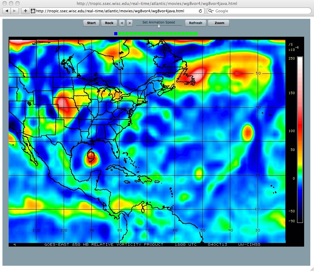
A sequence of images of the satellite-wind-derived 850 hPa relative vorticity product at 6-hour intervals covering the period 04 October to 09 October 2013 (above; click image to play animation) showed that the vorticity associated with Tropical Storm Karen over the Gulf of Mexico on 04 October could be followed northeastward as the storm made the transition to an extratropical low as it movved inland and interacted with a frontal boundary, then eventually organizing into a slow-moving coastal low along the US East Coast.
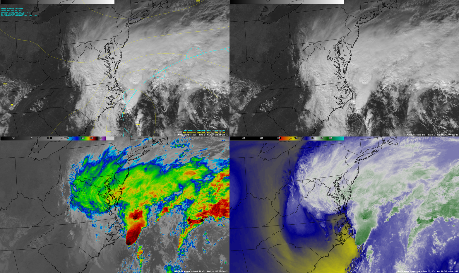
A comparison of 1-km resolution MODIS 0.65 µm visible channel, 11.0 µm IR channel, and 6.7 µm water vapor channel images (below) showed the organization of the coastal low at 18:10 UTC on 09 October, which featured deep offshore convection with IR cloud-top temperatures as cold as -75º C.

MODIS 0.65 µm visible channel, 11.0 µm IR channel, and 6.7 µm water vapor channel images (09 October)
===== 10 October Update =====
A comparison of 1-km resolution Suomi NPP VIIRS 0.64 µm visible channel and 11.45 µm IR channel images at 17:59 UTC on 10 October (below) revealed that some strong convective elements had moved inland over southeastern Virginia and northeastern North Carolina, producing heavy rainfall.


