Tropical Storm Karen
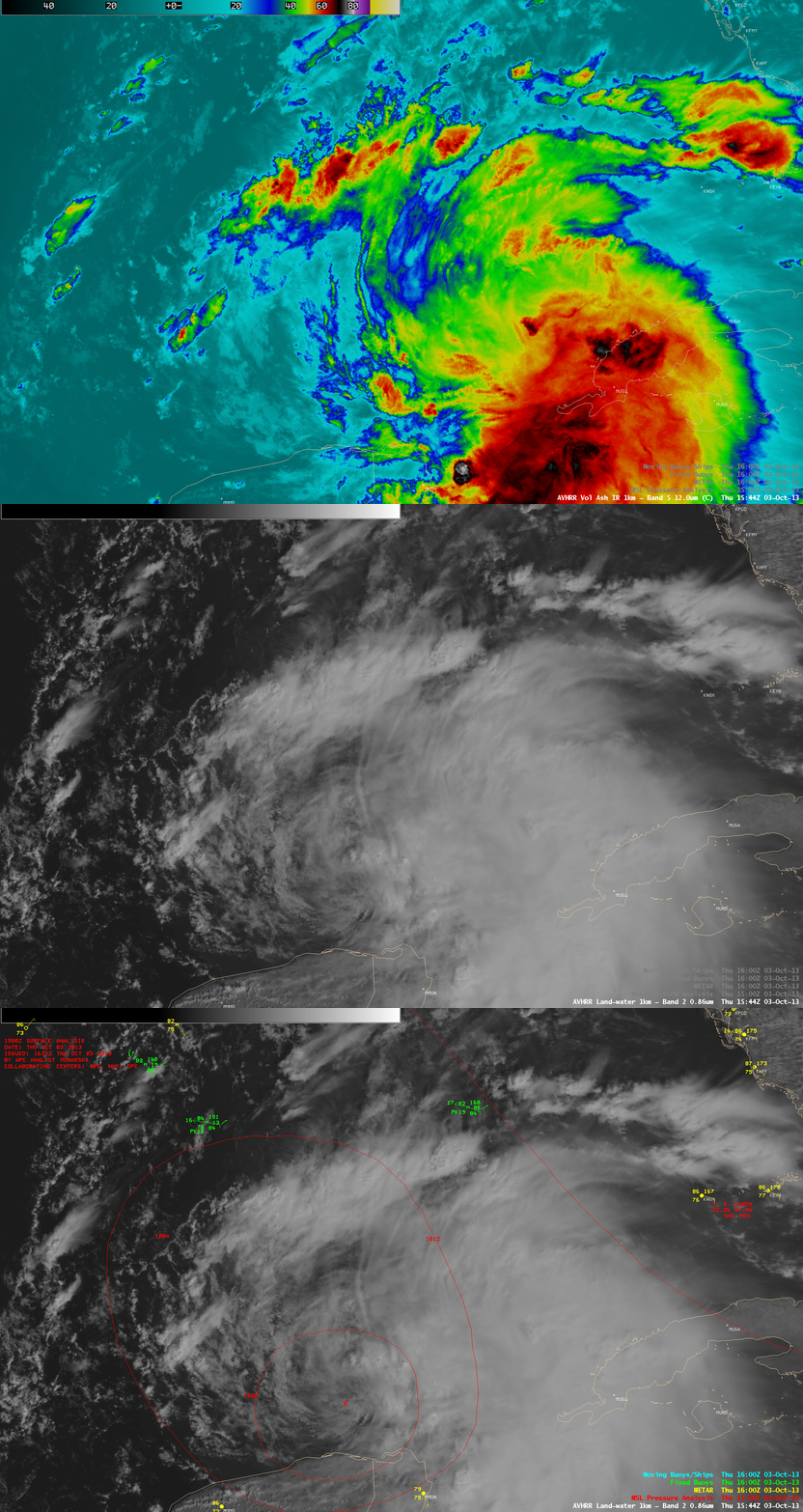
Tropical Storm Karen formed in the far southern Gulf of Mexico early in the day on 03 October 2013. About 2 hours after formation, AWIPS images of 1-km resolution POES AVHRR 12.0 µm IR channel and 0.86 µm visible channel data at 15:44 UTC (above) showed that areas of organized deep convection were displaced well to the east and north of the center of Karen.
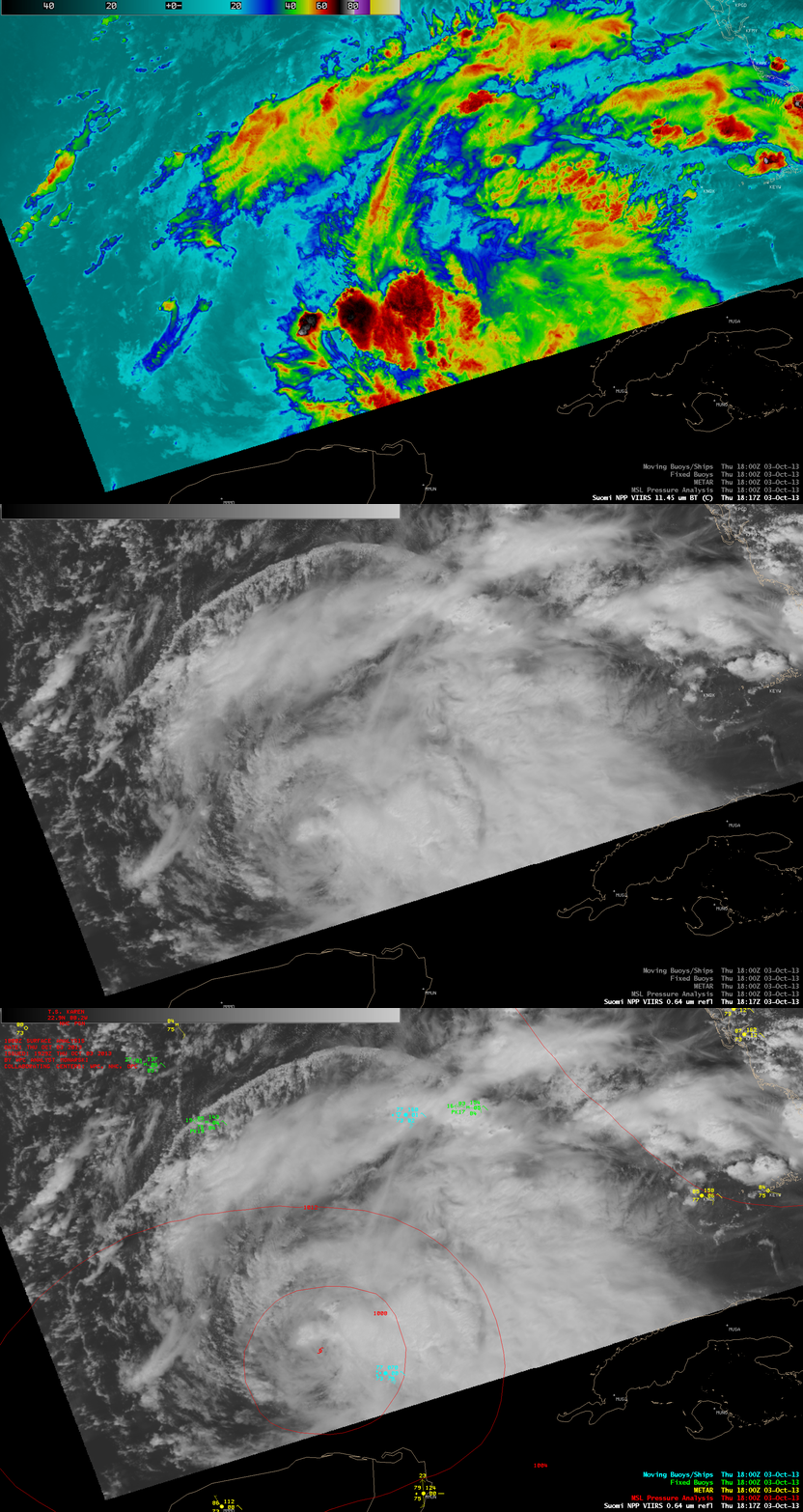
A few hours later at 18:17 UTC, 375-meter resolution (projected onto a 1-km AWIPS grid) Suomi NPP VIIRS 11.45 µm IR data (below) revealed that a small convective burst had formed just to the northwest of the low-level circulation center (LLCC).
McIDAS images of 1-km resolution 0.63 µm GOES-13 visible channel data (below; click image to play animation) showed the exposed LLCC as it migrated slowly northwestward. Additional convective bursts near the LLCC werer seen to develop at the end of the animation. Another feature of interest was the well-defined low-level arcing convective outflow boundary moving northward away from the convective activity that was dissipating along the northern fringe of the Karen. Note that the GOES-13 satellite had been placed into Rapid Scan Operations (RSO) mode, providing images as frequently as every 5-10 minutes.
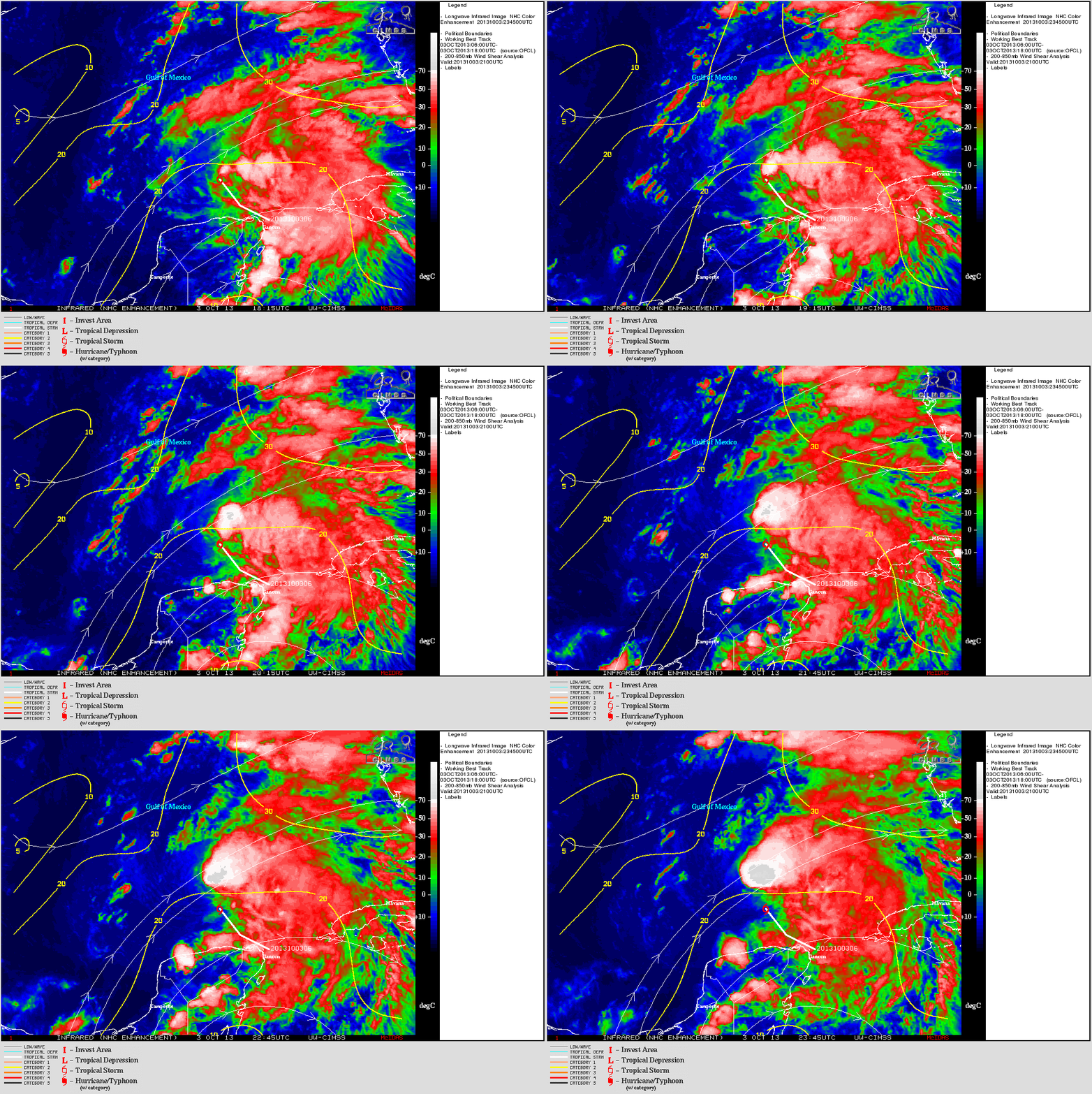
From the CIMSS Tropical Cyclones site, an animation of 4-km resolution GOES-13 10.7 µm IR channel imagery with an ovelay of the deep-layer wind shear (below) depicted about 20 knots of wind shear, which was acting to keep the most of the main convection away from the exposed LLCC.


