Bore Feature over Wisconsin
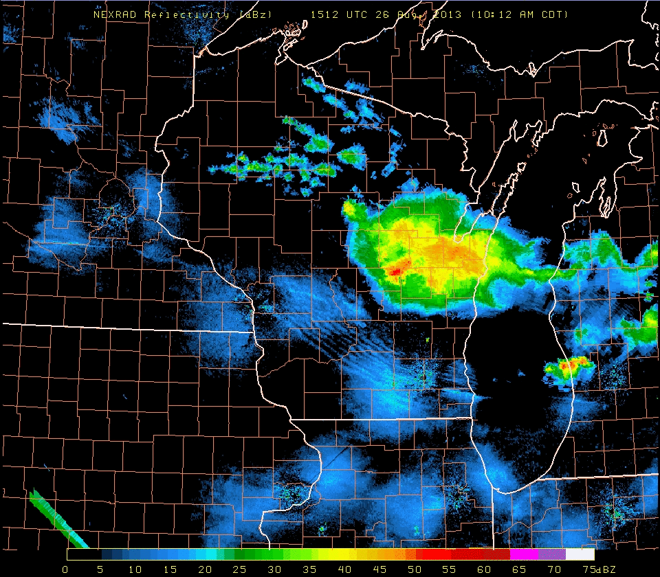
Satellite and especially radar revealed the tell-tale signs of an undular bore over southern Wisconsin on the morning of 26 August. The parallel lines of enhanced radar return, above, suggest that the outflow from the convective complex over northern Wisconsin organized into a bore, in part because the atmosphere over Wisconsin (as sampled, for example, by the 1200 UTC Green Bay Sounding) included a stable layer. The wind at Madison’s Truax Airport shifted to northeast at 1453 UTC as the bore moved overhead. This is typical. Winds are parallel to the bore motion and perpendicular to the linear bore feature. What did the visible imagery show?
GOES-14 was in SRSO-R mode over the midwest on 26 August, providing one-minute imagery. As shown below, an abundance of cirrus obscured information from the lower cloud deck throughout the early part of the morning. However, parallel lines of low clouds do occur, marking the edge of the bore, later in the loop (after 1600 UTC northwest of Madison). The GOES-14 animation also shows the transformation of the atmosphere from convectively unstable at the beginning, with transverse bands in the cirrus outflow suggestive of turbulence, to an atmosphere with mid-level cumuliform clouds (over northwest Wisconsin) in the wake of a departing Mesoscale system. Finally, the Mesoscale system exits the state as cirrus continues to erode. Low- and mid-level clouds have dissipated. As the lower atmosphere destabilizes due to diurnal heating, the bore must dissipate, as it requires a stable layer to propagate.
(Click here for a QuickTime movie of the animation above. It has a much smaller file size).
GOES-13 imagery of the same event shows the general evolution of the atmosphere, but the temporal resolution is very coarse, with half-hourly imagery between 1445 UTC and 1545 UTC due to a Full-disk scan and subsequent housekeeping. This is a period during which GOES-14 shows considerable weakening of the convective complex. The coarse time steps also make it difficult to infer the presence of a bore.
Landsat-8 imagery (below) shows that the parallel lines of clouds persisted past 1642 UTC. Note that the Landsat-8 imagery is also available through the SSEC Web Map Server: Link.
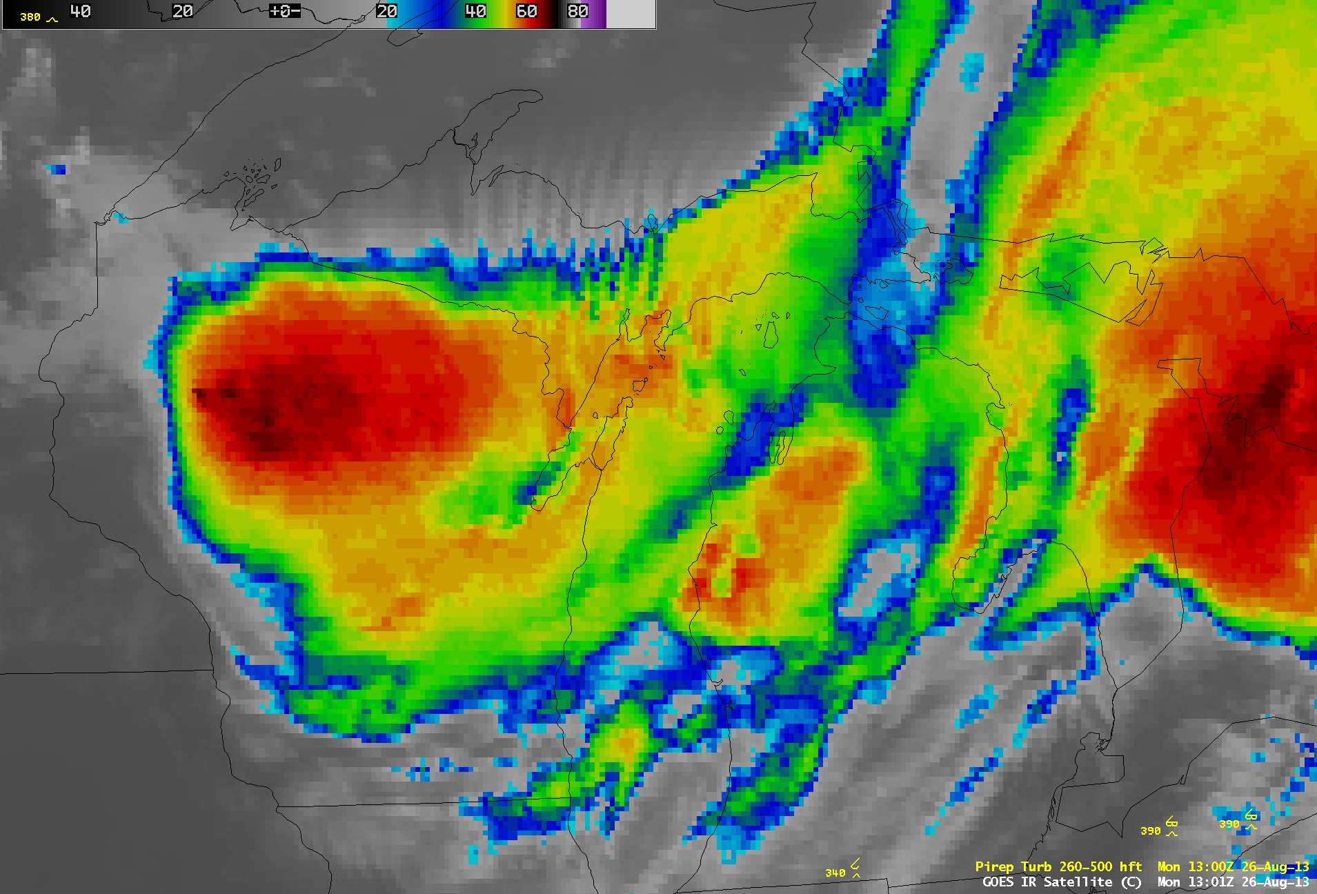
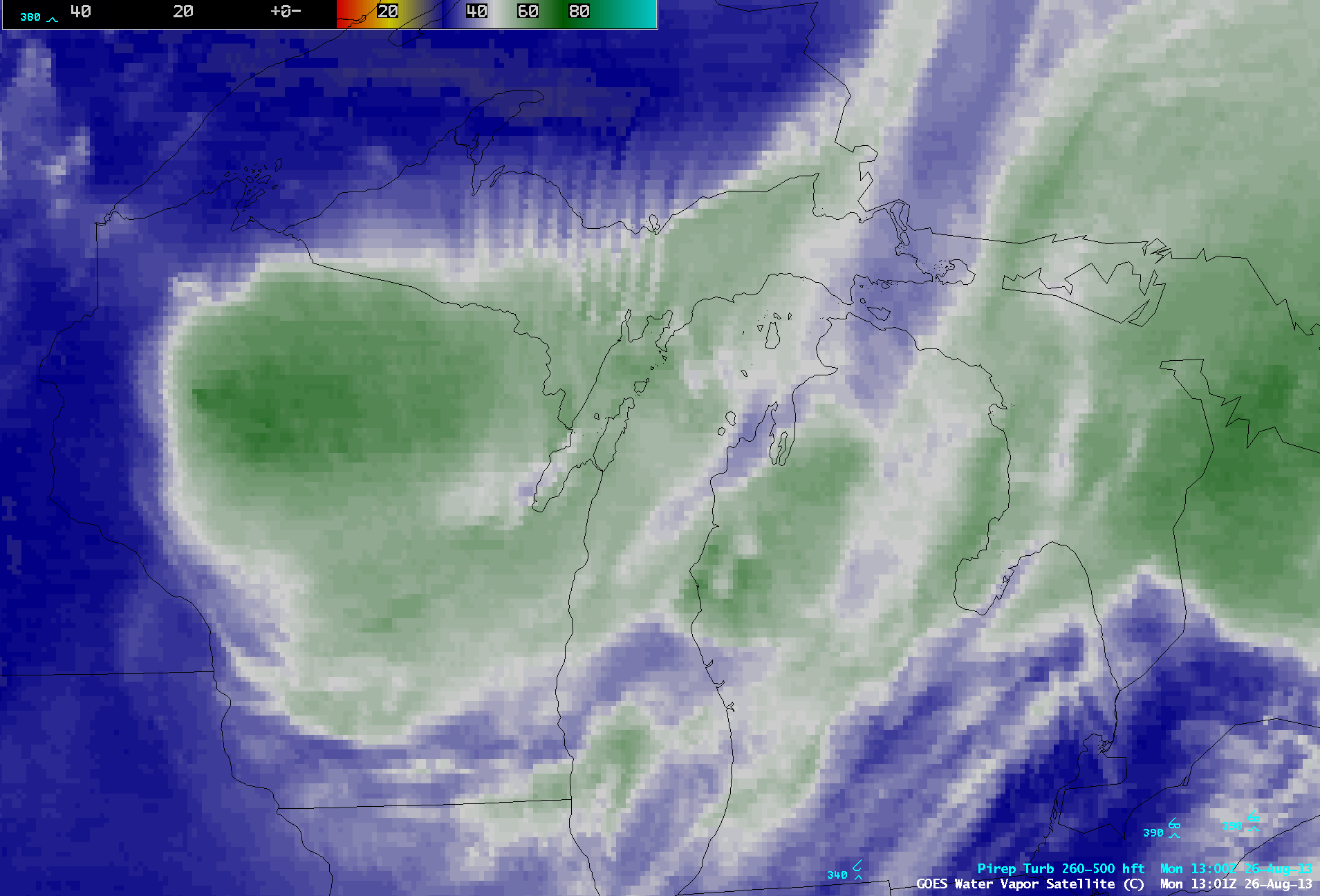
Regarding the aforementioned transverse bands in the cirrus outflow, there were a few pilot reports of turbulence that appeared to be associated with these cloud features as they were dissipating over northern Lower Michigan and adjacent portions of Lake Michigan and Lake Huron. AWIPS images of GOES-13 10.7 µm IR channel data (above; click image to play animation) and GOES-13 6.5 µm water vapor channel data (below; click image to play animation) showed the location of pilot reports of turbulence.
Most notable was the report of Severe turbulence at an altitude of 39,000 feet over northeastern Lower Michigan at 19:20 UTC (which the pilot reported as a “mountain wave”). Farther to the southeast, there was a report of Moderate turbulence at 19:00 UTC as the aircraft was descending from 40,000 to 32,000 feet. By these later times, the transverse banding signature was becoming difficult to identify on the 4-km resolution GOES-13 IR and water vapor imagery. However, the transverse banding signature was a bit more evident on a 1-km resolution POES AVHRR 12.0 µm IR image at 18:08 UTC (around the time of a report of light to moderate Clear Air Turbulence at an altitude of 35,000 feet).


