Another “small ice crystal” mountain wave event
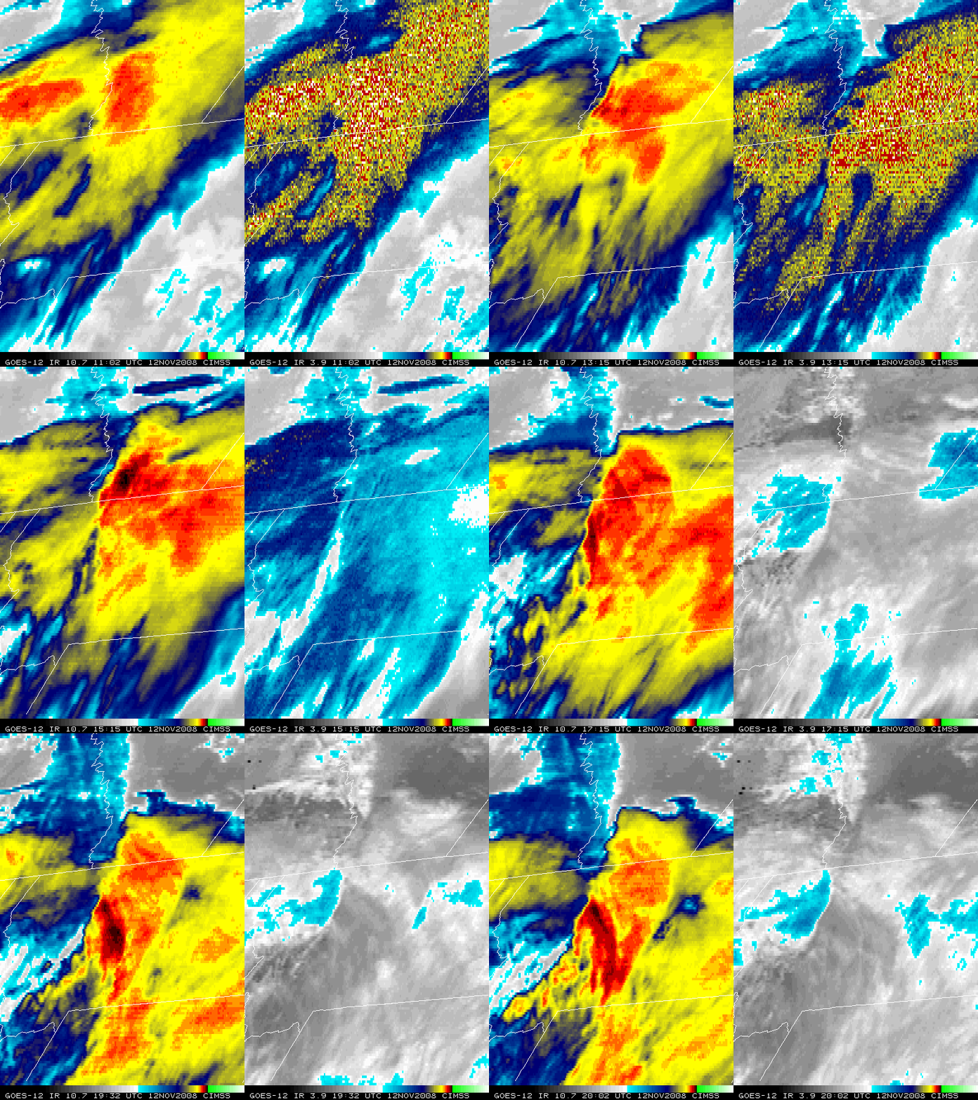
GOES-12 10.7 µm “IR window” and 3.9 µm “shortwave IR” images (above) showed a large area of mountain wave clouds to the lee of the spine of the Rocky Mountains, spreading eastward across parts of Alberta and Montana on 12 November 2008. Note how quickly the 3.9 µm IR brightness temperatures increased once the reflection of solar radiation commenced — the wave clouds almost seem to “disappear” on the 3.9 µm imagery as the daytime sun angle increased, even as 10.7 µm IR brightness temperatures as low as -60º to -70º C (red to black color enhancement) persisted. While this case was in the same general region as another mountain wave event observed on 03 November, the mountain wave cloud was much larger in this case.
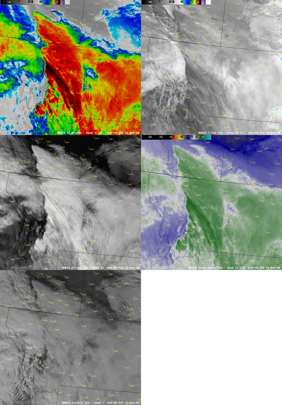
AWIPS images of 1-km resolution MODIS 11.0 µm “IR window”, 3.7 µm “shortwave IR”, 1.3 µm near-IR “Cirrus detection”, 6.7 µm “Water vapor”, and Visible channels (below) allowed a more detailed look at the mountain wave clouds around 19:50 UTC. The coldest 11.0 µm IR brightness temperature over western Montana was -71º C (black enhancement), which corresponded to the 39,200 foot (200 hPa) level according to the Great Falls, Montana rawinsonde data. However, the 3.7 µm brightness temperatures in that same area were around +22º C (about 90º C warmer!), due to the strong reflection of solar radiation by the very small ice crystals that comprised the mountain wave cloud.
The MODIS cirrus detection image with an overlay of MADIS atmospheric motion vectors (below) confirmed the presence of strong winds aloft over the region, with wind speeds of greater than 100 knots (with one target as high as 186 knots over northwestern Montana). The MODIS cirrus image also helped to highlight some subtle cloud-top striations that were present.


